lexxnchloe
Member
I only get 10 inches. Cheated again50+ in Philly/NJ LOL. Maybe the Drones up there flying around are laying the ground work.
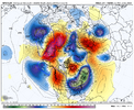
View attachment 155828
I only get 10 inches. Cheated again50+ in Philly/NJ LOL. Maybe the Drones up there flying around are laying the ground work.
View attachment 155828
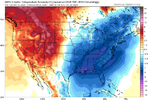
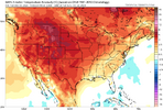
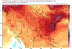
Insane cold air press though.200 hour teases. We all knew this is what the next run would show.
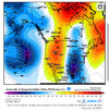
View attachment 155850
At least it did keep the general H5 look similar earlier in the run. At 180, the western ridge looks taller, so it's actually not that bad, I expected worse TBH.
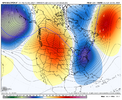
View attachment 155851
Euro AI had the general look as well....just not enough amplitude / dive with the ridge-trough. All we can say is that this is a pattern look that can work. It's possible and worth watching.200 hour teases. We all knew this is what the next run would show.
View attachment 155850
At least it did keep the general H5 look similar earlier in the run. At 180, the western ridge looks taller, so it's actually not that bad, I expected worse TBH.
View attachment 155851

It very well could work, but IMO we’ve had better looks than this at this range that didn’t work out already this year (well at least they didn’t work for some/most including myself haha).Euro AI had the general look as well....just not enough amplitude / dive with the ridge-trough. All we can say is that this is a pattern look that can work. It's possible and worth watching.

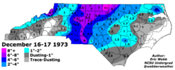
Yeah, I'm not really sure where I am with all that. The prior look(s) did have the added benefit of the Greenland-esque / bootleg(?) -NAO and some split stream action at times, but there always seemed to be a good amount of question as to whether it was going to all come together. Same with this setup too - a lot has to hit right. Guess I just like the big amplification that has been shown at times on the runs. We have some analogs to this that have worked and been good storms - just not the classic gulf low with high to north deal of course. Low chance but worth watching - possible, not probable.It very well could work, but IMO we’ve had better looks than this at this range that didn’t work out already this year (well at least they didn’t work for some/most including myself haha).
Yeah, I'm not really sure where I am with all that. The prior look(s) did have the added benefit of the Greenland-esque / bootleg(?) -NAO and some split stream action at times, but there always seemed to be a good amount of question as to whether it was going to all come together. Same with this setup too - a lot has to hit right. Guess I just like the big amplification that has been shown at times on the runs. We have some analogs to this that have worked and been good storms - just not the classic gulf low with high to north deal of course. Low chance but worth watching - possible, not probable.
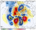

I think the trough is still too far east for most. We have a ways to go imo
I only get 10 inches. Cheated again

