-
Hello, please take a minute to check out our awesome content, contributed by the wonderful members of our community. We hope you'll add your own thoughts and opinions by making a free account!
You are using an out of date browser. It may not display this or other websites correctly.
You should upgrade or use an alternative browser.
You should upgrade or use an alternative browser.
Pattern December Dud 👀
- Thread starter SD
- Start date
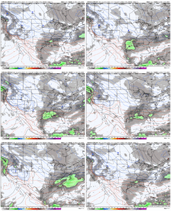
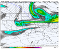
Oh, my. The look of that JMA run is amazing!We are obviously honing in on the timeframe after the Turkey Day storm passes as cold air filters in. For a storm, we are watching to see if a piece of the Baja wave can eject east <OR> a wave can dive down from the northern stream into the Southern Plains or dive down sharply right on top of us in the SE <OR> both of those occur with some phasing
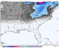
We may not come close to getting a storm here, but one of the analog comparisons that has been peppered on the CPC forecasts is from December 1958. Back-to-back winter storms occurred on December 11-14, 1958 (thanks to EWebb for the accumulation maps)


Here is a surface / 500mb animation from December 10-15, 1958:

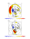
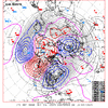
Here is what the pattern looked like for December 10-15, 1958

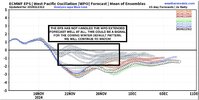
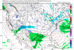
Here is today's EPS, pattern average for Nov 29-Dec 4

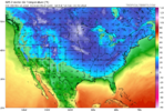
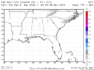
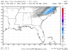
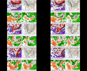
Here is today's JMA run which looks nice for Nov 29-Dec 1

Here is western amplification shown at the end of the EPS run for Dec 3-8

That is all. Hope yall are having a dam good day
A closer look-see indicates a board-wide storm in the next 24-48 hours past the end of its run as the cold press would continue southward.
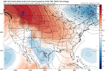
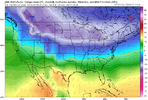
The good old days featured arctic fronts sagging southward as waves developed and moved along the boundary.Oh, my. The look of that JMA run is amazing!
A closer look-see indicates a board-wide storm in the next 24-48 hours past the end of its run as the cold press would continue southward.
View attachment 154676View attachment 154677
The new world features more north-south frontal zones and cutting and/or filling-reforming systems (i.e. Miller Bs).
The JMA takes us on a trip back in time to when the world was right.
NBAcentel
Member
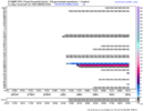
This is looking like the coldest GEFS run. You can still see some members try to spit something out early dec as well
NBAcentel
Member
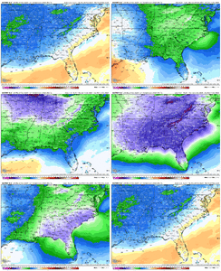
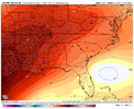
Nice run to run change, colder run (coldest yet) and Barney colors at 850, and first run with many mean high temps across the upper SE in the 30s on the 2nd-3rd. 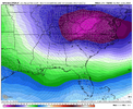
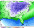
Also gotta like how much this ens run opened up the Central/southwestern US but kept the same amount of EC troughing and a stronger -NAO block to boot. Potentially signaling more energy diving out of Canada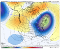
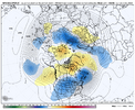


Also gotta like how much this ens run opened up the Central/southwestern US but kept the same amount of EC troughing and a stronger -NAO block to boot. Potentially signaling more energy diving out of Canada


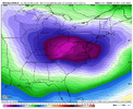
To see those kind of temp anomalies in the ensemble mean at this range is impressive because it is basically signaling virtually full member support at 200 hours out.Nice run to run change, colder run (coldest yet) and Barney colors at 850, and first run with many mean high temps across the upper SE in the 30s on the 2nd-3rd. View attachment 154683View attachment 154682
Also gotta like how much this ens run opened up the Central/southwestern US but kept the same amount of EC troughing and a stronger -NAO block to boot. Potentially signaling more energy diving out of Canada View attachment 154685View attachment 154684
NBAcentel
Member
GolfishardIknowit70
Member
I think energy diving down four corners would be most ideal or slightly east of there imo for winter events across the south and eastTo see those kind of temp anomalies in the ensemble mean at this range is impressive because it is basically signaling virtually full member support at 200 hours out.
Last edited:
Webberweather53
Meteorologist
GolfishardIknowit70
Member
One thing you don't see often is when the euro is colder than other models, especially the cmc
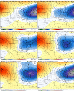
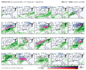
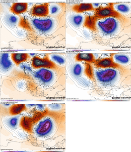
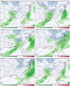
Nice to see it’s not a lone ensemble member throwing us a boneDidn’t even check out the 12z CMC ENS but it’s definitely more bullish on a trailing wave View attachment 154688View attachment 154689View attachment 154690View attachment 154691View attachment 154692
These are usually 360 maps from one ensemble suite. And it usually things just get pinned at 300+.Pretty darn impressive agreement on the main players at D7 in the ops. IMO and recent past experience, strong op agreement at range is better than same-suite ensemble agreement.
View attachment 154696
It's encouraging to see this kind of a setup work in closer. The shape and orientation of the PNA ridge on the 12z ICON is really ideal for cold air transport into the SE. Lately, any ridging up near AK or NW Canada has been defeated by troughing in the SW, but that's not happening here. Throw in a little well-placed -NAO, and woof bark growl....
It's hard not to feel excited, while at the same time feel PTSD about an upcoming rug pull.
Agreed there are a number of ways we can score. The dates in and around the 12/22 - 12/24 1989 storm continues to show up in analogs, and that is one of the ways we can score as you mentioned, which is with enough of a consolidated northern stream wave diving in far enough west to amplify and initiate surface cyclogenesis along the Arctic front likely to be along/near the Gulf Coast with or without interaction from additional southern stream energy ejecting eastward.We are obviously honing in on the timeframe after the Turkey Day storm passes as cold air filters in. For a storm, we are watching to see if a piece of the Baja wave can eject east <OR> a wave can dive down from the northern stream into the Southern Plains or dive down sharply right on top of us in the SE <OR> both of those occur with some phasing
We may not come close to getting a storm here, but one of the analog comparisons that has been peppered on the CPC forecasts is from December 1958. Back-to-back winter storms occurred on December 11-14, 1958 (thanks to EWebb for the accumulation maps)


Here is a surface / 500mb animation from December 10-15, 1958:

Here is what the pattern looked like for December 10-15, 1958

Here is today's EPS, pattern average for Nov 29-Dec 4

Here is today's JMA run which looks nice for Nov 29-Dec 1

Here is western amplification shown at the end of the EPS run for Dec 3-8

That is all. Hope yall are having a dam good day
Last edited:
Very rare when we have a window of opportunity to track/seek a winter wx event and its the qpf we are looking for and not the cold. Usually opposite.
I always say get the cold 1st, and if you can get it to hang out 5-7 days, that usually works in our favor 8-9 times out of 10.
I always say get the cold 1st, and if you can get it to hang out 5-7 days, that usually works in our favor 8-9 times out of 10.
Yeah that 12/11/58 storm looked like a slightly more inland version of Dec ‘89. That’s a good point about the baroclinic zone being draped along the gulf coast post Turkey Day. Any waviness that can approach from the W or NW will easily ignite a gulf / SE coast lowAgreed there are a number of ways we can score. The dates in and around the 12/22 - 12/24 1989 storm continues to show up in analogs, and that is one of the ways we can score as you mentioned, which is with enough of a consolidated northern stream wave diving in far enough west to amplify and initiate surface cyclogenesis along the Arctic front likely to be along/near the Gulf Coast with or without interaction from additional southern stream energy ejecting eastward.
View attachment 154698
View attachment 154697
Brent
Member
Dang we had 10 inches of snow in December 1958. 2nd snowiest December on record
Sign me up
Sign me up
Gary M
Member
Looking like I can bring the golf clubs inside for a while after my round Tuesday.
- Joined
- Jan 2, 2017
- Messages
- 1,566
- Reaction score
- 4,279
Shiii..cart heater and cover for the cart...only way to go!Looking like I can bring the golf clubs inside for a while after my round Tuesday.
@Rain Cold said it best, I'm cautiously optimistic with all the signals in the long/med range. Fully expect a complete floor drop, rug pull or something to happen and ruin it. But it's super encouraging to see Webb and grits positivity!
Webberweather53
Meteorologist
Just wait until these Siberian Express air masses start out ~20F colder over the source region later in the winter. Those will be fun to track.
Brent
Member
Just wait until these Siberian Express air masses start out ~20F colder over the source region later in the winter. Those will be fun to track.
Yeah that's an interesting point. It hasn't been that cold upstream yet...
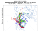
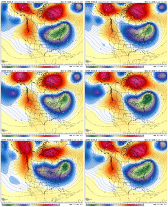
Here is a comparison of the Euro AI and the Euro Ens Mean for Dec 5th. The Euro AI is similar to the GFS (as of 18z run) with how it has a stronger Pac Jet and wants to push the western ridge inland, which shoves our eastern trough farther east. Instead, we need some of that flow to slow down a bit out west so that the western ridge can gain some amplification, allowing a wave to dig into an eastern trough that is not too far east


Another cold Gfs run next weekend and just beyond.
accu35
Member
accu35
Member
Brent
Member
View attachment 154708
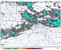
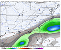
Potential storm incoming on the CMC
Hey that's the day our met predicted the first snow
Just saying
not really enthused by anything yet.
the cold is neat; and when it's in abundance as guidance suggests it is easier to stumble backwards into a nuisance event, but i don't see that currently. instead this is reminiscent of october, when we were trying to squeeze water from a stone for any moisture.
there are some pretty maps, but i would advise caution. the last few years all day 6-10 phantom events got squashed by poor trough orientation and this feels no different. I don't remember the last time we were stressing over northwest trends.
i'm filled with oysters and vodka so if there was room for optimism I would put it out there, but so far the long range seems to be enough to kill a lot of bugs and not much else (not complaining about that first part). i will admit it's nice to be prognosticating before thanksgiving
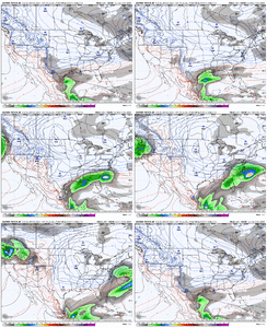
00z EC AI sharpened up western ridge while part of the TPV energy held further west, which allowed more northern stream energy to enter and dig further west and initiate cyclogenesis along Arctic front. Being honest, seeing the TPV split apart does raise some alarm bells based on the past few years, but with a mean trough already established to the east, hopefully we don't repeat the same fate. Getting what we want always requires threading the needle, and too consolidated of a TPV with no backside energy would have been cold and dry, we just need the backside energy to orientate N/S and dig, not close off.


Last edited:
Webberweather53
Meteorologist
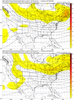
Agreed there are a number of ways we can score. The dates in and around the 12/22 - 12/24 1989 storm continues to show up in analogs, and that is one of the ways we can score as you mentioned, which is with enough of a consolidated northern stream wave diving in far enough west to amplify and initiate surface cyclogenesis along the Arctic front likely to be along/near the Gulf Coast with or without interaction from additional southern stream energy ejecting eastward.
View attachment 154698
View attachment 154697
I bet if you put Dec 1989’s storm in todays background climate the heavy snow would shift NW in response to a stronger warm conveyor belt and upstream latent heat release from higher mean SSTs.
NBAcentel
Member
Ron Burgundy
Member
ITUSETOSNOW
Member
No offense, but what do you mean "getting real"?
Ron Burgundy
Member
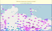
Just that the artic airmass the models have been pointing towards is showing up in grids now. After so many headfakes from the models last year it’s nice to see it verify so early this year.No offense, but what do you mean "getting real"?
Sorry - guess that wasn’t clear
He means boring.No offense, but what do you mean "getting real"?
Nah he is talking about storms for his area.
Avalanche
Member
He’s calling for severe stormsNo offense, but what do you mean "getting real"?
Ron Burgundy
Member
Actually I was talking about the cold finally showing up!He means boring.
Nah he is talking about storms for his area.

