• Hello, please take a minute to check out our awesome content, contributed by the wonderful members of our community. We hope you'll add your own thoughts and opinions by making a free account!

Pattern December Dud 👀

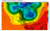
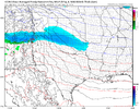
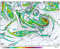
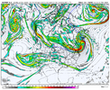
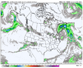
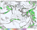
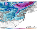
If there’s a time period I’m starting to focus on within this pattern for us to score, it’s here. That southern stream wave around Baja cali and TPV in The NE US. certainly can trend the right way real quick. Need that TPV to slide NE cleanly and something to kick that Baja wave or at least get some energy that sheds off of it, perhaps for some overrunning, and in the same process keep the area around the lakes clean for some trailing high pressure. This look imo starting to get my attention for scoring prospects View attachment 154607View attachment 154608
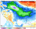
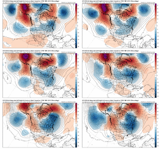
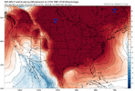
Do you have the 18z gefs temp anomalies map for day 6-10?
 
I would like to see one of those get stuck over me this winter. I'm greedy
Let’s compromise. We’ll let it stall for 24 hours over you and then start moving eastward just as a northern PVA streamer intercepts it right over the Mississippi River.
 
We've had a lot of trouble getting those Baja waves to kick out and they just get stuck or shoved to the southwest.
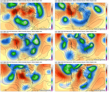
No joke. It’s been a while. Last one was dec 2018. Wonder what gave it the kick in that setup. Does somebody have a 500mb chart of that winter storm, maybe @Ollie Williams ? Wonder what gave it the kick
 
No joke. It’s been a while. Last one was dec 2018. Wonder what gave it the kick in that setup. Does somebody have a 500mb chart of that winter storm, maybe @Ollie Williams ? Wonder what gave it the kick
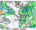
Here is a play-by-play of that storm from the 2nd to the 11th. The ridge over the Pacific that migrated to Northwest Canada was particularly helpful. The wave was allowed to slide underneath and phase with the 50/50 low. However, the Baja wave would have gotten stuck if the ridge had been further south.

output_NZDQVS.gif
 
Here is a play-by-play of that storm from the 2nd to the 11th. The ridge over the Pacific that migrated to Northwest Canada was particularly helpful. The wave was allowed to slide underneath and phase with the 50/50 low. However, the Baja wave would have gotten stuck if the ridge had been further south.

View attachment 154616
Where's your no talking thread? That should be starting up pretty soon I would think? 😄
 
Here is a play-by-play of that storm from the 2nd to the 11th. The ridge over the Pacific that migrated to Northwest Canada was particularly helpful. The wave was allowed to slide underneath and phase with the 50/50 low. However, the Baja wave would have gotten stuck if the ridge had been further south.

View attachment 154616

Ah. This time it’ll likely be harder to boot given the tall ridge in the pacific will stick around and more then likely have it trapped, Vs that progression where that pattern was falling apart and the pacific was speeding up due to a over extension of the pacific jet
 
I would like to see one of those get stuck over me this winter. I'm greedy

Ah. This time it’ll likely be harder to boot given the tall ridge in the pacific will stick around and more then likely have it trapped, Vs that progression where that pattern was falling apart and the pacific was speeding up due to a over extension of the pacific jet
If that does happen, we probably need to focus on later in December imo
 
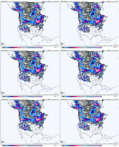
I still would like to see more snowy ensembles here before I get too hyped up but we'll see. Only 5 GEFS members had any snow at 18z meh way less than half the EPS at 12z
 
Regarding the suppression we're seeing in the modeling in the 8-10 day range, it's worth remembering that the models almost always overestimate the strength and southern push of these arctic outbreaks at this range. And, the ULL near California in this time range isn't the only trigger to keep an eye on and look for a short-wave not yet well modeled that may round the top of the PNA ridge and either interact with the ULL as mentioned earlier or perhaps be sharp enough to trigger a weak southern slider on its own.

It is an interesting period to kick off the winter.
Yes it is to say the least!! Also a "howdy neighbor" as we are close by... as I am "between" Between and Monroe.. At least the winds seem to be relaxing some here for the rest of weekend!!!
 
Yes it is to say the least!! Also a "howdy neighbor" as we are close by... as I am "between" Between and Monroe.. At least the winds seem to be relaxing some here for the rest of weekend!!!
Hey bud. Yep, I'm right up the street from you between Between and Loganville lol. Right here where the NW snow showers go to die and we struggle at the tail end of 33 and rain CAD events.

This is our year. I can feel it! Heck, we have something to track and it's not even turkey day.
 
Gulf Coast gets in the action before we do lol. Euro was mighty close too. I just can't get too excited yet, been burned so many times last few yrs
I agree. Overall, it's going to come down to the little details, as it always does. The pattern looks quite favorable for BN temps, with decent to good ridging out west and a tendency for a well-positioned ridge/block over or near S Greenland and eastern Canada.

I like the suppression look this far out. Temps are always the big question mark and what looks really cold out in time often ends up being marginal at game time.

Anyway, it's nice to have something to talk about. And it's especially fun in December.
 
i don't really see what others are seeing in the icon

not enough lift to really get anything past nashville
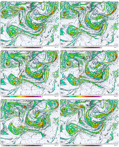
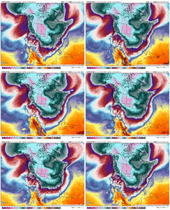
I think the 00z Euro shows the potential even with a worse H5 setup (tpv not as consolidated, less cold press, western ridge not as tall/sharp, less southern energy ejection). At 180, even though it had less stream interaction potential and a weaker consolidation of southern wave energy moving eastward, it still generated a light frozen qpf field all the way to the coast later on.
ecmwf-deterministic-namer-vort500_z500-2968000.pngicon-all-namer-vort500_z500-2968000.png
ecmwf-deterministic-namer-precip_6hr_inch-2968000.pngicon-all-namer-precip_6hr_inch-2968000.png
Moving after 180 (stupid, yes):
ecmwf-deterministic-namer-vort500_z500-1732320000-1732968000-1733140800-40.gifecmwf-deterministic-namer-instant_ptype-1732320000-1732968000-1733184000-40.gif
ecmwf-deterministic-namer-precip_48hr_inch-3184000.png
It's possible the 00z ICON could have been suppressed if the northern stream interaction wasn't strong enough, but I'll take my chances with that at this range.
 
One thing on our side is as with anything EVENTUALLY things have to go our way again. And with all the crappy winters we have had I would think that the longer we go without something the better chance we have as each year passes.
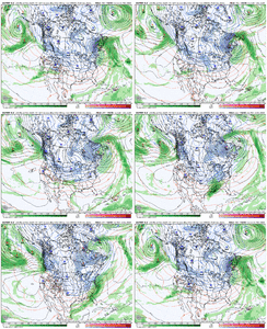
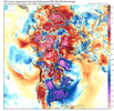
that’d be some wall to wall cold for early December View attachment 154645
is it suppression city?
 
Back
Top