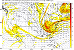
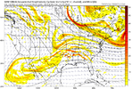
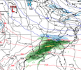
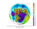
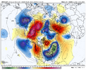
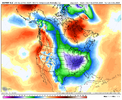
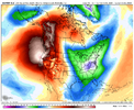
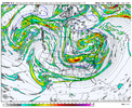
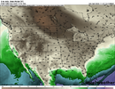
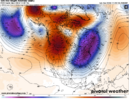
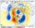
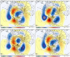
Yes it’s that suppressed look we’ve come to know and love (hate). Also let the record show I despise cold looks this early in the season as I think it spoils the pattern for when climo shows up later. But that’s just me. We’ll take what we can get in 2024. Also if I’m not mistaken we had some big 1st and 2nd week December winter storms 3-4 years in a row around our region with last year being the first year in a while where we didn’t get one. Wouldn’t surprise me to see that trend pick back up where we left off. Just something to think about.One thing on our side is as with anything EVENTUALLY things have to go our way again. And with all the crappy winters we have had I would think that the longer we go without something the better chance we have as each year passes.
is it suppression city?
-
Hello, please take a minute to check out our awesome content, contributed by the wonderful members of our community. We hope you'll add your own thoughts and opinions by making a free account!
You are using an out of date browser. It may not display this or other websites correctly.
You should upgrade or use an alternative browser.
You should upgrade or use an alternative browser.
Pattern December Dud 👀
- Thread starter SD
- Start date
JHS
Member
Not correct. The last good December storm was 2018.Yes it’s that suppressed look we’ve come to know and love (hate). Also let the record show I despise cold looks this early in the season as I think it spoils the pattern for when climo shows up later. But that’s just me. We’ll take what we can get in 2024. Also if I’m not mistaken we had some big 1st and 2nd week December winter storms 3-4 years in a row around our region with last year being the first year in a while where we didn’t get one. Wouldn’t surprise me to see that trend pick back up where we left off. Just something to think about.
Going back through my pictures it looks like there was also good snow on the ground in 19’ and 20’ as we went up 441 over the mountain and into Gatlinburg. Less snow on the ground in 21’ 22’ and 23’ but still some. Funny the way remember things.Not correct. The last good December storm was 2018.
Gfs remains cold post thanksgiving.
- Joined
- Jan 23, 2021
- Messages
- 4,602
- Reaction score
- 15,197
- Location
- Lebanon Township, Durham County NC
GFS was so close to liftoff
Yeah, shows a Tennessee and NC winter storm. Who knows...The Canadian is trying to conjure something up:
View attachment 154650
JHS
Member
I think maybe I misunderstood you. You most likely did see snow up there like you said. I was thinking about upstate SC.Going back through my pictures it looks like there was also good snow on the ground in 19’ and 20’ as we went up 441 over the mountain and into Gatlinburg. Less snow on the ground in 21’ 22’ and 23’ but still some. Funny the way remember things.
...
Looks similar to last night's Euro.
Looks similar to last night's Euro.
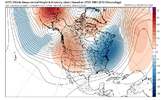
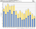
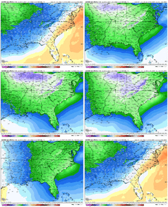
Don’t worry I’m refreshing 5-10x an hour like we are tracking a big dog.Man this place is dead for the potential guidance is showing. Last few years have sucked I know, but this is what we live for (opportunities)!
View attachment 154652
View attachment 154653
We might be....Don’t worry I’m refreshing 5-10x an hour like we are tracking a big dog.
SimeonNC
Member
NBAcentel
Member
This euro run is just trough after trough with Arctic intrusions
Euro is plum cold next weekend
NBAcentel
Member
Iceagewhereartthou
Member
And has the ICON ever been right about anything?i don't really see what others are seeing in the icon
not enough lift to really get anything past nashville
Man. That’s the recipe for sure. What a pretty map12/1-12/3 window is looking ripe. Arctic front draped along the Gulf with strong digging energy around TPV that may interact with southern stream energy.
View attachment 154661
Iceagewhereartthou
Member
Yeah, for me, If I have to chase it's a miss. Leaving my snowless backyard to go see what someone else got, only to return to my snowless backyard is even worse.I think maybe I misunderstood you. You most likely did see snow up there like you said. I was thinking about upstate SC.
Iceagewhereartthou
Member
I've reached the cynical phase. Its just another head fake or North of the state line storm. I have no hope left.Man this place is dead for the potential guidance is showing. Last few years have sucked I know, but this is what we live for (opportunities)!
View attachment 154652
View attachment 154653
Brent
Member
And has the ICON ever been right about anything?
It was in January here the one week we had winter last year...
We need to back that trough diving down through the Great Lakes to the Dakota's/Minnesota and we're in business. Certainly doable at this range.12/1-12/3 window is looking ripe. Arctic front draped along the Gulf with strong digging energy around TPV that may interact with southern stream energy.
View attachment 154661
View attachment 154662
That euro run was one of those give me that and it'll snow type looks. Way too much energy embedded within the flow to not produce imo
The cold air for this coming period is legitimate! The last GFS run I looked at agreed with the ECMWF with highs in the fourties for several days. If we can get some energy or a disturbance in the right place at the right time, things could get very interesting for many of us long suffering winter weather lovers.
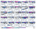
I'll take frame 42 and call it a win!Obviously grain of salt here. But a couple EPS members with strips of snow DEEP into the south. Goes to show where it can snow and what can happen if you have abundant cold air around
View attachment 154667
NBAcentel
Member
NBAcentel
Member
Like seeing the -NAO trendinspirational View attachment 154670
Prestige Worldwide
Member
Very encouraging to read this
Detective WX
Member
I'll be darned... Maybe a White Christmas after all? In all seriousness, a cold Dec would be a welcome sight in a furnace of the year that is 2024, and would buck my thinking of a 1931, 2001, '11, '15, 21, 23 type I was speculating given the furnace of a Nov we've been through.
Regarding the suppression we're seeing in the modeling in the 8-10 day range, it's worth remembering that the models almost always overestimate the strength and southern push of these arctic outbreaks at this range. And, the ULL near California in this time range isn't the only trigger to keep an eye on and look for a short-wave not yet well modeled that may round the top of the PNA ridge and either interact with the ULL as mentioned earlier or perhaps be sharp enough to trigger a weak southern slider on its own.
It is an interesting period to kick off the winter.
We are obviously honing in on the timeframe after the Turkey Day storm passes as cold air filters in. For a storm, we are watching to see if a piece of the Baja wave can eject east <OR> a wave can dive down from the northern stream into the Southern Plains or dive down sharply right on top of us in the SE <OR> both of those occur with some phasingThis EPS run really brought back the +PNA/-EPO couplet in the longer term View attachment 154668
We may not come close to getting a storm here, but one of the analog comparisons that has been peppered on the CPC forecasts is from December 1958. Back-to-back winter storms occurred on December 11-14, 1958 (thanks to EWebb for the accumulation maps)


Here is a surface / 500mb animation from December 10-15, 1958:

Here is what the pattern looked like for December 10-15, 1958

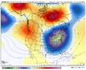
Here is today's EPS, pattern average for Nov 29-Dec 4

Here is today's JMA run which looks nice for Nov 29-Dec 1

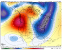
Here is western amplification shown at the end of the EPS run for Dec 3-8

That is all. Hope yall are having a dam good day
Webberweather53
Meteorologist
We are obviously honing in on the timeframe after the Turkey Day storm passes as cold air filters in. For a storm, we are watching to see if a piece of the Baja wave can eject east <OR> a wave can dive down from the northern stream into the Southern Plains or dive down sharply right on top of us in the SE <OR> both of those occur with some phasing
We may not come close to getting a storm here, but one of the analog comparisons that has been peppered on the CPC forecasts is from December 1958. Back-to-back winter storms occurred on December 11-14, 1958 (thanks to EWebb for the accumulation maps)


Here is a surface / 500mb animation from December 10-15, 1958:

Here is what the pattern looked like for December 10-15, 1958

Here is today's EPS, pattern average for Nov 29-Dec 4

Here is today's JMA run which looks nice for Nov 29-Dec 1

Here is western amplification shown at the end of the EPS run for Dec 3-8

That is all. Hope yall are having a dam good day
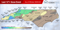
That’s the last time Fayetteville saw a foot of snow. Crazy it’s been that long…

