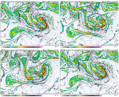
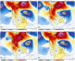
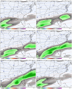
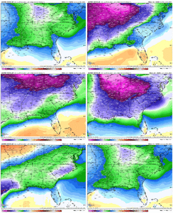
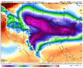
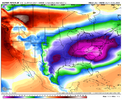
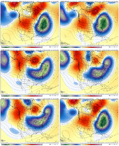
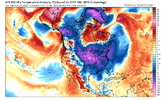
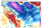
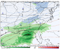
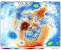
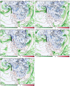
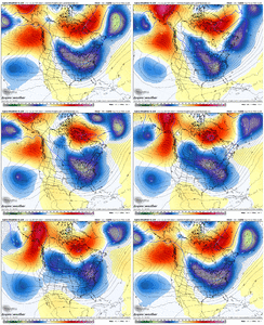
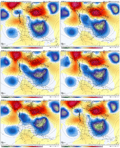
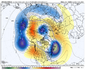
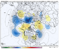
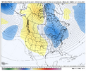
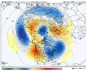
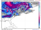
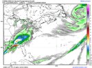
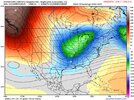
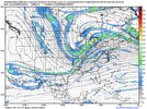
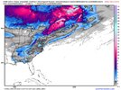
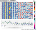
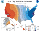
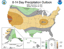
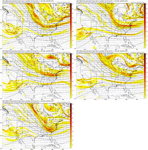
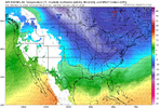
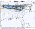
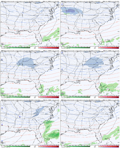
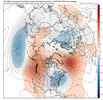
The cold is definitely going to be here next week. Just need some precip to go with it.
-
Hello, please take a minute to check out our awesome content, contributed by the wonderful members of our community. We hope you'll add your own thoughts and opinions by making a free account!
You are using an out of date browser. It may not display this or other websites correctly.
You should upgrade or use an alternative browser.
You should upgrade or use an alternative browser.
Pattern December Dud 👀
- Thread starter SD
- Start date
December great white buffalo pattern setting up. In the long term we just need to keep the pacific NW as quiet as possible. Seems the last several years it’s just been wave after wave crashing in up there spoiling our party. Need a Seattle drought tbh. Let’s get that +PNA entrenched for the long run. It’s our turn.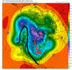

GolfishardIknowit70
Member
I feel like a subtle shift west with the ridge would be ideal moving forward imoDecember great white buffalo pattern setting up. In the long term we just need to keep the pacific NW as quiet as possible. Seems the last several years it’s just been wave after wave crashing in up there spoiling our party. Need a Seattle drought tbh. Let’s get that +PNA entrenched for the long run. It’s our turn.View attachment 154752
NBAcentel
Member
It's just astonishing to see those kinds of colors over our area, even if it is way out in time. I don't care too much about the details at those leads, as I'm sure the actual pattern will look different in the end. But man, that is some read deal cold, and that's step #1, IMO. I like it!EC AI more suppressive vs last runView attachment 154756View attachment 154757
Very cold though View attachment 154758View attachment 154759View attachment 154760
NBAcentel
Member
If we get that kind of pattern (in the last image of your gif) to actually show up, there is a 100% chance that somebody in the south and southeast is getting a winter storm.Gotta love this trend on the AIFS. More Alaskan ridge, and opening up the northern plains some which allows a better shot at digging energy View attachment 154761
The Spire -- go ahead, call me a weenie -- was just a hair away from a big hit. Similar trends as all other guidance today at H5.Gotta love this trend on the AIFS. More Alaskan ridge, and opening up the northern plains some which allows a better shot at digging energy View attachment 154761
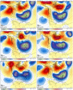
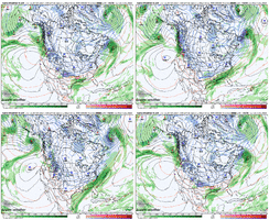
Agreed 100%. And virtually all guidance is trending that direction as we move inside truncation.If we get that kind of pattern (in the last image of your gif) to actually show up, there is a 100% chance that somebody in the south and southeast is getting a winter storm.
NBAcentel
Member
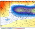
Maybe we are starting to cook. Starting to get some flashes of agreement. Still a lot to work on and a lot of other possible outcomes but I’m liking the fact that the model with the current highest verification score is showing a solution close to what you posted (the spire)The Spire -- go ahead, call me a weenie -- was just a hair away from a big hit. Similar trends as all other guidance today at H5.
View attachment 154764
View attachment 154765
Branch
Member
Webberweather53
Meteorologist
NBAcentel
Member
Webberweather53
Meteorologist
NBAcentel
Member
NBAcentel
Member
"convection on gulf coast will rob moisture"
A phrase we haven't had the privilege of saying in 10 years."convection on gulf coast will rob moisture"
NBAcentel
Member
Love that model, but after seeing it I always want more an hour later.Here’s H5. Looks like it really slows down the trailing wave and tilts it far more then any other modeling does. View attachment 154789View attachment 154790
Also here’s the China model for anyone interested
View attachment 154791
Give me this and I’d call it a winter! Really excited for December!Here’s H5. Looks like it really slows down the trailing wave and tilts it far more then any other modeling does. View attachment 154789View attachment 154790
Also here’s the China model for anyone interested
View attachment 154791
- Joined
- Jan 23, 2021
- Messages
- 4,602
- Reaction score
- 15,197
- Location
- Lebanon Township, Durham County NC
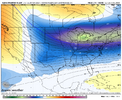
The models have surprised me so far with their consistency for the first week of December. We are within the ten day window now and while details will have to be ironed out, one thing seems for certain, there will be plenty of abnormally cold air. Now lets see if they can focus on some precipitation to go along with the cold air that will be in place.
GolfishardIknowit70
Member
If we didn't have a +AAM, would we be getting this cold pattern and is it stemming from the +EAMT event that triggered this +AAM? Just curious. I personally hope we can maintain it but with enough retrogression in troughing to put most of us in the game often this winter.
Last edited:
Brent
Member
The models have surprised me so far with their consistency for the first week of December. We are within the ten day window now and while details will have to be ironed out, one thing seems for certain, there will be plenty of abnormally cold air. Now lets see if they can focus on some precipitation to go along with the cold air that will be in place.
I'm still thinking about how our met predicted first snow on the 3rd like a week and a half ago and here we are... Like how...
He's a day off at worst right now if the models are right
Now we need above average precip to go with it.Not often you get a map like this in Dec/Jan/Feb. I’ll take my chances
View attachment 154793
NBAcentel
Member
EC ai is now a much more delayed system, rather with energy that dives behind the main trough, causes a coastal about 48 hours later then the previous run
Brent
Member
Eh you can have one but not the other hahaView attachment 154794
Yeah the met who predicted the 3rd here is now saying "mostly dry"
Although he did note if there is a storm it will snow so there's that... It's always something
Slightly above precip chances and somewhat below normal temps for this time period? I'll take that for my location in southern Louisiana!Eh you can have one but not the other hahaView attachment 154794
lexxnchloe
Member
LC:
You may have noticed that the forecast models and other guidance are backing away from a "Classic La Nina" winter forecast.Indeed, the first true Arctic air mass of the season is set to sweep across the eastern two-thirds of the nation starting late next week. That cA intrusion is not the brutal, late January type of chill, but rather a starter course of sorts that will get people in the mood for the holiday season. And, I suspect, creating heating demand increases for 5 to 7 days and ends the trend for warmth shown this autumn.
But as you can figure, any good cold shot is likely to give way to a warming trend. It appears highly likely that the blocking signatures over the Davis Strait and Alaska will break down in Week 3, and not resume until the hammock week between Christmas and New Year's Day. But before you right off the cold for good, consider that a sub-Aleutian vortex is predicted to emerge, and a subtropical jet stream will be present through Mexico into Florida. The latter feature suppresses the Greater Antilles heat ridge. Without a southern branch wind field, the ridge expansion pulse would take the center at 500MB into Florida. Then a Southeast Ridge would emerge, which during an -ENSO event is a "winter destroyer" to the right of the Rocky Mountains. A storm appears likely to take a "Colorado/Trinidad A" path in the last week of December. That system may be the draw to bring the cold air back to the southern and eastern tiers of the nation.
Webberweather53
Meteorologist
SimeonNC
Member

