NBAcentel
Member
Here we are in mid-December and Hudson Bay is still mostly ice-free.pattern setting up nicely View attachment 155928
1050 HP in a perfect location lol Canadian lol. I wish that was like 2 days out. It's pretty.The CMC has cooked up an interesting look at the end of its run. A building CAD with light overrunning precip.
View attachment 155938
I tried to look for something to hate about what the Canadian is selling here at the end of its run but I couldn’t. Shucks. Legit cold air modeled into SE Canada.The CMC has cooked up an interesting look at the end of its run. A building CAD with light overrunning precip.
A bit more entertaining than usual given that's Christmas Eve.
View attachment 155938
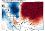
That 1050 high will be replaced by a 1079 low cutting across Lake Erie in about 11 hours1050 HP in a perfect location lol Canadian lol. I wish that was like 2 days out. It's pretty.


Model could just be wrong. I haven't looked at what the other models are showing, though.The Pacific onslaught on this GFS run is just insane. The MJO alone isn’t going to fix that problem. The MJO moving out of the Maritime Continent and across the Pacific (6-7-8) is a process that adds momentum into the Pacific Jet. Having the jet already energized isn’t a good starting point. So, we need to take a step back there before we can move forward. Something has the jet really energized so far here in early winter. You can see here on the 2nd image where the subtropical jet along 30N was weaker than normal from late Oct to early Nov, but has been stronger than normal since late Nov. The MJO has been in 5-6 during that time, not where you would expect to see an extended Pac Jet. Also, there hasn't been strong + East Asian Mtn Torque either. * Throws hands up *


Looking like we got a ways to go stillEuro looks more like my thinking. Energy moving at break neck speed! No way to slow down and build up a good storm for us..
Think the GFS is out to lunch.
pattern setting up nicely View attachment 155928
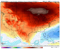
Nice. Looks chilly down in Playa Del Carmen. We might have to take a trip back down there to escape this heatWinter getting into "February" mode quickly...at least it's cold in Florida #sarcasm...
View attachment 155945
There, found it for you lol. I am so sick of 240 hour maps. I still sincerely wonder what type of error keeps occurring in all NWP that always results in these wildly wintery looks for the east and southeastern US that never come to fruition once model error decreases (i.e. shorter lead times).I tried to look for something to hate about what the Canadian is selling here at the end of its run but I couldn’t. Shucks. Legit cold air modeled into SE Canada.View attachment 155940
Alright, let’s cook.
View attachment 155939
I honestly think the GFS is out to lunch here. This has been the theme so far to try to bring the warm hounds in the extended only to reverse as we get closer in time. Let's see how this goes the next few days before we worry about can kicking.Winter getting into "February" mode quickly...at least it's cold in Florida #sarcasm...
View attachment 155945
I feel like this is close, but that warmer period 27-2nd is definitely going to be longer. Probably can push all of that out another week or so I bet.My snapshot pic from the BAM Wx video yesterday. I still think this high level forecast is on board to play out.
View attachment 155947
Gotta shift the ridge axis west yallAlright, let’s cook.
View attachment 155939
I said that 2 weeks ago lolGotta shift the ridge axis west yall
Bamwx made a tweet about the -epo is coming back quicker than we believe. We shall seeMy snapshot pic from the BAM Wx video yesterday. I still think this high level forecast is on board to play out.
View attachment 155947
I’ll be surprised if the cold blast lasts until Dec 26th. I’m not even sure it lasts until the 24th.My snapshot pic from the BAM Wx video yesterday. I still think this high level forecast is on board to play out.
View attachment 155947
Bam is wanting some clicks lolBamwx made a tweet about the -epo is coming back quicker than we believe. We shall see
That’s actually been Webb’s thinking from what I’ve read of his postsBamwx made a tweet about the -epo is coming back quicker than we believe. We shall see
This looks a lot like the overnight op and AI euro. I guess you can find some enthusiasm that this pattern would likely try to build a -nao in early January but with that pac look it would be a miller b hell. I personally think we are getting into the front part of the window where we are going to need to see positive changes at the end of the runs. If we revisit next week and the day 13-16 range is a train wreck with no signs towards a change or building to a change ill be concernedThe Pacific onslaught on this GFS run is just insane. The MJO alone isn’t going to fix that problem. The MJO moving out of the Maritime Continent and across the Pacific (6-7-8) is a process that adds momentum into the Pacific Jet. Having the jet already energized isn’t a good starting point. So, we need to take a step back there before we can move forward. Something has the jet really energized so far here in early winter. You can see here on the 2nd image where the subtropical jet along 30N was weaker than normal from late Oct to early Nov, but has been stronger than normal since late Nov. The MJO has been in 5-6 during that time, not where you would expect to see an extended Pac Jet. Also, there hasn't been strong + East Asian Mtn Torque either. * Throws hands up *


The Pacific onslaught on this GFS run is just insane. The MJO alone isn’t going to fix that problem. The MJO moving out of the Maritime Continent and across the Pacific (6-7-8) is a process that adds momentum into the Pacific Jet. Having the jet already energized isn’t a good starting point. So, we need to take a step back there before we can move forward. Something has the jet really energized so far here in early winter. You can see here on the 2nd image where the subtropical jet along 30N was weaker than normal from late Oct to early Nov, but has been stronger than normal since late Nov. The MJO has been in 5-6 during that time, not where you would expect to see an extended Pac Jet. Also, there hasn't been strong + East Asian Mtn Torque either. * Throws hands up *


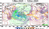
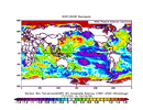
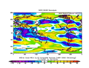
The one thing that really sticks out to me that has the potential to significantly mute the canonical La Niña -PNA pattern this year & isn't getting a lot of notoriety, is the warm North Indian Ocean.
A warm North Indian Ocean actually favors a positive PNA, in part because the excess convection here adds enough westerly momentum into the Pacific jet to kick the Aleutian ridge closer to the US West Coast.
View attachment 154391
View attachment 154393
View attachment 154394
Yall please listen to the man. Sheesh.I think we’re just fine in the longer term.
I could see the reverberating impacts of this jet extension hanging around a bit longer than say the euro weeklies are forecasting, delaying the onset of -PNA later in January perhaps.
CruiseNice. Looks chilly down in Playa Del Carmen. We might have to take a trip back down there to escape this heat
Need a deeper trough and farther north southern energy and either a much faster southern energy or much slower northern trough.That’s not nothing. Christmas miracle not out of the question View attachment 155954
There’s a wave to our south and a cold airmass right on top of us. Squash city currently. Can we find a way to amplify or phase? Doubt it. But i’ll stand firm in that it’s not nothingNeed a deeper trough ans farther north southern energy and either a much faster southern energy or much slower northern trough.
