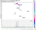
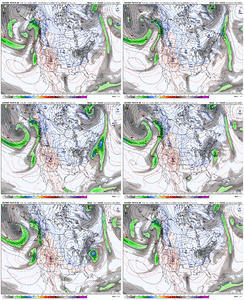
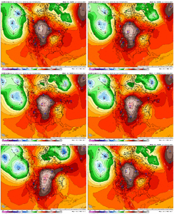
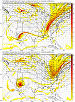
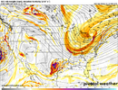
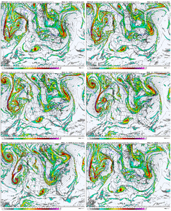
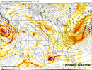
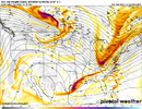
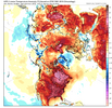
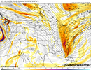
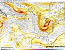
What's puzzling to me is that we're not really experiencing La Nina conditions while we have a Nina...but we're going into more typical Nina conditions when Nina has faded or is fading.Today's Euro weeklies imho have the right overall path going forward here from now through about early-mid February or so, though the exact timing (day to day scales) shouldn't be taken too seriously.
The Nino-esque pattern late month gives way to a -EPO/+TNH after New Years and then we slowly fade into a more stereotypical Nina look as we get closer to February. I think our best chance for scoring a big winter storm this year happens during the -EPO/+TNH phase and/or as it starts to progressively fade into a -PNA & we get moist southwesterly flow aloft to overrun the preceding arctic air mass.
This ought to be a very fun ride.
View attachment 155892
-
Hello, please take a minute to check out our awesome content, contributed by the wonderful members of our community. We hope you'll add your own thoughts and opinions by making a free account!
You are using an out of date browser. It may not display this or other websites correctly.
You should upgrade or use an alternative browser.
You should upgrade or use an alternative browser.
Pattern December Dud 👀
- Thread starter SD
- Start date
Webberweather53
Meteorologist
What's puzzling to me is that we're not really experiencing La Nina conditions while we have a Nina...but we're going into more typical Nina conditions when Nina has faded or is fading.
There's too much westerly momentum in this background state (fueled by a warm tropical indo-pacific warm pool) to keep the typical Nina look around. It's advecting the mean standing wave pattern to the east of its normal position, with for example the Aleutian Ridge closer to the GOA/US West Coast. I think the classic Nina pattern will try to show up in February though as the wavelengths start to shorten (moving everything westward in the means) and there's some help from the MJO.
NBAcentel
Member
Yeah we get the table scraps this run while the NE gets raked
NBAcentel
Member
Eh I’d say this cold start is pretty on cue for Nina’s since there better up front and suck on the back endWhat's puzzling to me is that we're not really experiencing La Nina conditions while we have a Nina...but we're going into more typical Nina conditions when Nina has faded or is fading.
Webberweather53
Meteorologist
There's too much westerly momentum in this background state (fueled by a warm tropical indo-pacific warm pool) to keep the typical Nina look around. It's advecting the mean standing wave pattern to the east of its normal position, with for example the Aleutian Ridge closer to the GOA/US West Coast. I think the classic Nina pattern will try to show up in February though as the wavelengths start to shorten (moving everything westward in the means) and there's some help from the MJO.
The climatological shortening of the wavelengths is one reason among many that Nino winters tend to be backloaded more than Ninas.
This pattern we're seeing late month is a good example of that. If we had a legitimate Nino to couple with that, we'd almost certainly be torching (as is common in late Dec of El Niño winters). Oth, as time goes on & we approach February, the wavelengths start to shorten, and the ridge that was over south-central Canada in a big Nino winter begins to move westward towards the Canadian Rockies, triggering more of a +PNA by Feb
Corrections. Without another reshuffle we know where this is going (and should have seen it coming).Yeah we get the table scraps this run while the NE gets raked
packfan98
Moderator
Do you think the mjo keeps moving into phase 7-8-1 with a healthy amplitude or stall out like the euro has been predicting? Seems like in years past, models dampens out the wave too much and it corrects stronger.There's too much westerly momentum in this background state (fueled by a warm tropical indo-pacific warm pool) to keep the typical Nina look around. It's advecting the mean standing wave pattern to the east of its normal position, with for example the Aleutian Ridge closer to the GOA/US West Coast. I think the classic Nina pattern will try to show up in February though as the wavelengths start to shorten (moving everything westward in the means) and there's some help from the MJO.
Last edited:
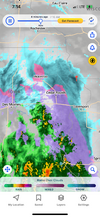
Hopefully not that bad, I would imagine a lot of trees/limbs and power lines down for Iowa!Ok, 1 more, then I’m done! View attachment 155895
Webberweather53
Meteorologist
Do you think the mjo keeps moving into phase 7-8-1 with a healthy amplitude or stall out like the euro has been predicting? Seems like in years past, models dampens out the wave too much and it corrects stronger.
I don’t see any real reason why it won’t stay strong overall at least into 7-8 or so.
This is one of the few times where I think we will see the MJO verify closer to the CFS/GEFS than the EPS.
The EPS is generally better at forecasting the MJO than the CFS just about everywhere in tropics, except when an MJO wave is being initialized over the maritime continent (phase 4-5), which is where it is now.
I see a lot of similarities to the current forecast bifurcation between the extreme EPS & CFS suites & this paper from Kim et al (2014) that I read several years ago. Even despite a decade plus of model upgrades to the EPS, many of the same biases still linger
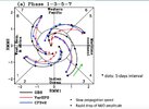

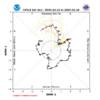
https://webster.eas.gatech.edu/Papers/Kim2014.pdf
packfan98
Moderator
Music to my ears! Thank you. I had heard some other Mets say that there wasn’t anything that should halt the progression. I didn’t want to seem like a simp for wanting the CFS depiction to be right.I don’t see any real reason why it won’t stay strong overall at least into 7-8 or so.
This is one of the few times where I think we will see the MJO verify closer to the CFS/GEFS than the EPS.
The EPS is generally better at forecasting the MJO than the CFS just about everywhere in tropics, except when an MJO wave is being initialized over the maritime continent (phase 4-5), which is where it is now.
I see a lot of similarities to the current forecast bifurcation between the extreme EPS & CFS suites & this paper from Kim et al (2014) that I read several years ago. Even despite a decade plus of model upgrades to the EPS, many of the same biases still linger
View attachment 155899
View attachment 155896
View attachment 155897
https://webster.eas.gatech.edu/Papers/Kim2014.pdf
Triplephase93
Member
Let’s consolidate this thing further by west for an East Tn special. Any chance of that?
- Joined
- Jan 23, 2021
- Messages
- 4,601
- Reaction score
- 15,196
- Location
- Lebanon Township, Durham County NC
EastmanGAWX
Member
That’s correct, I was all of six years old and this event and the February 12, 2010 storm are the two biggest snowfalls that have ever occurred in Eastman during my life. The annual from South Dodge Elementary that year actually had a picture of the school covered in snow as the center picture. I have always been told that the forecast was just for rain only, watching the snow fall that night was one of my best memories as a child! I had no clue that there was a fellow Dodge County Indian on here!It may have brought a couple of inches to the Midlands. I remember that little storm well. We got 2-3” of snow on the evening of December 23rd in my hometown of Eastman, GA (south central GA). It went back and forth with rain and snow for most of the day before turning to all snow just as it was getting dark (shocking everyone). Nothing like building a snowman on Christmas Eve.
View attachment 155908
one run change inside 150 hours can we be serious
And now suddenly the gfs has southern stream wave that may phase with northern stream. That southern wave wasn’t even there 3 runs ago at all
Sent from my iPhone using Tapatalk
Only Strike 1. We aint out yet.
They just can’t ever phase. It’s ridiculous
I actually think this solution is a trend in the complete wrong direction. It is a symptom of less overall northern stream injection with the round one trough, which then carries downstream effects into the second trough not digging as much, which can be seen in the H85 temp trend.Only Strike 1. We aint out yet.
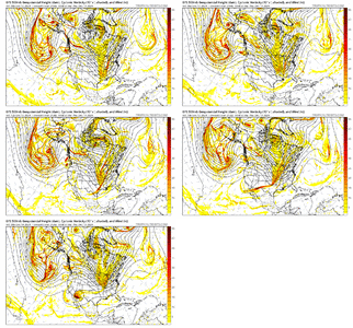
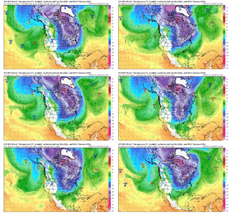
When you are chasing needles in a Haystack, which is essentially what we are doing , espeacilly with this one. Thats what should be expected. Its been a fustrating Hobby for to long now, no doubt. We all need to spend a winter south of Buffalo. That would cure us.They just can’t ever phase. It’s ridiculous
1042.6mb
Blue_Ridge_Escarpment
Member
Dang, the ole changing to rain in the afternoonWhen you go to sleep expecting apocalypse of ice and wake up to this!View attachment 155925View attachment 155924
LickWx
Member
Time to mow!pattern setting up nicely View attachment 155928
Yes, we are setting the stage beautifully for a dislodgment of cold air that will set up an Arctic boundary stalling in Huntsville Alabama. We should get a 53° rain while Nashville snows at 3°.
Well, GFS has not given up yet on this thought of a trailing wave. Not dead yet!From what I can see on my phone, looks like the trough stays positive tilt
Probably best scenerio to root for. Long shot still, but it would catch the brief window of cold enough tempsWell, GFS has not given up yet on this thought of a trailing wave. Not dead yet!
12z guidance is just flat out better overall. Canadian says what warm up & pumps out an event at day 9-10

