lexxnchloe
Member
I only get 10 inches. Cheated again50+ in Philly/NJ LOL. Maybe the Drones up there flying around are laying the ground work.
View attachment 155828
I only get 10 inches. Cheated again50+ in Philly/NJ LOL. Maybe the Drones up there flying around are laying the ground work.
View attachment 155828
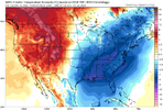
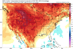
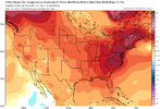
Insane cold air press though.200 hour teases. We all knew this is what the next run would show.
View attachment 155850
At least it did keep the general H5 look similar earlier in the run. At 180, the western ridge looks taller, so it's actually not that bad, I expected worse TBH.
View attachment 155851
Euro AI had the general look as well....just not enough amplitude / dive with the ridge-trough. All we can say is that this is a pattern look that can work. It's possible and worth watching.200 hour teases. We all knew this is what the next run would show.
View attachment 155850
At least it did keep the general H5 look similar earlier in the run. At 180, the western ridge looks taller, so it's actually not that bad, I expected worse TBH.
View attachment 155851

It very well could work, but IMO we’ve had better looks than this at this range that didn’t work out already this year (well at least they didn’t work for some/most including myself haha).Euro AI had the general look as well....just not enough amplitude / dive with the ridge-trough. All we can say is that this is a pattern look that can work. It's possible and worth watching.

Yeah, I'm not really sure where I am with all that. The prior look(s) did have the added benefit of the Greenland-esque / bootleg(?) -NAO and some split stream action at times, but there always seemed to be a good amount of question as to whether it was going to all come together. Same with this setup too - a lot has to hit right. Guess I just like the big amplification that has been shown at times on the runs. We have some analogs to this that have worked and been good storms - just not the classic gulf low with high to north deal of course. Low chance but worth watching - possible, not probable.It very well could work, but IMO we’ve had better looks than this at this range that didn’t work out already this year (well at least they didn’t work for some/most including myself haha).
Yeah, I'm not really sure where I am with all that. The prior look(s) did have the added benefit of the Greenland-esque / bootleg(?) -NAO and some split stream action at times, but there always seemed to be a good amount of question as to whether it was going to all come together. Same with this setup too - a lot has to hit right. Guess I just like the big amplification that has been shown at times on the runs. We have some analogs to this that have worked and been good storms - just not the classic gulf low with high to north deal of course. Low chance but worth watching - possible, not probable.
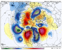
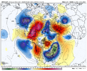

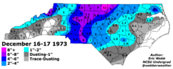
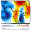
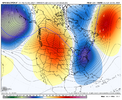
I think the trough is still too far east for most. We have a ways to go imo
I only get 10 inches. Cheated again

I think everybody in North and South Carolina would be happy with that map. Nice little appetizer before Christmas then the real fun comes in about mid January. Probably not going to happen but fun to track.Yep, 6z GFS day 10 Kuchera totals:
View attachment 155865
I'm not greedy, I would take my 2" of snow and salute all the folks on the coast.
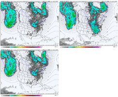
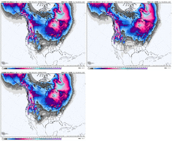
Looks like it backed off that run from yesterday a little bit.Yep, 6z GFS day 10 Kuchera totals:
View attachment 155865
I'm not greedy, I would take my 2" of snow and salute all the folks on the coast.
What happened to the pattern change around New Years/beginning of Jan? Oh wait it changes everyday so no need to believe it will be hot or cold lolWell the odds are stacked against us for a storm for sure. Just very brief window where we drop a trough but looks too far east. And I won't even post the EPS beyond Christmas because it's about as ugly as it comes. I guess as usual near New Years we spend each day hoping and analyzing 2 week out ensembles to see any sign of a pattern change by mid Jan. So if we're lucky we'll get 2 weeks because Feb is dead to me until it proves otherwise
If the EPS is right with the zonal flow it's going to take awhile to get out of that. No way it happens by New Years.What happened to the pattern change around New Years/beginning of Jan? Oh wait it changes everyday so no need to believe it will be hot or cold lol
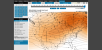
This reeks of can kickingWhat happened to the pattern change around New Years/beginning of Jan? Oh wait it changes everyday so no need to believe it will be hot or cold lol
Let me point you to the complaining thread...This reeks of can kicking
3K NAM has been showing it so I wouldnt be shocked.I'm sure it will NOT happen, but at least they give me a chance of a bit of ZR/IP Sunday morning.
SATURDAY
Mostly sunny. Highs in the lower 40s. East winds around 5 mph.
SATURDAY NIGHT
Mostly cloudy. Cold with lows in the lower 30s. Northeast winds around 5 mph.
SUNDAY
Cloudy. A chance of rain showers, freezing rain and sleet in the morning, then rain showers likely in the afternoon. Little or no sleet accumulation. Highs in the lower 40s. Northeast winds around 5 mph. Chance of precipitation 60 percent.
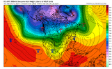
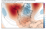
Bro relax and enjoy the weather week by week. I really don't understand the looking so far in advance. The default negative setting many have is understandable, but try to take it out of what we are trying to break down. The extended on models are going to change over and over and over again. I'd argue so far this Winter, they have actually changed for the BETTER as we approached a timeframe that originally looked shot. This entire month has been a prime example of that. I don't see an issue with looking way ahead and trying to gradually learn & see if we can get better at forecasting the longer range, but sometimes i feel like people look at it so much that they are just constantly living in the future. Just my opinion, but sticking to what is right in front of us (Between now & the next 10 days) is the way.This reeks of can kicking
That hook back on the MJO is exactly why forecasting the MJO is an absolute crap shoot lmao.Better score while we can. Euro AI moving toward an ugly pattern out in time. Fits the MJO progression of stalling out in unfavorable phases, as usual in winter. CFS moving steadily in a less favorable direction also for January. At this rate, we're going down the same path as every other winter in the last few years: A few cold shots, followed by crap for days/weeks.
Hopefully, all of that is wrong. But it's not pleasant to see, particularly since there's been an expectation of happy happy joy joy for January. Not feeling the vibes on that yet, though. But maybe it's just PTSD.
View attachment 155872View attachment 155873View attachment 155874
Yeah I don't disagree. But like how many winters in a row now have we seen the bulk of the season spent on the right side of the diagram? The higher bust risk, IMO, is believing forecasts that show a robust wave entering phases 7-2.That hook back on the MJO is exactly why forecasting the MJO is an absolute crap shoot lmao.
We’re basically banking on a 2-3 week window hoping the MJO cooperates. This is what winter has become in the eastern US now.Better score while we can. Euro AI moving toward an ugly pattern out in time. Fits the MJO progression of stalling out in unfavorable phases, as usual in winter. CFS moving steadily in a less favorable direction also for January. At this rate, we're going down the same path as every other winter in the last few years: A few cold shots, followed by crap for days/weeks.
Hopefully, all of that is wrong. But it's not pleasant to see, particularly since there's been an expectation of happy happy joy joy for January. Not feeling the vibes on that yet, though. But maybe it's just PTSD.
View attachment 155872View attachment 155873View attachment 155874
