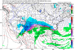
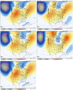
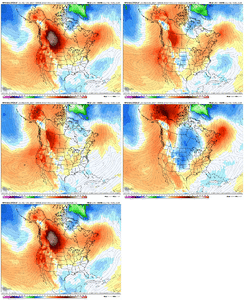
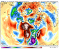
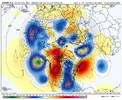
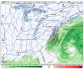
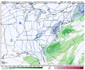
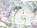
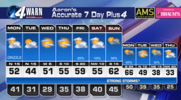
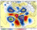
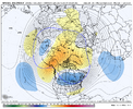
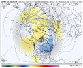
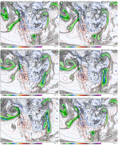
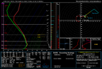
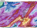
Gfs going wild at the end of its run
-
Hello, please take a minute to check out our awesome content, contributed by the wonderful members of our community. We hope you'll add your own thoughts and opinions by making a free account!
You are using an out of date browser. It may not display this or other websites correctly.
You should upgrade or use an alternative browser.
You should upgrade or use an alternative browser.
Pattern December Dud 👀
- Thread starter SD
- Start date
LukeBarrette
im north of 90% of people on here so yeah
Meteorology Student
Member
2024 Supporter
2017-2023 Supporter
Christmas Eve tooGfs going wild at the end of its run
1052 banana high on MN/canada border, just like the 80s!Gfs going wild at the end of its run
88 redux incoming….
Last edited:
That Christmas Eve forecast would be only the third time I've ever seen a White Chirstmas if it were to verify. In 2010 it started snowing Christmas night in Raleigh and when the storm ended the next day there was an accumulation of around seven inches. In 1989 there was the blizzard that hit the North Carolina coast and in Smithfield where I spent Chritsmas there was probably around two inches of snow that day.
LickWx
Member
Highs over performing today! Mid upper 60s
Brent
Member
You can pretty much always count on this around here on sunny warm winter daysHighs over performing today! Mid upper 60s
LickWx
Member
Yep, same for clear windless nights. This is why I don’t take the models temp forecasts on days like this seriously… if the models forecast 65-66 on a day like this , you’ll prolly hit 70.You can pretty much always count on this around here on sunny warm winter days
Yep. Thats one of the big points early in synoptic with Lackmann, on a day like this in WxChallenge he’s almost always warmer than modeling or even NWSYep, same for clear windless nights. This is why I don’t take the models temp forecasts on days like this seriously… if the models forecast 65-66 on a day like this , you’ll prolly hit 70.
NBAcentel
Member
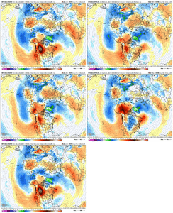
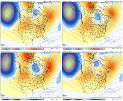
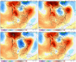
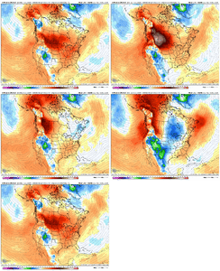
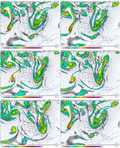
This will allow us to cash in at some point. Gonna stay positive this Winter. Quietly positive.This is amazing. Seems like we are stuck in a state that wants western ridging this winter View attachment 155651View attachment 155653View attachment 155654View attachment 155652View attachment 155650View attachment 155649
- Joined
- Jan 23, 2021
- Messages
- 4,602
- Reaction score
- 15,197
- Location
- Lebanon Township, Durham County NC
Euro just matched the AI at the end of the run
Dibs on "No way it can cut with a [1052] high up there"!1052 banana high on MN/canada border, just like the 80s!
88 redux incoming….
rburrel2
Member
Things are definitely looking more favorable close to Christmas. The end of the gfs wasn’t awful looking either.
NBAcentel
Member
That's a pretty good storm signal on that map. No idea if the surface is showing anything, but that is very nice upper air signal.euro looks so good lol View attachment 155655View attachment 155656
NBAcentel
Member
LukeBarrette
im north of 90% of people on here so yeah
Meteorology Student
Member
2024 Supporter
2017-2023 Supporter
Move that block closer to greenland and we are really talking againThis is amazing. Seems like we are stuck in a state that wants western ridging this winter View attachment 155651View attachment 155653View attachment 155654View attachment 155652View attachment 155650View attachment 155649
Webberweather53
Meteorologist
Both the extended GEFS and European Weeklies show RMM MJO entering phase 7 as we enter the new year.
Something is probably going to happen in early to mid January.
Also, I am working on the long-term analysis of ERA-5 OMI MJO (1940 - near present) and NC winter storms and the results are interesting thus far, having gone through all the data through the mid 1980s. Hopefully, I can finish it soon and show some of the results.
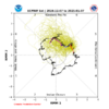
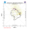


Quite a few members are showing high amplitude in phases 6-7. Any significance there?Both the extended GEFS and European Weeklies show RMM MJO entering phase 7 as we enter the new year.
Something is probably going to happen in early to mid January.
Also, I am working on the long-term analysis of ERA-5 OMI MJO (1940 - near present) and NC winter storms and the results are interesting thus far, having gone through all the data through the mid 1980s. Hopefully, I can finish it soon and show some of the results.
View attachment 155660
View attachment 155659
Webberweather53
Meteorologist
Quite a few members are showing high amplitude in phases 6-7. Any significance there?
The higher the amplitude, the more time it is likely to spend in phase 7. The long lived January phase 7 events (like most recently 2022) tend to give us multiple opportunities for snow/ice
lexxnchloe
Member
Brent
Member
NBAcentel
Member
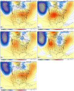
It looks like a good pattern for loading cold, but it looks kind of dry, verbatim. If we could get a little -NAO action to help us put, that would be nice. I like the -EPO and the western ridge, though it may be a tad too far east. But whatever...it sure beats the alternative usual pattern by a mile.Man the EC AIFS at H5 is a masterclass pattern. Looks like a copy and paste from jan 2014 View attachment 155663
NBAcentel
Member
Agree. It did have ENC snow with that one pacific wave that passed under the big TPV again this run.It looks like a good pattern for loading cold, but it looks kind of dry, verbatim. If we could get a little -NAO action to help us put, that would be nice. I like the -EPO and the western ridge, though it may be a tad too far east. But whatever...it sure beats the alternative usual pattern by a mile.
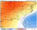
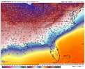
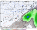
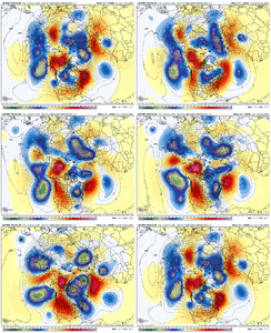
But this progression is a beauty. Slowly start getting the western ridging settled, then it sticks in place and the whole pacific pattern is arranging to a more equator-ward extended pac jet, with slow retrogression and more tendency towards ridging into Alaska, which starts dropping some really cold air and the trop TPV. We have been wanting a pacific like this for years
Webberweather53
Meteorologist
Brent
Member
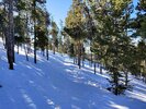
Doesn’t count if it’s not at home!Had to go all the way to the Rockies to find snow but I found it
View attachment 155648
GolfishardIknowit70
Member
I looked at all the mjo charts from the various models and ensembles, and most have it in either low amp phase 6 or into or towards the cod. Wanted to add that I go to dacular weather mjo to look at them in the same screen
Last edited:
Brent
Member
Doesn’t count if it’s not at home!
Oh yeah it's definitely not the same that's for sure
Honestly there were moments in the last week I wasn't even sure it would snow at all
I honestly think you had it worse than even those of us east of the Apps. We never even sniffed a legitimate chance last winter. You looked like you just missed really good storms in every directionOh yeah it's definitely not the same that's for sure
Honestly there were moments in the last week I wasn't even sure it would snow at allbut really the only reason I even did this trip was because last winter drove me crazy
Brent
Member
I honestly think you had it worse than even those of us east of the Apps. We never even sniffed a legitimate chance last winter. You looked like you just missed really good storms in every direction
That's why it bothered me so much and for the 2nd year in a row we had a donut hole. Like I never want to hear that phrase ever again
The January storm wasn't a complete fail but it did go from a big storm over 6 inches to barely an inch... And then of course it blew up for Nashville which has worse climo than us
I mean technically I came out here last year but I stayed in Denver and yeah it was not very good all the fun is out here
Last edited:
Overnight model guidance was a thief of joy.
Drought Buster Week;
Some of us gonna net close to 4 inches qpf before the end of this week. Once these winter big rains unfold, the ground/yard/ Pasteur/golf course stays wet till late Feb, regardless how many days of sun. Unless its frozen
Some of us gonna net close to 4 inches qpf before the end of this week. Once these winter big rains unfold, the ground/yard/ Pasteur/golf course stays wet till late Feb, regardless how many days of sun. Unless its frozen
- Joined
- Jan 23, 2021
- Messages
- 4,602
- Reaction score
- 15,197
- Location
- Lebanon Township, Durham County NC
Okay signal on the 0z EPS for the last of its run - 10/50 members show something for the last two days.

