Southern Track
Member
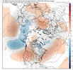
Wasn't expecting a big gorilla of a NPac low week 2...but EPS somewhat agrees. Nice if that ends up being a staple in January...assuming it's not to far east.
View attachment 155578
Probably gonna go to Stonebridge or Eagle Chase! Sucking during the warmer days is less miserable than sucking and freezing!Sunday afternoon will probably be perfect for golf in our area. Mid 60s and sunnny. The rest of the warm up looks wet
From what I know, the COD is better than having a strong amplitude in the warm phases, but I will let the experts weigh in on that.I am admittedly a novice at the MJO graphs - I imagine the wider turn is what you want, right? You dont want it hugging the circle of death.
I should've clarified - the wider turn through the cold areas for us.From what I know, the COD is better than having a strong amplitude in the warm phases, but I will let the experts weigh in on that.
Yeah it seems like the farther away from the COD, the stronger the pulse and more influential it is on the pattern. Of course, we caveat with the "it's just one piece of the puzzle" disclaimer.I should've clarified - the wider turn through the cold areas for us.
Wider turn, I assume, also means longer period of time in the given phase.Yeah it seems like the farther away from the COD, the stronger the pulse and more influential it is on the pattern. Of course, we caveat with the "it's just one piece of the puzzle" disclaimer.
Wasn't expecting a big gorilla of a NPac low week 2...but EPS somewhat agrees. Nice if that ends up being a staple in January...assuming it's not to far east.
View attachment 155578


You want it out of 4-5-6. That's by far and away the biggest thing. Especially 5. How I frigging hate 5. You want to predict warm spells a month in advance? That's your secret formula. I've done it many times and people are amazed. Why can't snow be that easy?I am admittedly a novice at the MJO graphs - I imagine the wider turn is what you want, right? You dont want it hugging the circle of death.
Yeah, 7-8-1 is our money zone, right?You want it out of 4-5-6. That's by far and away the biggest thing. Especially 5. How I frigging hate 5. You want to predict warm spells a month in advance? That's your secret formula. I've done it many times and people are amazed. Why can't snow be that easy?
Depends on the month. January yes you want 7/8Yeah, 7-8-1 is our money zone, right?
Yes. Both @Webberweather53 and I have individually found that January phase 7 (and 8 not far behind) is as close to a MJO money phase as we have for getting frozen precipitation in NC. These plots done by Allan Huffman are a good reference as well to see how it varies by month and by strength.Yeah, 7-8-1 is our money zone, right?
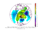
P.S. and looking at the H5 composite of phase 7 January, it's no great mystery why that is.RMM MJO Phase 7-8 in cold ENSO is usually the hot spot for getting a winter storm in NC.
View attachment 155534
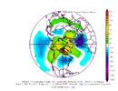
January phase 7 in general is the true hot spot for getting a winter storm in NC, with a 1 in 6 chance per day of seeing snow/ice. This is about 3x higher than climo
View attachment 155535

With me being in Boston next week, I hope you find out.I wonder what would happen if it went negative here instead of further east...
View attachment 155584
The EPS looks like it maaaaayyyy want to get a western ridge going with a trough in the east? You have to really squint though. The N pacific low needs to back up some...we'll see.
I started this season VERY pessimistic about cold/snow chances (still leaning that way hard). But we've had a solid 1-2 weeks of cool/cold air and a novelty snowy clipper for some, so considering it's December, that ain't bad. I'll take a few weeks of warm. Hopefully Webb's +TNH, TMNT, NSYNC, ACC, SEC will bring back some high latitude blocking in January.
View attachment 155583
Does it matter if it takes a wider or a tighter turn through the segment?Yes. Both @Webberweather53 and I have individually found that January phase 7 (and 8 not far behind) is as close to a MJO money phase as we have for getting frozen precipitation in NC. These plots done by Allan Huffman are a good reference as well to see how it varies by month and by strength.
MJO.html
www.americanwx.com
P.S. and looking at the H5 composite of phase 7 January, it's no great mystery why that is.
View attachment 155585
@Webberweather53 is certainly more of the expert on this subject matter, but the wider turn as you say is indicative of a stronger wave, which would likely stay in that location for longer. That said, the signal is virtually the same for the higher amplitude MJO events ("wider turn") compared to including all in the composite analyses (ignoring the amplitude of the wave and looking at all phase 7 January MJO events) Allan did (I'd need to see how many years of < 1 were included to figure out how significant this is, because if there aren't many years included it could be why the composite anomaly looks so similar).Does it matter if it takes a wider or a tighter turn through the segment?


It’ll take a while to recover from this garbage.
Even once the pattern flips back for the better, it’ll take at least a week to 10 days for true Arctic air (from Siberia) to get advected back into the CONUS.
Kicking the can til early January.
View attachment 155589
View attachment 155590
Are we gonna waste January as well?This is the classic cold rain purgatory pattern.
Not cold enough to snow and nowhere near warm enough to get good severe weather chances except for maybe the gulf coast.
Yuck
I was called a clown and a weenie for saying a couple of weeks ago that I hope we aren't kicking the can down the road and wasting the cold when the models showed a couple of storms, but they always kept them past 10 days.It’ll take a while to recover from this garbage.
Even once the pattern flips back for the better, it’ll take at least a week to 10 days for true Arctic air (from Siberia) to get advected back into the CONUS.
Kicking the can til early January.
View attachment 155589
View attachment 155590
It was nice of the models to keep the fantasy aliveI was called a clown and a weenie for saying a couple of weeks ago that I hope we aren't kicking the can down the road and wasting the cold when the models showed a couple of storms, but they always kept them past 10 days.

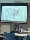
Is this 443 with Dr. Lackmann?View attachment 155594
Figured y'all might want to see what we are talking about in Synoptic Meteorology. We are doing a mini-unit on CAD!!! One of the only met schools that goes over CAD. Our professor used Feb 16, 2003 as an example. He also used one of the sleet/snow maps that NC State makes for North Carolina from this event. Im sure one of y'all could post that in here as a response to this. Seriously such a fun class!
Nope I go to Virginia Tech. Dr. Craig Rameseyer teaches it.Is this 443 with Dr. Lackmann?
He looks pretty young. Maybe 37 ? He’s a UGA Grad !Nope I go to Virginia Tech. Dr. Craig Rameseyer teaches it.
That was supposed to be the second horrific ice storm in that winter and CAD saved the day with sleetView attachment 155594
Figured y'all might want to see what we are talking about in Synoptic Meteorology. We are doing a mini-unit on CAD!!! One of the only met schools that goes over CAD. Our professor used Feb 16, 2003 as an example. He also used one of the sleet/snow maps that NC State makes for North Carolina from this event. Im sure one of y'all could post that in here as a response to this. Seriously such a fun class!
