Webberweather53
Meteorologist
What am I missing here? I'm sure we'll see above average temps and no snow regardless of what time of winter it is because thats how we roll now, but that doesn't look like recent winters from my memory. I'm used to seeing a huge ridge south of the Aleutians and troughing on the west coast. Yeah there is yellow over us as always but looks like ridging out west and troughing in the east by the isobars. And energy undercutting out west?This looks like the pattern that has set up in so many recent ninos View attachment 155566
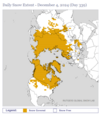
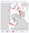
You can get snow extent and departures from normal at Rutgers Snow Lab: https://climate.rutgers.edu/snowcover/Anybody know what the typical snow cover is for this date? This looks pretty paltry and surprisingly so, to me, at least.
View attachment 155573


36/12 here, skin feels it lol. Gonna be another frigid nightMostly single digit and teens dews across NC this evening. Down at the coast, still in the mid 40s for dews!
Griteater, do these people or group have a good track record?In Seattle, they get their cold and snow from big ridges to their NW in the Bering Sea. In the UK, same concept, they get their cold and snow from big ridges to their NW in Greenland. So, there are some accounts over in that area that watch the NAO like a hawk and follow various meteorological concepts that can lead to -NAOs. Though not perfect (no one is), this is an account I'd recommend for -AO/-NAO forecast discussion: https://x.com/Met4CastUK
Latest post....https://x.com/Met4CastUK/status/1864797137227387090
"Mid-Late December Update
Poleward fluxing of -AAM anomalies are continuing on the latest GSDM update which is the reason we're seeing blocky outputs, not yet of the high latitude variety (at least, not with any consistency) but this is exactly what we want to be seeing. Couple this with the MJO transitioning into phase 5/6 and we find ourselves in a situation where the sub tropics & tropics are pointing in the same direction, i.e blocked patterns and a vastly different pattern to the usual westerly dominated pattern we often find ourselves contending with during December.
Interestingly, gravity wave torque is also on a rather steep incline, this often a pre-curser to +EAMT events which can cause significant stratospheric disruption but also dump a shed load of momentum into the atmosphere, namely the Pacific jet.
The GWO continues to orbit into Nino attractor phases, i.e a continued atmospheric & oceanic disconnect with no real sign of this changing for the foreseeable, the atmosphere is decidedly Nino rather than Nina, despite strong easterly trade winds in the Pacific.
What does this mean?
Potential for significant stratospheric disruption in January if we fast forward the clock, mid winter SSW? Maybe. In the shorter term, strong support for mid Atlantic highs to amplify towards the Arctic as -AAM flux continues into the higher latitudes via rossby wave packet transport, deterministic modelling will not have this down. I wouldn't be surprised to see modelling suddenly begin to converge towards colder/blocked northern hemispheric patterns within the next week or so.
The only thing we need to keep an eye on is the tropospheric vortex, how much energy is left over Greenland/Canada? Ideally, we want to see this shift eastwards to allow proper blocking to amplify north.
Steady.."
Do you by chance or anyone here have the ensemble members for snow?18z gfs singing Rocky Top Anthem. Later with qpf , next Fri, instead of Thurs
View attachment 155576
Yeah, good account. Not going to hit on every callGriteater, do these people or group have a good track record?
Last winter we had this look. It flooded us with mild pacific air, in dec and early jan. But it’s worth noting this look happened in early January, before that cold pattern occured (the pattern weakened the strat PV significantly) sort of similar like we might have coming up (Bering sea vortex signal)What am I missing here? I'm sure we'll see above average temps and no snow regardless of what time of winter it is because thats how we roll now, but that doesn't look like recent winters from my memory. I'm used to seeing a huge ridge south of the Aleutians and troughing on the west coast. Yeah there is yellow over us as always but looks like ridging out west and troughing in the east by the isobars. And energy undercutting out west?
Last winter we had this look. It flooded us with mild pacific air, in dec and early jan. But it’s worth noting this look happened in early January, before that cold pattern occured (the pattern weakened the strat PV significantly) sort of similar like we might have coming up (Bering sea vortex signal)
Stayed at 21 here. We had a bit of breeze I guess.19 here this AM
Cold air advecting, non radiational cooling.Stayed at 21 here. We had a bit of breeze I guess.
A lot here in NC complaining about the warmup coming. Sounds like golf weather to me!64° here in Tampa this morning!
