-
Hello, please take a minute to check out our awesome content, contributed by the wonderful members of our community. We hope you'll add your own thoughts and opinions by making a free account!
You are using an out of date browser. It may not display this or other websites correctly.
You should upgrade or use an alternative browser.
You should upgrade or use an alternative browser.
Pattern December Dud 👀
- Thread starter SD
- Start date
Brent
Member
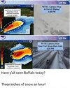
Just to add there's a primetime NFL game there tomorrow
GoDuke
Member
It was postponed last time they got that much snowJust to add there's a primetime NFL game there tomorrow
Brent
Member
It was postponed last time they got that much snow
Well see but I believe the heaviest snow is actually south of Buffalo. For some reason there's usually a sharp gradient up there
Drizzle Snizzle
Member
The Bills stadium is south of BuffaloWell see but I believe the heaviest snow is actually south of Buffalo. For some reason there's usually a sharp gradient up there
GolfishardIknowit70
Member
Orchard park I thinkThe Bills stadium is south of Buffalo
Brent
Member
But yeah it also appears the snow will break up a bit before the game. They are paying people to shovel the stadium tonight
GolfishardIknowit70
Member
The trough is too far east. Nothing more to say lol
HuhThe trough is too far east. Nothing more to say lol
597DM
Member
LolThe trough is too far east. Nothing more to say lol
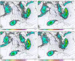
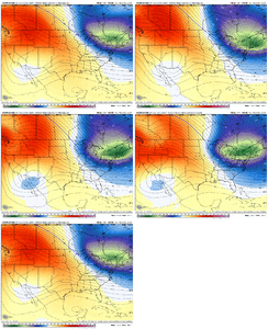
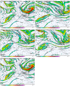
It’s the gray area descending down the western US ridge that is trending on the EPS that would drive cyclogenesis and overrunning precipitation later on. It may also interact with some of the Baja vorticity as well. On an ensemble mean at this range it can be fairly weak but it is beginning to trend a little stronger.The trough is too far east. Nothing more to say lol
NBAcentel
Member
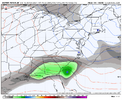
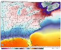
EC AI interacts but not as much due to a slower ejection of the Baja wave, and results in a poorly tilted system, so a more sheared wave is the result, and it doesn’t take great advantage of the CAD/in situ CAD dome in place due to the quick and suppressed solution. At least there’s still a interaction on this “bad” run 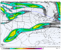


NBAcentel
Member
SimeonNC
Member
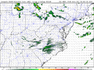
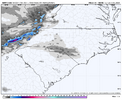
I wonder what the NAM is gonna showHRRR breaks containment mon night View attachment 155178
NBAcentel
Member
I wonder what the NAM is gonna show
Also wonder what other hi res models show (RRFS/HRW-FV3)
SimeonNC
Member
Blue_Ridge_Escarpment
Member
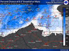
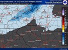
Wow that’s pretty bullish especially from GSP
NBAcentel
Member
Vort looks stronger and further S/W on both NAMS. We are cooking
NBAcentel
Member
NBAcentel
Member
This nam 3km run looks juicy… could be more then a floodlight event this run east of the mountains
SimeonNC
Member
NBAcentel
Member
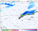
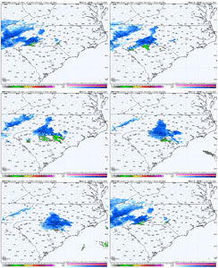
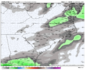
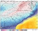
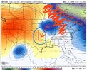
This kinda has the makings of one of those little light events that just kinda sneak up that we’ve seen a number of times through the years.Nam with a light event outside the mountains View attachment 155185View attachment 155186
Looks like some sfc dryness will have to be overcome initially if you get precip aloft. NAM3 has some pretty solid returns which gets stuff saturated pretty quick + falling into >0c you get some cooling from that melting
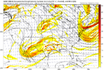
This trying to trend to a legit system, little stronger, sharpen up a hair....not out of realm of possibilityJust like the good ol' days.
View attachment 155190
CNCsnwfan1210
Member
Nam with a light event outside the mountains View attachment 155185View attachment 155186
That would be something if CLT and FAY received accumulating snow (even if it’s a dusting at best) before RDU, one model one run of course
Sent from my iPhone using Tapatalk
Yeah I think we still would need a good amount of additional shifts for this to trend to an actual widespread light event, but we've seen this so many times in the past and with it still being 48 hours out, it could potentially continue this stronger, more neutral tilt trend all the way in. That's historically been the name of the game when something like this starts happening down the stretch...it often doesn't ever really stop. We'll see.This trying to trend to a legit system, little stronger, sharpen up a hair....not out of realm of possibility
NBAcentel
Member
This is the trend man. NAM twins dig it 100mi further south than just about any other model except like the wrf CAMs. Wanna get some other models on board with this. GFS is pretty steadyJust like the good ol' days.
View attachment 155190
I want the nam on our side, been a long time but this is textbook for these small events that pop up. Crazy the gfs first showed it
NBAcentel
Member
- Joined
- Jan 23, 2021
- Messages
- 4,602
- Reaction score
- 15,197
- Location
- Lebanon Township, Durham County NC
Pretty okay saturation on the HRRR. Of course that is the end of its run
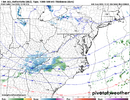
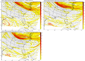
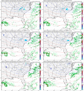
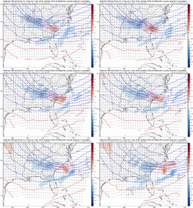
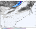
I don't hate that look at this lead. 12Z was a little slower and phased causing temp problems. A blend of the CION's 12Z and 00Z runs would likely work out perfectly.Not very great. Guess we needed more digging/tilting of the SW that icon run. Just light precipitation is the result. Still snow east of the mountains however View attachment 155200View attachment 155201View attachment 155202
Nothing to write home about on the 0z gfs as far as flurry watch. Trough a hair southeast compared to 18z and one frame of light precip in central nc
NBAcentel
Member
NBAcentel
Member

