-
Hello, please take a minute to check out our awesome content, contributed by the wonderful members of our community. We hope you'll add your own thoughts and opinions by making a free account!
You are using an out of date browser. It may not display this or other websites correctly.
You should upgrade or use an alternative browser.
You should upgrade or use an alternative browser.
Pattern December Dud 👀
- Thread starter SD
- Start date
NBAcentel
Member
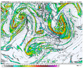
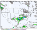
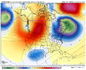
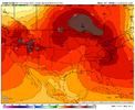
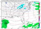
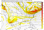
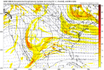
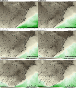
I’ll take where this was headed. Wish the icon had 2M Dews View attachment 155123View attachment 155124View attachment 155125
Blue_Ridge_Escarpment
Member
Also to keep in mind, 2m temps run warm on ICON
NBAcentel
Member
Could be way better that’s for sure
Blue_Ridge_Escarpment
Member
If the icon was showing 2m temps where we want them at this lead, I’d be concerned about long term power outages.Could be way better that’s for sure
I don't pay much attention to the winter weather models past seven days. Give me a good storm signal within five days and that's when my ears start to perk up. That being said, the period around December 7th is starting to look very interesting for many of us. We will see if the models continue to pick up on something happening during that period as it draws closer.
Twister
Member
I agree if we continue seeing this Tues Then we in business, But until then my expectations stay lowI don't pay much attention to the winter weather models past seven days. Give me a good storm signal within five days and that's when my ears start to perk up. That being said, the period around December 7th is starting to look very interesting for many of us. We will see if the models continue to pick up on something happening during that period as it draws closer.
We all enjoy telling ourselves this, but I’m not sure how much we actually believe it. We always will come back for more.I don't pay much attention to the winter weather models past seven days. Give me a good storm signal within five days and that's when my ears start to perk up. That being said, the period around December 7th is starting to look very interesting for many of us. We will see if the models continue to pick up on something happening during that period as it draws closer.
At least it seems we are waking up the Southern stream.
NBAcentel
Member
Don’t know if I like this GFS run regarding the CAD event… where’s the energy out west lol
Yeah, It's colder early but more suppressive and missing the SW in the PAC NW.Don’t know if I like this GFS run regarding the CAD event… where’s the energy out west lol
NBAcentel
Member
Yup this GFS run is likely not gonna have anything at all, or something super delayed
GFS trending to the euro. Could still be a later boomer for Boston metro
Very exciting.. very awesome.. very happy.
CNCsnwfan1210
Member
GFS doesn’t eject the Baja low from what I can tell on the 12z
Sent from my iPhone using Tapatalk
Sent from my iPhone using Tapatalk
LickWx
Member
Great GFS run so far, no ice for the mountains!
Brent
Member
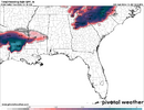
Frozen precip in Texas and Louisiana on the CMC
The GFS has a 1025 high pressure parked over eastern North Carolina on December 7th. It will be impossible to get anything to happen for the Southeast if that happens. There is one thing that is certain about weather models and that is there will always be changes especially in the mid to long term.
Lol this Canadian run is about to be wild. Gfs run has minor differences vs the overnight runs but it's enough to try to rex the west coast which locks the shortwave in place. Time to see if the euro goes toward the overnight gfs or if it stays consistent
Thread name living up to its name. Regardless, killer pattern for NC snow making if the tourists return to ski
I'm waiting on the precip maps on TT, but the CMC looks like more of a classic Miller A storm VS strictly a CAD event. Warmer in Ga. though.Lol this Canadian run is about to be wild. Gfs run has minor differences vs the overnight runs but it's enough to try to rex the west coast which locks the shortwave in place. Time to see if the euro goes toward the overnight gfs or if it stays consistent
If you're living and dying by every individual model run + not even bothering to look at the ensemble trends, you're going to be miserable. There is almost guaranteed going to be no consistency for the next several days, regardless of how this ends up. One model run also isn't a trend - the Euro also wobbled and came back at 06z.
Locking in a storm at this range and have every run match it is almost impossible. I've seen that with approx. two storms at this range in the last 20 years that I can recall, and they were with more simple setups than this will be.
Locking in a storm at this range and have every run match it is almost impossible. I've seen that with approx. two storms at this range in the last 20 years that I can recall, and they were with more simple setups than this will be.
D
Deleted member 609
Guest
My kids are going to suffer the rest of the day after that GFS runIf you're living and dying by every individual model run + not even bothering to look at the ensemble trends, you're going to be miserable. There is almost guaranteed going to be no consistency for the next several days, regardless of how this ends up. One model run also isn't a trend - the Euro also wobbled and came back at 06z.
Locking in a storm at this range and have every run match it is almost impossible. I've seen that with approx. two storms at this range in the last 20 years that I can recall, and they were with more simple setups than this will be.
JHS
Member
We may have a severe threat before any winter weather threat if the GFS is right. Maybe a lot of gradient wind too. A major low forms and heads straight to the Great Lakes.
LickWx
Member
CPS!!!!My kids are going to suffer the rest of the day after that GFS run
NBAcentel
Member
Yeah unfortunately the energy involved with our system is still not even to the Aleutians yet embedded in the extending jet so it’s gonna be a while
It's a wonky mess later with a huge ice storm in the classic zones.I'm waiting on the precip maps on TT, but the CMC looks like more of a classic Miller A storm VS strictly a CAD event. Warmer in Ga. though.
Straight to the chokeyMy kids are going to suffer the rest of the day after that GFS run
iGRXY
Member
To double down on that, I wouldn’t want to be seeing a winter storm in my backyard on the operationals beyond day 2-3 much less a week away. If you’re in the bullseye 48 hours out, you’re probably going to get screwed. Now x that by 100 at day 7 storms.If you're living and dying by every individual model run + not even bothering to look at the ensemble trends, you're going to be miserable. There is almost guaranteed going to be no consistency for the next several days, regardless of how this ends up. One model run also isn't a trend - the Euro also wobbled and came back at 06z.
Locking in a storm at this range and have every run match it is almost impossible. I've seen that with approx. two storms at this range in the last 20 years that I can recall, and they were with more simple setups than this will be.
Webberweather53
Meteorologist
Usually, to get a good CAD/ice storm in the Carolinas, we typically have a (east-based) -NAO/-PNA pattern in place.
-NAO traps/slows the 50-50 low off Atlantic Canada, while the -PNA allows for easier eastward propagation of southern stream waves into the south-central Plains that can overrun the cold air mass left behind by the 50-50 low.
It can certainly work here w/ a +TNH/+PNA too, but we'll have to try a little harder to get the waves in the right place.
Webberweather53
Meteorologist
In a +PNA/+TNH pattern like we have now, we tend to get more flat/overrunning type winter systems on the frontal boundary over the Gulf of Mexico & SE US coast. They're usually kind of a Miller A-B hybrid when they do happen here.
accu35
Member
Gfs will take another swing at a big one but it'll be post 300
That's certainly more entertaining to look at than the 300-hour torches it's been advertising, lol.Gfs will take another swing at a big one but it'll be post 300
New England weenies gotta be excited now. Several systems of wintry precip snow and ice. If it’s freezing rain in New York and Maine I doubt much of what falls below DC will be wintry. 

