Baja wave keeps trending faster too…..close to fireworks if keep the trending going
Sent from my iPhone using Tapatalk
looking at the GEFS panels, there are some big boys in there. I think this is our chance before a flip of the patternReally big difference now to as well is the ridge axis out west. It’s been shifting west, and this is opening up opportunity for us. we are looking solid atm on the gefs and the best run I’ve seen at H5 but it could still be so much better View attachment 155087

Do you have the mean/individual members?
Do you think this could be more ice or possibly holding on longer to snow like back in 22?View attachment 155105
GEFS mean went down vs 0Z but that is due to way more members being Ice Storms
Could easily see a 2022 redux. If and that’s a big if since this is still 200 hours out and we need way more consistent runs. With that said, if it does actually happen you probably see models showing ice and sleet for much of the western Carolinas and NE Georgia with a switch around I40 north. But we get a front end thumping of snow. Now does it hold on longer like it did in 2022 where we were expecting maybe an inch of snow before the switch or does it end up giving me another 7” of snow before switching would be the question IF it happens. We wouldn’t know those details until 24 hours out at the earliest. The HRRR was the first to start sniffing that out back then and it took the NAM all the way until we were 3 hours past the switchover before it finally picked up on what was happening.Do you think this could be more ice or possibly holding on longer to snow like back in 22?
Yep. How the models handle that lobe of the TPV north of the Great Lakes on day five is the thing to key on as the models run. The EMCF and ICON are similar VS the GFS and CMC which are also similar in closing off that backside piece by day 5 rather than the energy getting absorbed by the larger trough.Let's see who wins...this isn't 10 years ago when Euro always beat the GFS.
This is day 7 but the changes to get here start around day 5'ish. So would think we see some convergence this weekend.
View attachment 155110
With respect to the air mass, this has high end potential from a cold air damming standpoint if we don’t see drastic changes (we could of course)Man it's nice to wake up and see several new pages in this thread. We're finally getting a little bit of model fantasy payoff for the kind of air mass we'll have in place. It's nice to see, and necessary for forum sanity, I think.
I just hope this isn't a case of the models kicking the can down the road when we see something 10 days out only to go poof in a couple of days, rinse and repeat.Man it's nice to wake up and see several new pages in this thread. We're finally getting a little bit of model fantasy payoff for the kind of air mass we'll have in place. It's nice to see, and necessary for forum sanity, I think.
With the Baja upper low finally ejecting eastward, I don't think this precipitation event will completely go poof, but the timing and form of the precipitation could very well change many times in models.I just hope this isn't a case of the models kicking the can down the road when we see something 10 days out only to go poof in a couple of days, rinse and repeat.
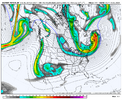
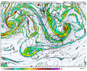
174<240I just hope this isn't a case of the models kicking the can down the road when we see something 10 days out only to go poof in a couple of days, rinse and repeat.
Just noticed your location update. Is that permanent or temporary? Be good to have you in this area174<240
Hopefully permanent. Im glad to be here. But you may feel differently when all the snow ends up east this year.Just noticed your location update. Is that permanent or temporary? Be good to have you in this area
Whoa, that's the stuff CAD dreams are made of.With respect to the air mass, this has high end potential from a cold air damming standpoint if we don’t see drastic changes (we could of course)
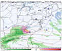
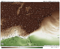
CMC has a dewpoint of 8 deg in Columbia as precip is approaching into the wedge on Dec 8th
View attachment 155112
View attachment 155113
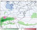
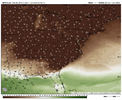
GFS has a dewpoint of 5 deg in Augusta as precip is approaching into the wedge on Dec 7th
View attachment 155114
View attachment 155115
That it is. I just don't want this cold to be for nothing.174<240
