NBAcentel
Member
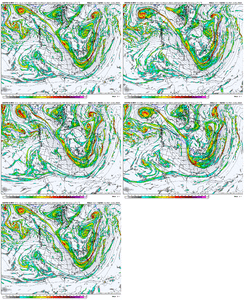
Makes me wonder if we have a window of favorable pattern in d8-12 range as the trough axis starts migrating W before the SER reappears around D12-16You can see the mean trough shifting west somewhat around mid-month as the Pacific jet retracts in response to this coming week's -EAMT event.
View attachment 155037
View attachment 155038
View attachment 155039
Yall think if the SER re appears mid month its brief or locks in?
Is this going to be a pattern that reloads every 2-3 weeks throughout winter or are we gonna be looking at a warm January?I'd wager a guess that outside of a well timed front or wedge (this doesn't seem impossible in this look) we are likely losing the idea of a cold Christmas. The whole process of adding momentum back to the pac jet and reestablishing cold is probably a 2-3 week deal so the cold is back roughly around new years
Unacceptable. This needs to be fixed before Christmas. ThxI'd wager a guess that outside of a well timed front or wedge (this doesn't seem impossible in this look) we are likely losing the idea of a cold Christmas. The whole process of adding momentum back to the pac jet and reestablishing cold is probably a 2-3 week deal so the cold is back roughly around new years
It doesn't matter. You're out, sir.Is this going to be a pattern that reloads every 2-3 weeks throughout winter or are we gonna be looking at a warm January?


I'm still rolling with my thoughts from August just push the windows back 5-10 daysIs this going to be a pattern that reloads every 2-3 weeks throughout winter or are we gonna be looking at a warm January?
If I had to put out a winter forecast today I'd go +1-3 Dec +2-4 Jan +6-8 Feb. Min temps for most of the region in the upper single digits (North/ normally colder) to upper 10s (south/urban centers). I think with the cold likely dumping in the rockies and upper Midwest areas of TX, AR, Ms, TN, NAl probably sneak in 1 or 2 significant overunning events, for us the carolinas if we score big its likely a miller a. Most likely period for cold/snow is 12/20-1/10 (possibly later as you go west), another lower confidence period late in November into the first handful of days in December. No reason to really predict snowfall vs average since our seasonal totals are low enough one good storm in an overall warm pattern puts you at 100+%. Caveats right now are the SPV, how much north Atlantic blocking is realized if any, how strong does the nina get, when does it start breaking down and where does the western ridge setup. But it's still late August so this will likely change
Wowoww! Bro you predicted it perfectly … you are the new Joe bastardi!I'm still rolling with my thoughts from August just push the windows back 5-10 days
Meterological muscleWowoww! Bro you predicted it perfectly … you are the new Joe bastardi!
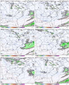
What areas do you think have the best chance of potentially seeing anything?This has been comical to watch. Every cycle a different NWP suite has the wave sharpen up enough to produce some QPF, but each time it's a different suite, and each cycle it's only one suite. UKMET had to have it's moment in the sun at 00z. I think almost everything outside the NAM and CMC/RGEM have shown something at this point, so we know what's coming next.
View attachment 155043
View attachment 155042
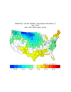
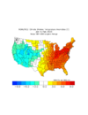
When I wrote that I had the SER back by 12/10 with the cold biased more in late November. Even with that if we get one of these heat pump SERs with the high dews and lows near 60 it won't take long to erase those departures unfortunatelyWe going to have really blowtorch the back half of Dec to not finish BN...I mean it is us...so yeah I guess that probably happens. But right now the 1st half of Dec looks -7 to -8FView attachment 155047
Dec 2022 was BN but then we went complete blowtorch in Jan/Feb. If that happens this year just kill me now...When I wrote that I had the SER back by 12/10 with the cold biased more in late November. Even with that if we get one of these heat pump SERs with the high dews and lows near 60 it won't take long to erase those departures unfortunately


Agreed it's been so hard to get any sustained cold around here in DJF this is a nice treat especially since we basically had extended summer through November this yearDec 2022 was BN but then we went complete blowtorch in Jan/Feb. If that happens this year just kill me now...
It's why I am going to really appreciate any BN temps we can get.
View attachment 155049View attachment 155048
In Shane’s forecasts we trust! You are my number 1 forecaster, after nailing this you knocked webber back to 2 and you take title as forums greatest forecaster. Lead us to glory shane!Agreed it's been so hard to get any sustained cold around here in DJF this is a nice treat especially since we basically had extended summer through November this year
At this point, odds are probably nowhere will see much of anything. Central to southern VA probably would stand the best chance to see a few snow showers, maybe as far south as the NC/VA border, but odds for anything widespread seem pretty low.What areas do you think have the best chance of potentially seeing anything?
