-
Hello, please take a minute to check out our awesome content, contributed by the wonderful members of our community. We hope you'll add your own thoughts and opinions by making a free account!
You are using an out of date browser. It may not display this or other websites correctly.
You should upgrade or use an alternative browser.
You should upgrade or use an alternative browser.
Pattern December Dud 👀
- Thread starter SD
- Start date
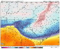
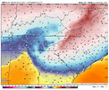
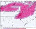
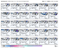
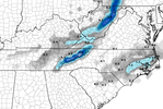
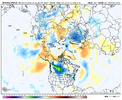
It’s amazing how the CAD is always the exact same fingerprint.GFS reeling us back in View attachment 154968
NBAcentel
Member
CAD winter storm setup isn’t impossible in this pattern if you slide a trough to SE Canada with a trailing high and we get some sort of ejection from the SW us or dig something far west
NBAcentel
Member
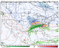
The GFS does a good job of showing how a western ridge / eastern trough doesn't have to mean a parade of clippers and dry NW flow. A ridge spike coming out ahead of the Aleutian low (like you mentioned recently) forces the downstream wave to dive SE into the S Plains in a split flow...i.e. having the ample stream separation is the key to getting the more potent storm in this kind of patternCAD winter storm setup isn’t impossible in this pattern if you slide a trough to SE Canada with a trailing high and we get some sort of ejection from the SW us or dig something far west

NBAcentel
Member
Yep. Stream separation (especially initially) is also key to raising heights above the system and around the Great Lakes which causes descent and high pressure in general for cold air damming. That GFS run evolution truly reminded me of that winter storm in January 2022 (same setup with diving energy that turned into a cutoff, a SE Canada vortex and rising heights around the lakes)The GFS does a good job of showing how a western ridge / eastern trough doesn't have to mean a parade of clippers and dry NW flow. A ridge spike coming out ahead of the Aleutian low (like you mentioned recently) forces the downstream wave to dive SE into the S Plains in a split flow...i.e. having the ample stream separation is the key to getting the more potent storm in this kind of pattern

would help if we could dig some energy before hand and bomb something out off the coast
Now where have I read this take before?
Webberweather53
Meteorologist
Some North Pacific jet retraction is favored near and just past mid-December w/ -EAMT event being forecast next weekend.
Any potential cold after mid-month may briefly shift back westward, before I suspect it comes back east yet again at the tail end of December into early January. Although the retraction will be limited by the high initial +AAM & continued tropical forcing from the Maritime Continent & West Pacific, so I don't expect us to see the jet retract to the point we see a persistent, classic Nina pattern w/ a ridge over the Aleutians.
High descending east of the Himalayas into the Urals & Kazakstan, with a trough near-east of China & Japan is one big clue of a -EAMT.
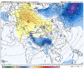

Do we like high +AAM and highs descending into the Urals with -EAMT?Some North Pacific jet retraction is favored near and just past mid-December w/ -EAMT event being forecast next weekend.
Any potential cold after mid-month may briefly shift back westward, before I suspect it comes back east yet again at the tail end of December into early January. Although the retraction will be limited by the high initial +AAM & continued tropical forcing from the Maritime Continent & West Pacific, so I don't expect us to see the jet retract to the point we see a persistent, classic Nina pattern w/ a ridge over the Aleutians.
High descending east of the Himalayas into the Urals & Kazakstan, with a trough near-east of China & Japan is one big clue of a -EAMT.
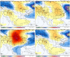
View attachment 154977
Webberweather53
Meteorologist
Do we like high +AAM and highs descending into the Urals with -EAMT?
My guess is the ridge on the west coast shifts westward a bit into the Gulf of Alaska & Alaska in week 3, with the core of any would be cold over the Northern Plains or so.
I think it’ll be something in between what we’re seeing this coming week w/ the trough axis to our east and a classic -PNA nina pattern w/ a western trough. Might work if we get just enough of a SE ridge but not too much to overwhelm everything.
Hard to know that when sensible weather in this longwave pattern is very fickle and can flip from vodka cold to a torch with subtle shifts
Webberweather53
Meteorologist
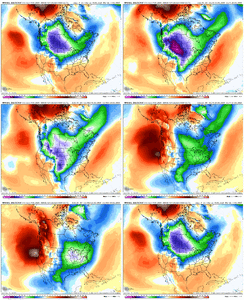
I like the way the GEFS extended control is handling the overall evolution of this pattern in week 3 through the end of December.
Core of the cold shifts back west for a bit into the Northern Plains or so following a -EAMT event, but higher initial +AAM and favorable MJO forcing in the West Pacific eventually force this cold back east again near the end of December into early January or so w/ +PNA returning yet again
Perhaps we can reel in a big fish during the latter transition period here or in this next bout of cold around or just after the Holidays. Southern jet may be more active in early Jan or so too with the west pac mjo

Webberweather53
Meteorologist
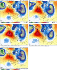
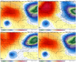
yikes. Pretty nasty retraction of the GEFS this run in the longer range turns it more into a central US trough View attachment 154957
Yeah I think that’s generally what will happen after this jet retraction. I could see a legit opportunity arise way down the line as we transition out of this and back into a +PNA ish/+TNH type pattern in early Jan or so
^ I’m actually in disagreement with all of this and what has been said. La Niña favors warmer and dryer overall. Time is running out for the early 1 hitter storm but there’s still time in climo areas. I believe it will take CAD for anyone east of the mountains to score this winter. I could see one storm this season for those in the foothills and northwest Piedmont. Elsewhere gonna be some close calls but largely cold rain Charlotte to Raleigh.
did you eat the pants yet?^ I’m actually in disagreement with all of this and what has been said. La Niña favors warmer and dryer overall. Time is running out for the early 1 hitter storm but there’s still time in climo areas. I believe it will take CAD for anyone east of the mountains to score this winter. I could see one storm this season for those in the foothills and northwest Piedmont. Elsewhere gonna be some close calls but largely cold rain Charlotte to Raleigh.
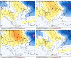
Yeah, the ridge axis needs to shift westward some to give the SE a reasonable chance of wintry weather given the longer wavelengths at this time of year. The 8-14 day CPC shows this need to retrograde the +PNA nicely.My guess is the ridge on the west coast shifts westward a bit into the Gulf of Alaska & Alaska in week 3, with the core of any would be cold over the Northern Plains or so.
I think it’ll be something in between what we’re seeing this coming week w/ the trough axis to our east and a classic -PNA nina pattern w/ a western trough. Might work if we get just enough of a SE ridge but not too much to overwhelm everything.
Hard to know that when sensible weather in this longwave pattern is very fickle and can flip from vodka cold to a torch with subtle shifts
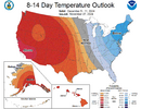
Drizzle Snizzle
Member
The oranges are creeping into the southeast.Yeah, the ridge axis needs to shift westward some to give the SE a reasonable chance of wintry weather given the longer wavelengths at this time of year. The 8-14 day CPC shows this need to retrograde the +PNA nicely.
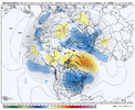
View attachment 154979
Ahh, 200 hours. Where the digital snow flocks like the salmon of capistrano.
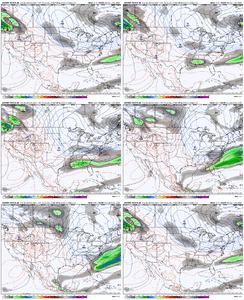

While others may disagree, I believe this was likely our best opportunity to get some flakes for the foreseeable future. The modeled upcoming pattern with no Greenland blocking will likely result in a trough axis not as far south, so it will likely be a favorable northeastern US pattern more than anything else. We can always get lucky if the western ridge is tall enough and in the right position with a well-timed, positioned and strong enough wave, but luck hasn't exactly been our thing lately, even in better setups like we're in now that matched analogs for southeastern winter storm periods.


While others may disagree, I believe this was likely our best opportunity to get some flakes for the foreseeable future. The modeled upcoming pattern with no Greenland blocking will likely result in a trough axis not as far south, so it will likely be a favorable northeastern US pattern more than anything else. We can always get lucky if the western ridge is tall enough and in the right position with a well-timed, positioned and strong enough wave, but luck hasn't exactly been our thing lately, even in better setups like we're in now that matched analogs for southeastern winter storm periods.
Last edited:
There’s no greater kick in the nuts than waking up to a Miller B fantasy runGFS reeling us back in View attachment 154968
Avalanche
Member
I’ve seen so many stories of all these rare snow events yet we can’t get any in a normal climate region for winter snow chances. WeirdWhile we’ve been over here fighting for our lives for the last 10 years View attachment 154983
Now where have I read this take before?
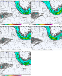
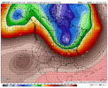
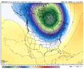
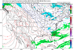
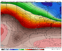
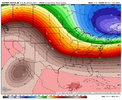
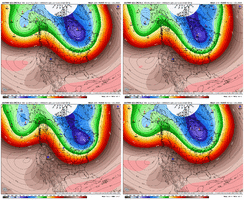
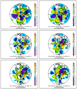
The Strat PV is currently very strong (1st image). That can be fine as long as it is getting stretched and is nosing down into Canada...but maybe moreso than the ridge / trough pattern going forward, my question / concern would be the SPV pulling back and consolidating over the pole as is being shown on the Euro here (2nd image). You would think that the ridge / trough pattern in the troposphere would be way more important, but seems like more times than not, we need both to get the cold down into us (ridge / trough pattern and support from the SPV behavior)
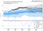

Last edited:
NBAcentel
Member
One Thing I’m noticing is a tendency to stronger western ridge on recent guidance. ICON continued it at 12Z and it looks like the GFS is gonna follow
NBAcentel
Member
NBAcentel
Member
CNCsnwfan1210
Member

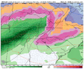
GFS came close to a decent coastal just too far offshore on the the 8th
Sent from my iPhone using Tapatalk
Southern Track
Member
Axis just a bit too far east. Shocker lol.
GFS came close to a decent coastal just too far offshore on the the 8th
Sent from my iPhone using Tapatalk
Webberweather53
Meteorologist
NBAcentel
Member
Webberweather53
Meteorologist
Webberweather53
Meteorologist
We could use a little pacific jet retraction from a -EAMT in the 2nd week of December. Need to shift the trough axis over the eastern us further west to get a better chance of overrunning type snow/ice.
NBAcentel
Member
Webberweather53
Meteorologist
NBAcentel
Member
NBAcentel
Member

