-
Hello, please take a minute to check out our awesome content, contributed by the wonderful members of our community. We hope you'll add your own thoughts and opinions by making a free account!
You are using an out of date browser. It may not display this or other websites correctly.
You should upgrade or use an alternative browser.
You should upgrade or use an alternative browser.
Pattern December Dud 👀
- Thread starter SD
- Start date
Brent
Member
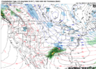
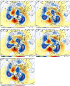
06z GEFS seems to have more of a signal then its had for the storm that the AI Euro has been hitting at. It ain’t much but it’s something. Anybody have the individual panels?
Eh not so much after all but still a system.
Eh not so much after all but still a system.
ITUSETOSNOW
Member
KATL say low 20s for Atlanta Sunday night. I sure hope the "official" reading can get to at least 31,,,LOL?
Ya'lllllll. Are we making winter great again? I need this! Hope everybody is well. 


Light snow event still possible especially TN and the NC mountains Sunday into Monday. Not sure we're going to get enough digging to give us the moisture transport and lift east of there, but there's still time. Certainly seen these types of events trend to a light event east of the mountains in the past.
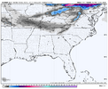
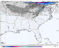


I mean this is the range when we start to see legit threats. We’ve had the euro, now the icon, and the GEFS at 06z did have an increase in members. I know I’m probably reaching but damn!
accu35
Member
You’re not reaching, you’re watching, as you should be. That’s our charter in hereI mean this is the range when we start to see legit threats. We’ve had the euro, now the icon, and the GEFS at 06z did have an increase in members. I know I’m probably reaching but damn!
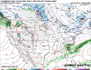
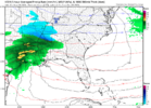
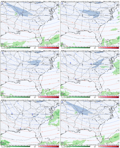
Yeah the ICON isn’t far off. Drops a wave from Washington state into the southern plains along the base of the eastern trough. Looks a bit suppressive, but good run in the big picture
accu35
Member
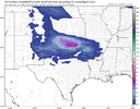
View attachment 154901It’s a start
That was getting ready to be a central Alabama paste bomb.
- Joined
- Jan 23, 2021
- Messages
- 4,602
- Reaction score
- 15,197
- Location
- Lebanon Township, Durham County NC
One thing if we can rope this in, the ground should be colder than normal this time of year.
Pics like this remind me of the old days
This will be the coldest and most dry start to December that I can remember. We may score a little snow sometime this winter but it won’t be early! Biggest chances have always been Jan- Feb!
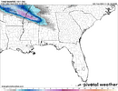
The Canadian tried. I’d much rather be dealing with suppression at this point than an amped up system imo.
Euro has a parade of cold shots into the E and SE. Couple of wound up waves dropping out of Canada past D10 that would be interesting
- Joined
- Jan 23, 2021
- Messages
- 4,602
- Reaction score
- 15,197
- Location
- Lebanon Township, Durham County NC
I might be in the minority on this but outside of snow this is very acceptable
Not cold enough for me. Need all 30s for highs.I might be in the minority on this but outside of snow this is very acceptable
I guess it will make it feel like Christmas, but really would like some snow with it since we don't get cold like that often.I might be in the minority on this but outside of snow this is very acceptable
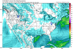
12z Euro still full-send on a huge piece of the TPV later in the run. Lots of interesting model solutions in our future I imagine.
View attachment 154910
All that western blocking…. Drool worthy.
Webberweather53
Meteorologist
We’re gonna have this overall wave pattern for a majority of this winter (& if history serves us right, it’ll be back next winter too) . Plenty of time to make some magic happen
We’re gonna have this overall wave pattern for a majority of this winter (& if history serves us right, it’ll be back next winter too) . Plenty of time to make some magic happen

Was wondering where you've been hiding with all this western ridging popping up.All that western blocking…. Drool worthy.
Like most modeling, the AI Euro now doesn't have a wave dropping down into us early next week underneath the bowl-shaped trough E of the Rockies. Shame cause the cold high pressure works in beautifully during that timeframe. Let's see if we can somehow find a wave to work thru the western ridging and dive in the next few days though.
It does have a little ice this run on Dec 8th

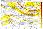
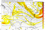
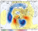
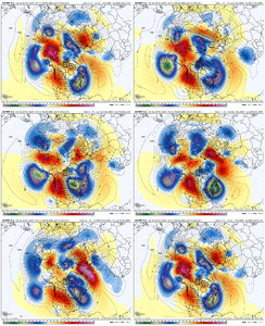
Here are days 5-10 and 10-15 on the AI Euro run. Impressive look there for day 10-15 as the Pac Jet calms down a bit and the western ridging fires up

Was wondering where you've been hiding with all this western ridging popping up.
Like most modeling, the AI Euro now doesn't have a wave dropping down into us early next week underneath the bowl-shaped trough E of the Rockies. Shame cause the cold high pressure works in beautifully during that timeframe. Let's see if we can somehow find a wave to work thru the western ridging and dive in the next few days though.
It does have a little ice this run on Dec 8th

Here are days 5-10 and 10-15 on the AI Euro run. Impressive look there for day 10-15 as the Pac Jet calms down a bit and the western ridging fires up

Not gonna lie, I’ve been burnt too many times over the last few years. My winter mojo is on life support. A few weeks of a +PNA would definitely get the fire burning again.
Edit: That last AI loop is straight 2013/2014.
Last winter almost broke me lol. Not so much that I didn't see anything (I'm reasonable enough to know the climatology fight that is real), but just how it was just a disaster up and down the whole eastern seaboard. And the winter before that was just as bad. Then November comes, and I'm right back in here lolNot gonna lie, I’ve been burnt too many times over the last few years. My winter mojo is on life support. A few weeks of a +PNA would definitely get the fire burning again.
EWebb has mentioned this, but here is SST comparison between Nov 2013 (Left) and Nov 2024 (Right)Not gonna lie, I’ve been burnt too many times over the last few years. My winter mojo is on life support. A few weeks of a +PNA would definitely get the fire burning again.
Edit: That last AI loop is straight 2013/2014.

NBAcentel
Member
EWebb has mentioned this, but here is SST comparison between Nov 2013 (Left) and Nov 2024 (Right)

That warm pool is a +TNH generator
The cold on that AI run is pretty incredible. After Thanksgiving a brief warm up ahead of a front that gets us to either side of 50 is really the warmest period for the run
- Joined
- Jan 23, 2021
- Messages
- 4,602
- Reaction score
- 15,197
- Location
- Lebanon Township, Durham County NC
Again, give me as much cold for as long as possible and we’ll figure it outThe cold on that AI run is pretty incredible. After Thanksgiving a brief warm up ahead of a front that gets us to either side of 50 is really the warmest period for the run
BingoAgain, give me as much cold for as long as possible and we’ll figure it out
How many times have rogue pieces of energy appeared in NWP around D4-5 and given us winter storms in the past. You guys are right - if we can get that sort of amplified pattern for a decent stretch the odds go up. But we have been incredibly unlucky the past few years which is frustrating.Bingo

