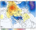
Gfs will take another swing at a big one but it'll be post 300

Gfs will take another swing at a big one but it'll be post 300

gfs/gefs suite pretty isolated as far as having any QPF return for this. NBM entertains the possibility with some very slim odds, but i wouldn't get fired up unless somebody else starts showing something
If the shortwave doesn’t pass to our south and take on a little more neutral tilt anything more than a passing flurry will be about all she wrote.I’m
gfs/gefs suite pretty isolated as far as having any QPF return for this. NBM entertains the possibility with some very slim odds, but i wouldn't get fired up unless somebody else starts showing something
Agreed. Like I had said yesterday I think VA/NC border and north stand the best chance at a few flakes as of now.
Looks like there’s some + vort advection in the ~800-700mb vicinity as well as a little bit of 850 FGEN even on the 12z GFS. It’s just not present on anything else, confusing to see itAgreed. Like I had said yesterday I think VA/NC border and north stand the best chance at a few flakes as of now.
If the mesos don’t hone in on it here shortly, definitely wouldn’t get excited about itLooks like there’s some + vort advection in the ~800-700mb vicinity as well as a little bit of 850 FGEN even on the 12z GFS. It’s just not present on anything else, confusing to see it
It’s definitely coming back. There’s clearly a signal there. This happens all the timeThe only thing I'll say about the day 7 (lost) storm, is in the past, we would many times lose a storm at about day 7 just to have it come back by day 5. Not sure if that is an issue/thing anymore, but we'll see.
Brick!!!!!?The only thing I'll say about the day 7 (lost) storm, is in the past, we would many times lose a storm at about day 7 just to have it come back by day 5. Not sure if that is an issue/thing anymore, but we'll see.


Yeah much improved on the 12k, previous run had nada. 3k probably its usual precip dry bias.Nam 12km has some spotty returns east of the mountains but the 3KM looks closer to the GFS for the flizzard
Definitely flood light worthy
If it wasn’t during the beginning of the work week I’d be booking GatlinburgDefinitely flood light worthy
Energy there and stronger just gets held up again.Looks like the GFS is another whiff

Energy there and stronger just gets held up again.
I agree that we more than likely won't get the full phase, but if it stretches and a stream of it interacts and helps to tug the entire northern stream trough further south, that would be the best-case scenario IMO.Has Baja energy ever come out when we’ve needed it to? Seems like whenever we score in +pna regimes we get northern stream energy out of Canada coming off the ridge just right and it tilts just enough for cyclogenesis near the base of the trough.
I would not put any bets on getting some kind of phase of that Baja energy. It’s always a tease.
Would also really help to if we just get a quicker, but more wound up exit of the TPV to our NE, and instead of more northern stream energy behind the trailing vortex, just a clean trailing ridge behind it for a stronger high pressure > CAA east of the apps. Something like the CMC/GFS from last night. The 00z GEFS from last night was the best example of that ens wise. I’d imagine a quicker exit increases odds of something digging further given stream separationI agree that we more than likely won't get the full phase, but if it stretches and a stream of it interacts and helps to tug the entire northern stream trough further south, that would be the best-case scenario IMO.
The danger in that though is you could end up with a trough that gets too amplified ala likely where the UKMET was going, which would probably be a M.E.C.S in New England and just a mess to rain for us haha.
