• Hello, please take a minute to check out our awesome content, contributed by the wonderful members of our community. We hope you'll add your own thoughts and opinions by making a free account!

Pattern December - Deal or No Deal?

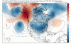
Yall are still looking too far ahead. This look here is beautiful on the Euro. Honestly even if it doesnt lead to storms, there are no major strengthening of the SE ridge and at most we get transient short wave ridging. The Euro is at worse gonna bring massive snow pack to the midwest which is where the majority of our cold air comes from. Get this look in four days and Im pumped.

500h_anom.na.png
 
Sigh, still having to straighten you out.

Edit: Looking over things, im liking what Im seeing. Seeing a decent agreement on a strong western ridge in the midrange.

fv3p_z500a_namer_36.png

Lol you’re inside day ten I’m way out into week two just pointing out slight differences


Sent from my iPhone using Tapatalk
 
Lol you’re inside day ten I’m way out into week two just pointing out slight differences


Sent from my iPhone using Tapatalk

Yeah but you are looking at a million dollar check that doesnt exist while walking on a real hundred dollar one. You have been taught better. Before long Shane will demote you, your wife will kick you out and you will have to live with Brick.
 
Yeah but you are looking at a million dollar check that doesnt exist while walking on a real hundred dollar one. You have been taught better. Before long Shane will demote you, your wife will kick you out and you will have to live with Brick.

Some days I wish I would be voted out and removed from the Southernwx board of directors lol

Wife is moody being 7 months pregnant so living with brick does not sound half bad .

But I get your point . We will see if the ridge materializes


Sent from my iPhone using Tapatalk
 
But JB jackpotted us. We got that going for us. He is usually right?

View attachment 7641 View attachment 7642
The thing is this pattern right here, will verify one day. I'm thinking the late 1800's must have looked like that, so 120 year pattern might be right around the corner. That might put JB in ColdRain snow on Xmas day rare air, lol. Or Larry's Sav snow prediction. He should be so lucky :)
 
Some days I wish I would be voted out and removed from the Southernwx board of directors lol

Wife is moody being 7 months pregnant so living with brick does not sound half bad .

But I get your point . We will see if the ridge materializes


Sent from my iPhone using Tapatalk
Oh wow!!! Didn’t know ya guys was expecting a 2nd child. He/She might be born right in the middle of a snowstorm. That would be wild!!! Be something to tell them when they grow up. I know my mom told me about the snow when I was born. They even slid into the ditch on the way to the hospital when I was about to be born!! Lol.
 
Last edited:
00z gfs is just a little cold in the extended lol


Sent from my iPhone using Tapatalk

Would be stupid cold day 12 or so coming across that Midwest snow pack. To be honest, that part isnt far fetched, the GFS actually strengthens the western ridge faster. Who needs a -NAO when you get a +PNA/-EPO like that.
 
and so far FV3 sucks out loud past hour 100. I mean I’m not mad. It’s still November. I just don’t see anything sexy out of the 00z runs. I’m sure that will all change in 6-12 hours so
I’m not sweating it. Model weather is not weather
 
Well for instance, we have red 2m anomolies in the SE from 120-276hr...then 348 through the end of the run is an all out torch. Not sure what I’m missing here

A ton. Firstly you have to learn to read 500mb, secondly learn to read 500mb and thirdly, learn to read 500mb. Oh and anything past 240hrs is as accurate as my one year old drawing on my table.
 
A ton. Firstly you have to learn to read 500mb, secondly learn to read 500mb and thirdly, learn to read 500mb. Oh and anything past 240hrs is as accurate as my one year old drawing on my table.
Fair enough. It’s easier for me to read color maps though. I like pwetty picktures.
 
FV3 drops the hammer and not completely in voodoo at that. First storm chance would come next Tuesday if it were right. Beautiful look from hr192 on.
 
Completely understand. You would get a ton more information if would read 500mb. I dont even look at the surface maps except for a quick glance until under a week out.
I get the general idea of what we want to see at 500mb in the winter time. Ridge out west. Eastern trough. Big heights over Greenland/Alaska. What is this called when you have a ridge just west of Alaska? Also it looks like we lose our Greenland block out past hr100 and that causes the east to be a little ridgey until heights rise west of
Alaska?
2B205A4C-29F6-49BF-8A4B-187657212D1B.png
 
I get the general idea of what we want to see at 500mb in the winter time. Ridge out west. Eastern trough. Big heights over Greenland/Alaska. What is this called when you have a ridge just west of Alaska? Also it looks like we lose our Greenland block out past hr100 and that causes the east to be a little ridgey until heights rise west of
Alaska?
View attachment 7652

That, but we also lose our western ridge which allows the trough to dig in out west causing ridging in the east. Then you see ridging building back into the east PAC as the Alutian low builds back in which forces the trough in the west east. Not only that, but the ridge builds across the pole which really pulls the cold air southward.

The question would be if the western ridge would be transient or stick around, but in any case that is life in the south and timing is everything.
 
I get the general idea of what we want to see at 500mb in the winter time. Ridge out west. Eastern trough. Big heights over Greenland/Alaska. What is this called when you have a ridge just west of Alaska? Also it looks like we lose our Greenland block out past hr100 and that causes the east to be a little ridgey until heights rise west of
Alaska?
View attachment 7652
I’m no expert, but I’m just not seeing monster +PNA ridge, or anything and most were saying they’d rather have that ridge, than a -NAO
 
I’m no expert, but I’m just not seeing monster +PNA ridge, or anything and most were saying they’d rather have that ridge, than a -NAO
Yeah the more I read about it the more it seems +PNA is a bigger driver than -NAO here in the east. It looks a -NAO can bail out the east/SE whenever the PNA goes negative. Seems +PNA is generally associated with an El Niño type of winter but I guess we will find out here in the next 3-4 weeks
 
At the edge of voodoo, but the Euro has joined the loco group. The question would be is it transient or does it continually reload.

ecmwf_z500a_namer_11.png
 
the end of the Euro is so close here... definitely snow just to the west

when is it gonna be interesting inside like 5 days:confused:
 
Last 3 runs of the Euro EPS, ridge pumping over AK gives way to a trough correcting west and a ridge pumping over the Atlantic. Not the trend you want in the best ensemble model.

9f945df39d1eef85dd16c23987c2c1f2.gif


Similar look for the GEFS as well.

8c906a85312478da2072dc51a57ee3e6.jpg


Sent from my iPhone using Tapatalk
 
As we get into early December we'll be entering less favorable phases of MJO, so tend to think we'll be dealing with cutters and transient cold shots.

test8.gif
 
Back
Top