NBAcentel
Member

Baby steps fro, we don't want this thing coming back too fast now....We need a more + tilted, more anchored western ridge that way this thing can dig in, but notable improvement View attachment 127665
The NBM isn't bad, but I think we could use some really large-scale height super ensemble height anomaly and circulation maps that go out to day 15 & cover the last few days of NWP runs as sort of an integrated super ensemble. That would take all the paid sites we use now to the next level and I think give everyone a much better understanding of what's actually happening in general + trends, etc.
If this were to really become something to watch, when would you say we should start seeing a legit storm on the models. Maybe end of week?We need a more + tilted, more anchored western ridge that way this thing can dig in, but notable improvement View attachment 127665
If it’s legit….If this were to really become something to watch, when would you say we should start seeing a legit storm on the models. Maybe end of week?
Trust those images only if you want to be disappointed. I don’t even know why they exist.
That's actually pretty close. I haven't looked at the vorticity charts yet, but if that southern section was just a little faster, we'd have a boom.Pretty big change on the Euro that's for sure

You're right. I'm quickly learning how useless ensembles are for storms. Means are skewed by large members mostly. Seeing what percentage of members show accumulating snow and ignoring the amounts seems to be best. But even then caution is advised. Just this past week 30+ out of 51 members had snow for GSP, CLT and RDU. Even Atlanta had decent amounts. We see how that worked out.Trust those images only if you want to be disappointed. I don’t even know why they exist.
Don't let the gif fool you, it's a 24 hr qpf and I'm looking at the increase along the coastal inland sectionsHopefully guys with better access will chime in soon but seems to be a tick increase in precip on the EPS, guess there might be a few members biting?
View attachment 127666
It’s not the ensemble part that is garbage, it’s that type of chart. It is the worse form of looking at the 6hr QPF/850mb temp chart and then assuming it’s snow.You're right. I'm quickly learning how useless ensembles are for storms. Means are skewed by large members mostly. Seeing what percentage of members show accumulating snow and ignoring the amounts seems to be best.
Models will probably be better here than a tropical system honestly. The isobars are stacked on the back of the front so we likely rip right as it passes then slowly taper from thereAll right, who can discern max wind gust behind front and Wind Chill (Apps-East)? Cant trust Euro and most models as the tend to be high most of the time on these guest. Which is most reliable SD?
Guessing high peaks get some crazy negative 20-30 windchill forecast.
This is one of those fronts where temps drop several degrees in a matter of minutesModels will probably be better here than a tropical system honestly. The isobars are stacked on the back of the front so we likely rip right as it passes then slowly taper from there
its gonna be pretty sick tbh, generally im pretty psyched to bear witness to some cool meteorologyThis is one of those fronts where temps drop several degrees in a matter of minutes

Does your model show anything from the 26-28th time frame? Thanks12z MMFS.. all backside snow.
View attachment 127670
euro is usually high because it has a bias to underestimate friction, which is a big problem when it comes to strong gradient winds & forest. I’d say chop 10-20mph off of the max prog from the euroModels will probably be better here than a tropical system honestly. The isobars are stacked on the back of the front so we likely rip right as it passes then slowly taper from there
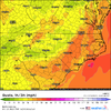
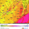
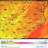
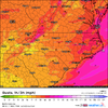
It is really rare to see a temp drop over ne ga and the upstate like those being modeled. Besides the mountains slowing it down,, Normally downslope warming also keeps temps warmer. If temps such as the icon verify, teens in the afternoon in ne ga, sc..it will be exceptionally rare. The euro and Canadian show low 20s in the afternoon which is still very impressive. Truly looks like one of the most impressive cold frontal passages in decades..especially for the upper Savannah River Valley.Icon coming in colder, Friday late morning:
so 3 above at ATL at 3pm? Wow.
This is unlikely!so 3 above at ATL at 3pm? Wow.
It happened on January 21, 1985This is unlikely!
Yeah, don't expect that to verify, but I find it interesting that its sticking to its guns. However, both the Euro and the GFS show upper teens Friday afternoon, so its not totally crazy.so 3 above at ATL at 3pm? Wow.
