I think the GFS will be too flat out west to get an Icon like result.
It is definitely a better look. I think it was close.It's a start though
I think the GFS will be too flat out west to get an Icon like result.
It is definitely a better look. I think it was close.It's a start though

Put this in the whamby thread if need be, but would this be a board wide storm or just a Carolina storm. It is point towards overrunning to me!3 run trend .. suddenly extremely workable .. with this look View attachment 127597
GFS has another west based -NAO this run. This model changes so much


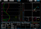
Yep. That is the one. The ridge has to hold.If the western ridge doesn’t go to ---- this is interesting View attachment 127602
What was your point? Cold chasing moisture rarely ever works out for our area if you want snow. Then everything often gets suppressed to the Caribbean once the cold arrives. 'Hard to get snow in the South, yada yada, must thread the needle'Not my point, but thanks..

These are the sort of run to run changes I can get down with.


??
 ???? on the Euro to shed some better light on this....I can't with the GFS. I will not play these games with her ??.


While it’s a small possibility, we’re more worried about actually getting a wave to amplify right now. We can worry about those things later. I highly doubt it wouldReality check:
Lakes Low
Canada low diving to Gulf then up East Coast unlikely
Marginal temps
Don't get sucked into this one.
Reality check:
Lakes Low
Canada low diving to Gulf then up East Coast unlikely
Marginal temps
Don't get sucked into this one.

Reality check:
Lakes Low
Canada low diving to Gulf then up East Coast unlikely
Marginal temps
Don't get sucked into this one.