Thread
-
Hello, please take a minute to check out our awesome content, contributed by the wonderful members of our community. We hope you'll add your own thoughts and opinions by making a free account!
You are using an out of date browser. It may not display this or other websites correctly.
You should upgrade or use an alternative browser.
You should upgrade or use an alternative browser.
Wintry December 23-26 2022 Winter Weather and Cold
- Thread starter SD
- Start date
Cad Wedge NC
Member
GSP still has rain changing to snow in their grids for Friday.
HurricaneSolomon
Member
- Joined
- Dec 6, 2021
- Messages
- 132
- Reaction score
- 237
Yes, so far WTVD and NBC-17 mention the possibility of wrap around snow showers, however, for now anyway it appears less likely than two days ago. It will be interesting to see how this plays out.
Sent from my iPad using Tapatalk
Sent from my iPad using Tapatalk
I’m heading back to the Triangle today. I have a slim hope of seeing some (Falls) lake effect snow when the cold comes in. About 25 years back we had an event that dropped 2” in Wake Forest and 1” up at my current location. There’s been some write ups about this.
LukeBarrette
im north of 90% of people on here so yeah
Meteorology Student
Member
2024 Supporter
2017-2023 Supporter
It’s happening now thanksThread
Will be interesting to see how the 12z runs look . Ensembles are trending far less aggressive for the mid south Thu/Fri
Brent
Member
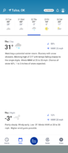
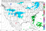
Here you go.We shall see how this goes. I will say that Norman is hating on the GFS with the blizzard conditions ? Tulsa hasn't ruled out higher snow totals
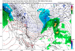
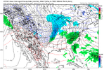
View attachment 127405
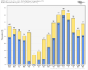
Anomalous cold core dropping in behind an arctic front will produce snow showers and flurries in many locals. Nope not the great winter storm we once had hoped (although don't rule out that sneaky piece of energy/potential coastal after Christmas just yet) but it will feel like Christmas. And I think many will at least see a few flakes fly, could be worse.
Flotown
Member
agreed but i think snow showers and flurries a good bet especially the further nw u areWill be interesting to see how the 12z runs look . Ensembles are trending far less aggressive for the mid south Thu/Fri
Thor
Member
SimeonNC
Member
Yep, this plus the stuff I've been talking about with potential enhancement from both the great lakes and some local NC lakes, I feel like there could be a lot of places in NC that get flizzards.Anomalous cold core dropping in behind an arctic front will produce snow showers and flurries in many locals. Nope not the great winter storm we once had hoped (although don't rule out that sneaky piece of energy/potential coastal after Christmas just yet) but it will feel like Christmas. And I think many will at least see a few flakes fly, could be worse.
Other than that I've been looking at the models this morning and some of them have borderline extreme wind gusts for a lot of NC during the day, windchills could be brutal.
Sent from my LM-Q730 using Tapatalk
rburrel2
Member
This Tuesday threat could go poof anytime, but it definitely reminds me of the February 16, 2015 overperformer. This is the exact kind of setup we get where CAD can overperform modeled output. A Cold but stale airmass already in place /insitu wedge and a weak wave. With that 2015 event models were a little off on dewpoints the day of and the Upstate wound up bottoming out at 27 degrees with an inch of sleet and 1/10th of freezing rain. All of the short range models has us bottoming out at 32 or 33 the day before. The globals had us bottoming out in the mid 30's.
Edit to add: Won't matter if we don't get precip though... let's hope the trends continue in that regard.
Edit to add: Won't matter if we don't get precip though... let's hope the trends continue in that regard.
Last edited:
Fwiw, 12z NAM/RGEM were cooler in the CAD regions Tuesday, but like you said it won’t matter much if the precipitation isn’t there at the right time to lock it in.This Tuesday threat could go poof anytime, but it definitely reminds me of the February 16, 2015 overperformer. This is the exact kind of setup we get where CAD can overperform modeled output. A Cold but stale airmass already in place /insitu wedge and a weak wave. With that 2015 event models were a little off on dewpoints the day of and the Upstate wound up bottoming out at 27 degrees with an inch of sleet and 1/10th of freezing rain. All of the short range models has us bottoming out at 32 or 33 the day before. The globals had us bottoming out in the mid 30's.
Edit to add: Won't matter if we don't get precip though... let's hope the trends continue in that regard.
Brent
Member
I can't wait for that wind chill
Heelyes
Member
Over 25 easy, just the posts about the biggest storm since 93 and complaining about all the nc posts should cover that
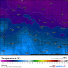
Icon has highs in the single digits and teens west of the apps and highs in the low 20s/upper teens east of the apps on Friday. Super impressive airmass. It looked like the icon setup a taller western ridge so it was dumping more cold the end of the run….

