-
Hello, please take a minute to check out our awesome content, contributed by the wonderful members of our community. We hope you'll add your own thoughts and opinions by making a free account!
You are using an out of date browser. It may not display this or other websites correctly.
You should upgrade or use an alternative browser.
You should upgrade or use an alternative browser.
Wintry December 23-26 2022 Winter Weather and Cold
- Thread starter SD
- Start date
NWS Raleigh going for windchill value in the negatives now
turn a faucet on to drip or slightly run and you will be finePlumbers delight. They will be charging extra for Christmas emergencies.
when is GFS ever right? Been watching it for many years and winter time is not the gfs strong suitThe GFS may be close for you Carolina guys.
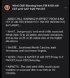
I think the craziest thing along with temperatures will be frequent strong wind gusts. NWS Raleigh shooting for frequent 40-45 mph gusts with a period of 50-55 mph gusts associated with the front. That’s going to rival Ian. We’re going to have some power outage issues I would suspect.
gawxnative
Member
I would not be shocked if it did.. I have seen it before with the Lakes in the Tennessee Valley and also from Lake Lanier in N GA.So will places in the southeast with large lakes see lake effect snow showers out of this?
Darklordsuperstorm
Member
What are suggestions for people in a manufactured home like myself? Anything I should do differently?
gawxnative
Member
I agree with wind impacts. I remember when the Christmas Artic Blast of 1983 came through, the wind just kept blowing all day that Saturday. (Christmas Eve) . Fortunately no power loss, but also it had been dry for a good bit preceding it. This time with the wet soils from last few weeks issues could be more significant.I think the craziest thing along with temperatures will be frequent strong wind gusts. NWS Raleigh shooting for frequent 40-45 mph gusts with a period of 50-55 mph gusts associated with the front. That’s going to rival Ian. We’re going to have some power outage issues I would suspect.
- Joined
- Jan 23, 2021
- Messages
- 4,601
- Reaction score
- 15,196
- Location
- Lebanon Township, Durham County NC
We had lots of trees loosened up by the tropical season tooI think the craziest thing along with temperatures will be frequent strong wind gusts. NWS Raleigh shooting for frequent 40-45 mph gusts with a period of 50-55 mph gusts associated with the front. That’s going to rival Ian. We’re going to have some power outage issues I would suspect.
Yes, if the angle is just right. If it's off by as little as 5 degrees it can make a big difference is some places.So will places in the southeast with large lakes see lake effect snow showers out of this?
LickWx
Member
Wonder what the death toll will be from this arctic front. I think 2021s Texas front killed over 100. Going to be a rough few nights. Brr
Drizzle Snizzle
Member
Do you have a way to keep warm if your power goes out ?Wonder what the death toll will be from this arctic front. I think 2021s Texas front killed over 100. Going to be a rough few nights. Brr
ChattaVOL
Member
With a westerly wind the lakes in North Alabama may be able to produce.Yes, if the angle is just right. If it's off by as little as 5 degrees it can make a big difference is some places.
Brent
Member
Cindy131
Member
I remember from the 1980 cold snaps losing gas every time the temp dropped to the single digits due to the gas pressure. Central air home so no heat during the cold snaps. And yes it would take days sometimes over a week for the pressure to build back up to get heat again in the houses. I think they do better with the gas pipes and pressure now.I agree with wind impacts. I remember when the Christmas Artic Blast of 1983 came through, the wind just kept blowing all day that Saturday. (Christmas Eve) . Fortunately no power loss, but also it had been dry for a good bit preceding it. This time with the wet soils from last few weeks issues could be more significant.
ChattaVOL
Member
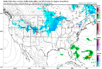
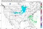
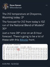
It looks like the HRRR and RAP are on par with the cold. What we saw in WY and out west just shows how powerful this cold is.
I own a manufactured home as well. I’m dripping all faucets through the weekend. It’s well insulated but the rooms away from the center of my home tend to get a little cooler so I’ll prob run my infrared heater as well. This should be the coldest it has been for my house since I bought it in 2017.What are suggestions for people in a manufactured home like myself? Anything I should do differently?
Darklordsuperstorm
Member
Yeah my house seems to do the same temp wise. I'll definitely be dripping all the faucets. My main concern is the main water line freezing up with it being under the home. Fingers crossed ?I own a manufactured home as well. I’m dripping all faucets through the weekend. It’s well insulated but the rooms away from the center of my home tend to get a little cooler so I’ll prob run my infrared heater as well. This should be the coldest it has been for my house since I bought it in 2017.
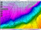
I really hope GSP updates their point forecast in the morning to show the daytime temperature drop that’s coming Friday for the CLT area. To read it right now, you would think it’s gonna be in around 40 during the afternoon when it may well be about 20 degrees colder
ChattaVOL
Member
J1C1111
Member
I really hope GSP updates their point forecast in the morning to show the daytime temperature drop that’s coming Friday for the CLT area. To read it right now, you would think it’s gonna be in around 40 during the afternoon when it may well be about 20 degrees colder
Yeah. That's ridiculous. I thought the same as well. Great point.I really hope GSP updates their point forecast in the morning to show the daytime temperature drop that’s coming Friday for the CLT area. To read it right now, you would think it’s gonna be in around 40 during the afternoon when it may well be about 20 degrees colder
NBAcentel
Member
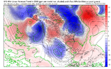
Don’t want to be that guy but the 18z euro looked way better at H5
Flotown
Member
lets seeDon’t want to be that guy but the 18z euro looked way better at H5
VegasEagle
Member
iGRXY
Member


Yep looks better.
VegasEagle
Member
VegasEagle
Member
dsaur
Member
Well, I didn't get my sleet but I have flurries! I'll take in this close the Xmas.... edit: and now it's drizzle, lol.
Ron Burgundy
Member
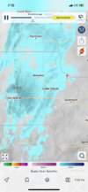
Not to mention it went from 43 to 11 in NINE minutes! That’s basically like having a blast chiller overtake you. ?
buckinbronco
Member
Thanks for posting. The west ridge definitely a smidge better.


Yep looks better.
NBAcentel
Member
But EPS still no Bueno.
Webberweather53
Meteorologist
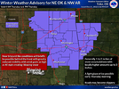
I'm going to be traveling across the US tomorrow for the holidays & I'm gonna do my best to keep tabs on this potential light glazing event in the mountains + foothills of NC. Hopefully, some of you here can help be my eyes + ears tomorrow, as I won't have internet access for the bulk of the day & I usually check mPING pretty religiously in these trace/low-end events like tomorrow.
whatalife
Moderator
NBAcentel
Member
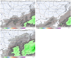
That’s hilarious lol. We go NW with this last one and we’re going SE with this one. Wtf ?EPS 18z, 12z, and 00zView attachment 128063

