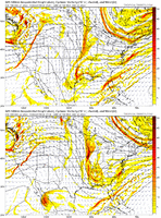
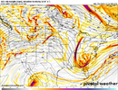
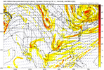
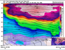
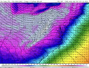
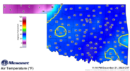
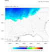
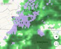
Indeed, though the chances of it screwing us over in one way or another are super high. ?Good thing is, it's 5 days out. So the chances that it's being correctly modeled are not super high.
-
Hello, please take a minute to check out our awesome content, contributed by the wonderful members of our community. We hope you'll add your own thoughts and opinions by making a free account!
You are using an out of date browser. It may not display this or other websites correctly.
You should upgrade or use an alternative browser.
You should upgrade or use an alternative browser.
Wintry December 23-26 2022 Winter Weather and Cold
- Thread starter SD
- Start date
Cary_Snow95
Member
Gfs is going to make an attempt to throw something back to the beaches
Complicated setup for models to handle. The main longwave's exit, the associated cold front, the two (or three) waves that come in the wake of the longwave trough.. It'll be tough to get much of this inland without some warm air advection occurring east of the waves (off the coast in the Atlantic)// otherwise you're just asking a low pressure system to form in the middle of a cold airmass, which won't happen.
I could see this surprising some folks in eastern NC and SC, but I'm not sure we see much of a massive NW trend with this thing. Hope I'm wrong though.
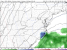
I could see this surprising some folks in eastern NC and SC, but I'm not sure we see much of a massive NW trend with this thing. Hope I'm wrong though.

If you can ever look at Denver’s average highs, they never get lower than about 40, but it’s because their weather is so freakin bi-polar… it’s common for them to be 65 one day and then 15 with snow the nextThey won't get above 0 tomorrow then they'll be 60 by Tuesday.
Brent
Member
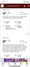
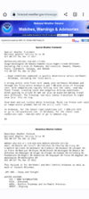
NWS just updated like I have no words for this. Even February 2021 wasn't this cold in the middle of the day
Thursday
A chance of snow and freezing rain before 7am, then snow likely between 7am and 3pm. Cloudy through mid morning, then gradual clearing and cold, with a temperature falling to around 1 by 11am.
Thursday
A chance of snow and freezing rain before 7am, then snow likely between 7am and 3pm. Cloudy through mid morning, then gradual clearing and cold, with a temperature falling to around 1 by 11am.
Drizzle Snizzle
Member
I just couldnt deal with that. I like for temps to be fairly uniform without such big day to day changes.If you can ever look at Denver’s average highs, they never get lower than about 40, but it’s because their weather is so freakin bi-polar… it’s common for them to be 65 one day and then 15 with snow the next
Complicated setup for models to handle. The main longwave's exit, the associated cold front, the two (or three) waves that come in the wake of the longwave trough.. It'll be tough to get much of this inland without some warm air advection occurring east of the waves (off the coast in the Atlantic)// otherwise you're just asking a low pressure system to form in the middle of a cold airmass, which won't happen.
I could see this surprising some folks in eastern NC and SC, but I'm not sure we see much of a massive NW trend with this thing. Hope I'm wrong though.
View attachment 128091
With that being said, though, I think the best scenario for those inland would be the first wave going a bit more negative and bringing the frontogenesis axis north, then the second wave can really mature the low pressure system and sling moisture west over the Carolinas.
NBAcentel
Member
Meaning lots of time for shifts ?That's a lot of wave action around and most still haven't ejected from their parents trough in the aleutians View attachment 128093
iGRXY
Member
Personally I think we see more digging of any waves coming down the trough. We have shown the last few years of sharpening troughs and digging waves further to the southwest as we get into the 3-5 day range. Maybe it doesn't happen here, but I am in a I think it will until it shows me it's not scenario. Looking how much better this has trended in about a 36 hour timespan.
Yep the 72-120 window seems like when we usually start seeing the NW trends start so let's see where we go. I would honestly expect the gefs to be mediocre at best after that op runMeaning lots of time for shifts ?
Oh I enjoy wild temperature swings like that around here, but it’s because they are so rare to see here. My favorite one was the 24 hour swing CLT had with the February 1994 Ice Storm… on Wednesday of that week the 5pm temperature was 76 degrees, and 24 hours later it was 26 with heavy sleet. All that said, if I lived in Denver, wild swings like that would probably get oldI just couldnt deal with that. I like for temps to be fairly uniform without such big day to day changes.
Drizzle Snizzle
Member
I wouldn't like the wild temperature swings all the time. I like it occasionally like this week when temps will plummet. It will be fun to watch.Oh I enjoy wild temperature swings like that around here, but it’s because they are so rare to see here. My favorite one was the 24 hour swing CLT had with the February 1994 Ice Storm… on Wednesday of that week the 5pm temperature was 76 degrees, and 24 hours later it was 26 with heavy sleet. All that said, if I lived in Denver, wild swings like that would probably get old
iGRXY
Member

Look how much better this trended in the 50/50 region and with the trough in general. Now we just need this to shift west around Louisiana which is not a tall ask at this range at all. We are asking for about 100-150 west shifts with plenty of time left. This isn't one of those needing changes with 24 hours left type of deal.
Iceagewhereartthou
Member
One aspect I haven't really heard much about is the affects this might have on Florida, especially the crops. I noticed the areas around Ocala are forecast to have 2 nights in the low 20s and a third in the upper 20s, even Orlando getting to freezing for two nights with a high of 47 in between. Okeechobee probably getting some frost with 2 nights at 35. Phil gonna have to bundle up!
Brent
Member
John1122
Member
The Euro is doing poorly vs actual OBS in the Midwest back towards Nebraska. The GFS is looking much better regarding snowfall amounts.
Ok ECMWF I see you...


VegasEagle
Member
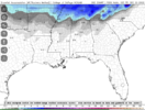
0Z looks ok, then it just dries up on its trip down south!?The Euro looks very robust with the clipper we are watching after Christmas! Edit: 18Z belowView attachment 128104
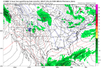
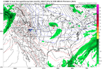
Currently 10 degrees SN+
Brent
Member
YepIt's here!View attachment 128115
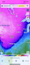
Brent
Member
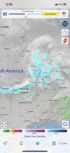
Starting to snow
Let us know how much you get. Curious if this will over perform a little bit. Most of the time with an arctic front they trend to squeeze all the available moisture out of the air and give a little extra snow.Starting to snow
37 and Rain. We aint hurting sround here for H2O anymore.
NBAcentel
Member
bigstick10
Member
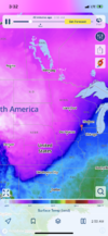
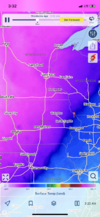
All of these models are busting, especially the NBM, look what happened in Cheyenne....All of our local NWS offices better take note, shave about 5-8 degrees off the temps you see predicted.. We all know models cannot handle this intensity of cold. The National blend is a joke.
Last edited:

