Very possible… but this will be with bright sunshine. One thing is we may be cursing the wind Friday afternoon but it being up will likely save a lot of places from dropping in the 0-5 degree range Friday nightGuessing that freak upper level low snowstorm back in 2008 maybe?
-
Hello, please take a minute to check out our awesome content, contributed by the wonderful members of our community. We hope you'll add your own thoughts and opinions by making a free account!
You are using an out of date browser. It may not display this or other websites correctly.
You should upgrade or use an alternative browser.
You should upgrade or use an alternative browser.
Wintry December 23-26 2022 Winter Weather and Cold
- Thread starter SD
- Start date
SimeonNC
Member
The NWS has my area with a "wintry mix" Friday morning lol.
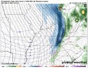
I’ll tell you what we’re focused on the 27-28 storm a lot but don’t sleep on this tiny little piece of energy infront if it on the 26th .. could end up being nothing but there may end up being just enough forcing to spit out some snow flakes for some lucky individuals. It’s been looking interesting past few runs. 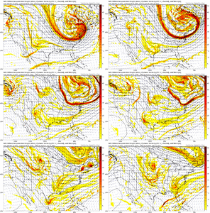

Drizzle Snizzle
Member
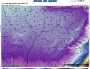
I mean does it really matter what the actual temp is on Fri night ? The wind chills will make it feel brutally cold.Very possible… but this will be with bright sunshine. One thing is we may be cursing the wind Friday afternoon but it being up will likely save a lot of places from dropping in the 0-5 degree range Friday night
Fountainguy97
Member
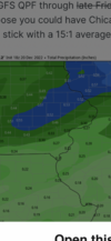
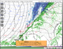
GFS/NAM/RGEM all showing that backside end of clipper providing a nice little band of snow showers it's slowly been ranging upward. I guess can watch over next day or so for how this further develops it ain't gonna be enough to build a snowman but people may get a little pretty dusting or so Christmas weekend
PS... for GA maybe some in N.AL and TN got a chance for a little more
PS... for GA maybe some in N.AL and TN got a chance for a little more

I've been watching this little guy too. A Christmas miracle!I’ll tell you what we’re focused on the 27-28 storm a lot but don’t sleep on this tiny little piece of energy infront if it on the 26th .. could end up being nothing but there may end up being just enough forcing to spit out some snow flakes for some lucky individuals. It’s been looking interesting past few runs. View attachment 127886

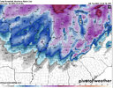
We just need more cold air wow ??View attachment 127892
FWIW 18Z is more cosolidated with the energy from the midwest, also closes it off
One thing I see is if not snow, you have a major ice problem across MS, AL and GA should precip make its way northward.
Yep, nice block in a good spot, also nice vortex location over Hudson Bay. You gotta like this look, and why I’m more confident we may see improvements in modeling for next week.
The GFS definitely has a handle on the ridge over Greenland
Interesting tidbit from FFC about tomorrow night/Thursday.
000
FXUS62 KFFC 202001
AFDFFC
Area Forecast Discussion
National Weather Service Peachtree City GA
301 PM EST Tue Dec 20 2022
...Afternoon Area Forecast Discussion...
.SHORT TERM...
(This afternoon through Wednesday)
Issued at 254 PM EST Tue Dec 20 2022
An upper disturbance will continue to move east in the flow this
evening and finally offshore overnight. The zonal flow aloft will
continue through the day tomorrow, but begin to shift to the SW
tomorrow night. At the surface, a weak low pressure wave off the
NE FL coast will meander off the SE coast while a ridge axis
remains situated from the Mid Atlantic states down the spine of
the Appalachians (a wedge).
The precipitation associated with the shortwave should taper off from
west to east this evening for most locales. A brief dry period is
anticipated Wednesday, although we will continue to be wedged.
Precip on the backside of the low off the SE coast should begin to
spread onshore and into the wedge tomorrow evening/overnight. Right
now, temps look to remain in the middle to upper 30s, but the models
may not be handling dewpoints upstream in the wedge very well -
especially at precip onset. The weak low pressure offshore may end
up reinforcing the wedge and bringing those mid/upper 20s dews
further SW. Will have to watch P-Type closely.
Have bumped MaxT`s down a degree or two within the wedge tomorrow.
NListemaa
 forecast.weather.gov
000
FXUS62 KFFC 202001
AFDFFC
Area Forecast Discussion
National Weather Service Peachtree City GA
301 PM EST Tue Dec 20 2022
...Afternoon Area Forecast Discussion...
.SHORT TERM...
(This afternoon through Wednesday)
Issued at 254 PM EST Tue Dec 20 2022
An upper disturbance will continue to move east in the flow this
evening and finally offshore overnight. The zonal flow aloft will
continue through the day tomorrow, but begin to shift to the SW
tomorrow night. At the surface, a weak low pressure wave off the
NE FL coast will meander off the SE coast while a ridge axis
remains situated from the Mid Atlantic states down the spine of
the Appalachians (a wedge).
The precipitation associated with the shortwave should taper off from
west to east this evening for most locales. A brief dry period is
anticipated Wednesday, although we will continue to be wedged.
Precip on the backside of the low off the SE coast should begin to
spread onshore and into the wedge tomorrow evening/overnight. Right
now, temps look to remain in the middle to upper 30s, but the models
may not be handling dewpoints upstream in the wedge very well -
especially at precip onset. The weak low pressure offshore may end
up reinforcing the wedge and bringing those mid/upper 20s dews
further SW. Will have to watch P-Type closely.
Have bumped MaxT`s down a degree or two within the wedge tomorrow.
NListemaa
National Weather Service
SWVAwxfan
Member
What's even more incredible is this is at 1 in the afternoon. My area showing 4 degrees on this model.Man, this is something else...

The next (18z) MMFS run will have a 4km southeastern regional nest with a 1km local nest over NGA and NAL, to focus in on the cold front and possible backend precip.
- Joined
- Jan 23, 2021
- Messages
- 4,603
- Reaction score
- 15,199
- Location
- Lebanon Township, Durham County NC
Appreciate all your work with this.The next (18z) MMFS run will have a 4km southeastern regional nest with a 1km local nest over NGA and NAL, to focus in on the cold front and possible backend precip.
I'm thinking some of this is overdoneLord have mercy..View attachment 127895
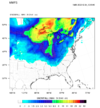
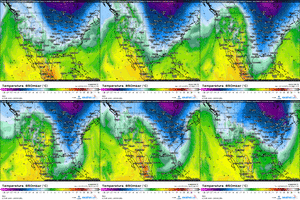
Wow!!! GFDL C-SHIELD, a hires model, has some very low wind chills Friday morning. Appears to be -10 to -20F around ATL.


That’s what I’ve been thinking for the last couple of days, but the all the modeling is pretty much in agreement… just some timing differences.I'm thinking some of this is overdone
Cad Wedge NC
Member
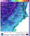
This map is "apparent temperature"... big differenceI'm thinking some of this is overdone
Maybe. That wind chill is going to have a serious bite. I’ll be dripping my faucets. No one is getting the white Christmas they wanted but the cold centered around the holidays is something any weather Goober can appreciate. This is rarefied air and we’ll look back on it many years from now and smile.I'm thinking some of this is overdone
I’ve got an air compressor and a hose pipe… I’ll be the most popular Dad in the neighborhood come Saturday morningMaybe. That wind chill is going to have a serious bite. I’ll be dripping my faucets. No one is getting the white Christmas they wanted but the cold centered around the holidays is something any weather Goober can appreciate. This is rarefied air and we’ll look back on it many years from now and smile.
Im gonna give a try mysellf. Ill probably cause ice to build up in hose and back into house knowing my luck. Get the wife in a great mood before 20 descend upon us to eat lol.I’ve got an air compressor and a hose pipe… I’ll be the most popular Dad in the neighborhood come Saturday morning
Before you start… run a cycle of the washing machine with hot water… that should keep the pipes plenty warm while your making itIm gonna give a try mysellf. Ill probably cause ice to build up in hose and back into house knowing my luck. Get the wife in a great mood before 20 descend upon us to eat lol.
GEFS was picking up on something in Mississippi and parts of alabama for the after Christmas storm, been some interesting trends for that. Hopefully we continue that going forward.
It’s cold enough, most people could easily make a snow gun out of their hoses outside, just to make a white Christmas easily in your own yard! The colder the better and easierMaybe. That wind chill is going to have a serious bite. I’ll be dripping my faucets. No one is getting the white Christmas they wanted but the cold centered around the holidays is something any weather Goober can appreciate. This is rarefied air and we’ll look back on it many years from now and smile.
AJ1013
Member
Front range of Colorado has the best climates on earth hands down. Check out Rye, Colorado. Weather Nirvana. https://en.m.wikipedia.org/wiki/Rye,_ColoradoView attachment 127896Denver always takes the cake for weather. 52 to -12 and snow in like 12 hours.
Webberweather53
Meteorologist
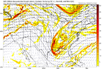
The wave dropping down after the Arctic blast has a decent look to it now on the modeling, but an issue I see is this…what we’d like to see as the wave drops down is a jet streak behind it to drive energy and lift into the base of the trough in the left exit region of the jet streak (a key feature in the Jan 2003 setup for example). With this one, the jet streak is weakening, and thus, the dynamics aren’t there for it to really explode like it needs to in the base of the trough. On the loop, it looks like the increasing jet flow from the west is breaking down our digging trough via an anti-cyclonic wave break (the top part of the ridge behind it is toppling over and the whole jet dynamics are weakening). I will continue to watch of course, but I suspect this isn’t something that is going to suddenly improve on the modeling. Of course, now that I state this, the happy hour GFS will assuredly go bonkers with it and look good
View attachment 127882
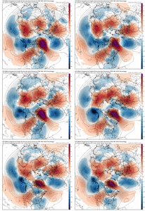
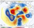
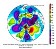
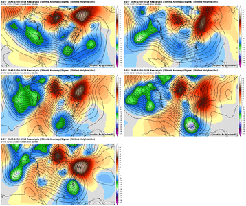
I did a lot of digging to find this one, but I think December 16-17 1973 is legitimately the best pattern match out there to next week. Wasn't easy trying to find cases where you had big +EPO, +PNA, east-central US trough, & a ridge just offshore Atlantic Canada
Cad Wedge NC
Member
No, it requires an air compressor or pressure washer and spray nozzles for correct atomization . Also, there must be a nucleation nozzle to create the ice crystals. It's not as easy as just spraying water in the air.It’s cold enough, most people could easily make a snow gun out of their hoses outside, just to make a white Christmas easily in your own yard! The colder the better and easier
Very impressive! Thanks for sharing.I did a lot of digging to find this one, but I think December 16-17 1973 is legitimately the best pattern match out there to next week. Wasn't easy trying to find cases where you had big +EPO, +PNA, east-central US trough, & a ridge just offshore Atlantic Canada
View attachment 127899
View attachment 127897
AJ1013
Member
67F here with a steady light rain. Yuck.
Was that storm a Miller A coastal or some type of anafront set up like January 2018?I did a lot of digging to find this one, but I think December 16-17 1973 is legitimately the best pattern match out there to next week. Wasn't easy trying to find cases where you had big +EPO, +PNA, east-central US trough, & a ridge just offshore Atlantic Canada
View attachment 127899
View attachment 127897
That’s close..I did a lot of digging to find this one, but I think December 16-17 1973 is legitimately the best pattern match out there to next week. Wasn't easy trying to find cases where you had big +EPO, +PNA, east-central US trough, & a ridge just offshore Atlantic Canada
View attachment 127899
View attachment 127897
I was Sledding on the Slopes of Fayettnam..I did a lot of digging to find this one, but I think December 16-17 1973 is legitimately the best pattern match out there to next week. Wasn't easy trying to find cases where you had big +EPO, +PNA, east-central US trough, & a ridge just offshore Atlantic Canada
View attachment 127899
View attachment 127897
Here's a daily gif of that event. This is a very rare case of getting snow with a ridge over SE Canada. The only reason that worked was because of a deeply cold air mass over Central Canada. Another similarity between this upcoming look and the Dec 1973 storm. By the time it reached the NE, there was ice.I did a lot of digging to find this one, but I think December 16-17 1973 is legitimately the best pattern match out there to next week. Wasn't easy trying to find cases where you had big +EPO, +PNA, east-central US trough, & a ridge just offshore Atlantic Canada
View attachment 127899
View attachment 127897
AJ1013
Member
@Ollie Williams
Where do you get those reanalysis maps from? I'd like to take a look at some events in 1971, 1989, and 2010.
Where do you get those reanalysis maps from? I'd like to take a look at some events in 1971, 1989, and 2010.

