
CMC no longer shows the ice storm.


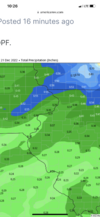
Slight uptick at 0zThat’s a lot of QPF for 15:1 ratios! ??? 18z GFSView attachment 127887
that bad news is that we're still trafficking in potential only and not in substance. the good news is that we've reeled in a couple of great model trends.So what happens, does it just peter out like ICON?
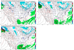
0.5” around Winston-Salem. 1” possible in Stokes Surry RockinghamGood ole FV3! It gets little mention these days, unless it’s showing snow! ?View attachment 127936
Notably the GFS did show some moisture but it sputteredthat bad news is that we're still trafficking in potential only and not in substance. the good news is that we've reeled in a couple of great model trends.
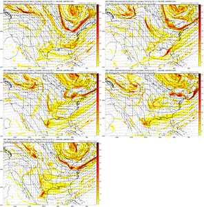
i've never lost faith in the dec 26th trough, the cold was there; what if we can improve the trough? reader, we have.
easy to see the general change on 5h- great trend for the s/w around Ok/TX (and look at the jolt south west it took at 00z!!)
View attachment 127934
So this has given the trough enough room and a fighting chance to tilt to neutral somewhere to benefit us in. shape looks better, western trough looks better, pretty sweet.
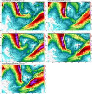
but the thing that really caught my eye? jet stream. here's another trend.
View attachment 127935
massive shift westward with the jet max, with much more velocity, and much better shape (see that 'arch' in the jet max off the SC coast? a stronger max with a more accentuated "arch" means more ascent)
moisture will be the limiter here on the heels of this siberian fart, but really good signs tonight. we increased our playoff odds from 10% to 20%.
could be smoke and mirrors but don't think we're as far away as people think
disclaimer: by "we" i mean "we-ilmington", where i'll be during this time period
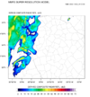
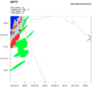
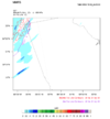
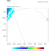
This seems to have Moisture and cold air arriving maybe spitballing by around 2 hours early to AL/GA border compared to 3k NAMInteresting note from the super-res 0.8km MMFS so far (it's coming in.. slowly but surely..)
The cold air is moving in very fast, especially at the lowest levels. Precip is quickly changing over to freezing rain and snow at the front, with only very light precip ahead of the front. In fact, it already has accumulating snowfall in northern Alabama at 4z.
View attachment 127937View attachment 127938View attachment 127939View attachment 127942

Brasstown Bald will be a winter wonderland!! I'm sure the access rd will be closed but it's only a 3-4hr hike to the top ... climbing over 2k ft ... ?0.8km MMFS is mostly in for GA..looks realistic. Post-frontal precip dries up quickly as the front moves through. Light snow accumulations possible in the highest elevations.
View attachment 127947View attachment 127948View attachment 127949View attachment 127950
We shall see if that 1-2 verifies. Hopefully. Trends have been rough since yesterday.View attachment 127963
The Euro gave us a leg and thigh...any 6Z GFS news?Sheash the Euro is close.

However due to the energy being neutral vs the last few runs, it's pretty close to what the Euro had at 0z. A slight adjustment and it'd be close just like the Euro.Nada on the 6z GFS


Most definitely hopefully it will trend colder maybe models are too fast on pushing cold air out.The cold tho… it just evacuates really quick because the pac jet. Just something to keep an eye on. We need lots of help from the vortex on top
This is usually the time models begin to bring back any wintry signal in south. It’s best to start seeing trends toward a southern slider now than say 3 to 4 days ago.

So with a retreating air mass, what would we essentially need to happen to bring more cold air into the picture for the 27th-28th without pushing our LP away?That’s a pretty nice improvement on the 06z eps. Stronger/more south TPV coexisting with our energy still at a optimal spot resulted in a colder run aloft and at the sfc View attachment 127975
Send TPV more SE, towards SE Canada, amplify western ridge, slow down GOA trough and - tilt it. introduce northern stream Energy or its components into the system at the right time. I like that energy placement on the EPS right now it’s good where it isSo with a retreating air mass, what would we essentially need to happen to bring more cold air into the picture for the 27th-28th without pushing our LP away?
Thank yall! That makes sense, was confused about a couple things. Cleared it up well.Send TPV more SE, towards SE Canada, amplify western ridge, slow down GOA trough and - tilt it. introduce northern stream Energy or its components into the system at the right time. I like that energy placement on the EPS right now it’s good where it is
