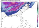
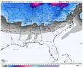
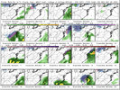
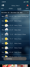
The good news as well is we should have plenty of room to wet bulb down even lower. Of course we will be cursing that when we are out of power.
-
Hello, please take a minute to check out our awesome content, contributed by the wonderful members of our community. We hope you'll add your own thoughts and opinions by making a free account!
You are using an out of date browser. It may not display this or other websites correctly.
You should upgrade or use an alternative browser.
You should upgrade or use an alternative browser.
Wintry December 23-26 2022 Winter Weather and Cold
- Thread starter SD
- Start date
accu35
Member
iGRXY
Member
Tonight’s 00z MMFS run will be a 8 day run (192hrs) to fully resolve any potential systems on the horizon.
Wasn’t too happy with its long range performance with this system, but I’m doing tests and making tweaks behind the scenes to improve things in the long range.
Wasn’t too happy with its long range performance with this system, but I’m doing tests and making tweaks behind the scenes to improve things in the long range.
I think you’re going to see some cooler temperature forecasts here overnight for Friday morning. Specifically talking about NWS Peachtree City. They currently have Atlanta at 10am Friday at 28 degrees whereas the National Blend of Models has KATL at 19 degrees then. Seems very likely we get into the teens before any kind of warmup
GFS, Icon, and CMC all keep Atlanta at or below 20 on Friday which would be wildly impressive
GFS, Icon, and CMC all keep Atlanta at or below 20 on Friday which would be wildly impressive
Brent
Member
NWS going with 7 here for pretty much Thursday after the late morning ? the high will be early for sure. There aren't many days colder in the records tbh. Fridays high is 10. I mean this is pretty insane even without the snow. February 2021's coldest high was 5
Also the record wind chill for Tulsa is -27... We may not be too far off that
Also the record wind chill for Tulsa is -27... We may not be too far off that
BHS1975
Member
Nice 100 degree swing from winter to summer.NWS going with 7 here for pretty much Thursday after the late morning ? the high will be early for sure. There aren't many days colder in the records tbh. Fridays high is 10. I mean this is pretty insane even without the snow. February 2021's coldest high was 5
Also the record wind chill for Tulsa is -27... We may not be too far off that
6z Gfs was looking like glory but cold air just disappeared just hrs prior to the event starting on 12-27/12-28
SnowwxAtl
Member
What happened to the colder solution? Hopefully, it is a blip and the GFS is GFSin!
Needs to be further offshore
This storm is coming on the heels of when the cold air is fleeting. We need some perfect timing and a quick moving system to come in so things match up. This was my initial worry when we started seeing this storm chance continue to pop up and will continue to be a worry moving forward. Lots of possibilities still with this though.What happened to the colder solution? Hopefully, it is a blip and the GFS is GFSin!
SnowwxAtl
Member
I had mentioned this awhile ago in the other thread. I do like the possibilities of this storm but we need the cold to stick around longer.This storm is coming on the heels of when the cold air is fleeting. We need some perfect timing and a quick moving system to come in so things match up. This was my initial worry when we started seeing this storm chance continue to pop up and will continue to be a worry moving forward. Lots of possibilities still with this though.
6z GFS has a pixel of Snow in Florida: Not worth posting cause it hasn't got a clue. Its night an day different from the Euro 12/26 onward. What a garbage model we have.
Best chance to see a few hours of frozen for the Triad -northwest will come Thursday morning before the rain takes over. Not seeing anything yet to get excited about for Friday as far as catching a few minutes of flakes as the powerful front pushes through. Like everyone else Im grasping/looking for any opportunity we can.
This is Thursday morning off the RDPS

SnowwxAtl
Member
By the way, everyone is quiet about the EURO?6z GFS has a pixel of Snow in Florida: Not worth posting cause it hasn't got a clue. Its night an day different from the Euro 12/26 onward. What a garbage model we have.
Best chance to see a few hours of frozen for the Triad -northwest will come Thursday morning before the rain takes over. Not seeing anything yet to get excited about for Friday as far as catching a few minutes of flakes as the powerful front pushes through. Like everyone else Im grasping/looking for any opportunity we can.
This is Thursday morning off the RDPS

Here's the Ens means for Post Christmas , Storm # 2, whatever we call it now


- Joined
- Jan 23, 2021
- Messages
- 4,601
- Reaction score
- 15,196
- Location
- Lebanon Township, Durham County NC
There’s some pretty decent dynamics passing through the triangle after the front on Friday. Might be able to squeeze out a snow shower.
With that kind of cold, there could be some unexpected development. Most likely it'll still be cold chasing moisture (so not much). Maybe with the warm(er) wet ground (> 1" qpf from initial rain) we can develop a few snow showers. Long shot but got to have something to hope on.There’s some pretty decent dynamics passing through the triangle after the front on Friday. Might be able to squeeze out a snow shower.
total qpf before cold:
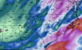
I know NWS had in their AFD the other day that cold chasing moisture rarely works but this was such an anomalous event could see something anomalous, like backside snow showers, happen.With that kind of cold, there could be some unexpected development. Most likely it'll still be cold chasing moisture (so not much). Maybe with the warm(er) wet ground (> 1" qpf from initial rain) we can develop a few snow showers. Long shot but got to have something to hope on.
total qpf before cold:
View attachment 127807
Meh, GFS being the GFS hopefully but by the time our system develops we've lost our pac ridge and the country is flooded with pacific maritime air. I'm no jet extension expert but I'd blame it on an over extension here but I'm just a meany greeny meanager wannabe so what do I know. LolWhat happened to the colder solution? Hopefully, it is a blip and the GFS is GFSin!

And the GEFs offered no hope either so on to the 12z to see if anything remotely favorable starts todayMeh, GFS being the GFS hopefully but by the time our system develops we've lost our pac ridge and the country is flooded with pacific maritime air. I'm no jet extension expert but I'd blame it on an over extension here but I'm just a meany greeny meanager wannabe so what do I know. Lol


Edit: EPS either..... yuck

I'm starting to think our best chance in this first winter window of opportunity is backside flurries and snow showers after the arctic front. Thankfully a lot of winter left yet
If it's any consolation for everyone not named Brent or Tarheel1, the wheels seems to be quickly falling off for the hyped up Midwest blizzard.
So everyone might get to be miserable, lol...
So everyone might get to be miserable, lol...
NBAcentel
Member
saw the models looked like Garbo last night, then was like yeah this one is dying, then saw the 06z eps look much improved lol
I'm actually a little intrigued by the post arctic front possibilitiessaw the models looked like Garbo last night, then was like yeah this one is dying, then saw the 06z eps look much improved lol
Shaggy
Member
This hobby is so frustrating nowadays. It was so much easier and fun when all I needed was the 5 day planner on TWC showing rain in south Texas a mix over north central Texas and snow north of there. Then I'd know we had a shot at snowsaw the models looked like Garbo last night, then was like yeah this one is dying, then saw the 06z eps look much improved lol
I hate to be the bearer of bad news but...I'm actually a little intrigued by the post arctic front possibilities
alfoman
Member
Looks like the TPV gets pushed up in bewteen the NAO and western ridge on the 6Z rather than it getting trapped underneath the connecting block between the two. We need that established connection to occur to prevent the NW Pacific energy train from trugging along as well.


NBAcentel
Member
I just think the CAA/dry air infiltration is gonna be to strong for backside flurries tbh, we have no favorable vort max orientation swinging through to help us out, it would help a lot of it closed off closer or the trailing “tail” digs more to our southI'm starting to think our best chance in this first winter window of opportunity is backside flurries and snow showers after the arctic front. Thankfully a lot of winter left yet
- Joined
- Jan 23, 2021
- Messages
- 4,601
- Reaction score
- 15,196
- Location
- Lebanon Township, Durham County NC
TDF had -TSSN in it's extracted data on the 6z NAM so that definitely means the energy is there. It's just timing and lining up with available moisture.I'm actually a little intrigued by the post arctic front possibilities
Like I said last night, if the ICON is correct in it’s trajectory of how the cold air pushes in, we absolutely could see a burst of snow come through.With that kind of cold, there could be some unexpected development. Most likely it'll still be cold chasing moisture (so not much). Maybe with the warm(er) wet ground (> 1" qpf from initial rain) we can develop a few snow showers. Long shot but got to have something to hope on.
total qpf before cold:
View attachment 127807
- Joined
- Jan 23, 2021
- Messages
- 4,601
- Reaction score
- 15,196
- Location
- Lebanon Township, Durham County NC
Also, harkening back to last year, the 3K NAM and HRRR had a good winter in these scattered snow shower situations.
- Joined
- Jan 23, 2021
- Messages
- 4,601
- Reaction score
- 15,196
- Location
- Lebanon Township, Durham County NC
*IF* the canadian is right, it's 15F in my backyard at 4PM on Friday
rburrel2
Member
GFS and CMC look really similar for the 27th storm. This threat is another thread the needle situation, but has better odds than the Friday arctic plunge ever had, imo. At least with this system it looks like we may need it to trend towards less digging. I'd much rather need that adjustment than needing a clipper to dig more than shown.
Stormlover
Member
NBM at only 10:1, so these may be low


Brent
Member
If it's any consolation for everyone not named Brent or Tarheel1, the wheels seems to be quickly falling off for the hyped up Midwest blizzard.
So everyone might get to be miserable, lol...
Even here I'm like meh. I mean yeah it may snow an inch or two but this is Tulsa not Dallas or Alabama and that is not a winter storm. The wind and cold is gonna be by far the bigger story
Even here I'm like meh. I mean yeah it may snow an inch or two but this is Tulsa not Dallas or Alabama and that is not a winter storm. The wind and cold is gonna be by far the bigger story
12z NAM is a total and complete disaster. The so-called blizzard is basically just a glorified arctic front now. ?
Drizzle Snizzle
Member
Tulsa averages less than 10" of snow per year so an inch or two would still be pretty significant I would think.Even here I'm like meh. I mean yeah it may snow an inch or two but this is Tulsa not Dallas or Alabama and that is not a winter storm. The wind and cold is gonna be by far the bigger story

