W
-
Hello, please take a minute to check out our awesome content, contributed by the wonderful members of our community. We hope you'll add your own thoughts and opinions by making a free account!
You are using an out of date browser. It may not display this or other websites correctly.
You should upgrade or use an alternative browser.
You should upgrade or use an alternative browser.
Pattern December 2023
- Thread starter whatalife
- Start date
- Joined
- Jan 23, 2021
- Messages
- 4,595
- Reaction score
- 15,183
- Location
- Lebanon Township, Durham County NC
Of course the 18z GFS goes way way west
dsaur
Member
Yeah, a split flow can make it work, where just bitter cold is just dry bitter cold. A split flow with blocking can give you hit after hit while it lasts. Get an upper low in the Baha spitting out impulse after impulse into cold air in situ. I love to dream like that, lol.Here in Georgia, I'll take my chances with vodka cold and a juiced up STJ.
Looks similar to this past weekend initial system kicks but the upstream activity dives in and starts to help to shear and bounce NW off of the SEROf course the 18z GFS goes way way west
Brent
Member
Well todays Good News wx wise is the CFS keeps harping for winter to show up bigly Christmas eve and all through the holidays into 2024. Bad news is , its the CFS. Looks like the Operational models say enjoy the golf weather until then, minus a couple 24 hour post frontal cool downs.


Facts! Vodka cold gets you nothing but suppression city for most on this board. Give me split flow and I'll take my chances. I've received my biggest storms in early to mid December here in the foothills.Yeah, a split flow can make it work, where just bitter cold is just dry bitter cold. A split flow with blocking can give you hit after hit while it lasts. Get an upper low in the Baha spitting out impulse after impulse into cold air in situ. I love to dream like that, lol.
Shaggy
Member
I moved to Wilmington I'm gonna need suppression city if I ever have a hope of snow again. Think the southeast sees a few good looks this winterFacts! Vodka cold gets you nothing but suppression city for most on this board. Give me split flow and I'll take my chances. I've received my biggest storms in early to mid December here in the foothills.
A lot of times, not all the time. You can score on the back end of suppresion city. I would think more so with more active STJ. I never root against supper cold press. Cause cold is always the hardest piece of the puzzle to achieve.
- Joined
- Jan 23, 2021
- Messages
- 4,595
- Reaction score
- 15,183
- Location
- Lebanon Township, Durham County NC
Someone put @BIG FROSTY on flurry alert from 6z-13z tomorrow
dsaur
Member
Yep, that's the right look! Except to get Tenn more involvedWell todays Good News wx wise is the CFS keeps harping for winter to show up bigly Christmas eve and all through the holidays into 2024. Bad news is , its the CFS. Looks like the Operational models say enjoy the golf weather until then, minus a couple 24 hour post frontal cool downs.

W
WSW
Guest
Brent
Member
Well todays Good News wx wise is the CFS keeps harping for winter to show up bigly Christmas eve and all through the holidays into 2024. Bad news is , its the CFS. Looks like the Operational models say enjoy the golf weather until then, minus a couple 24 hour post frontal cool downs.

No snow here. Seems believable ?
Drizzle Snizzle
Member
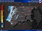
Does anyone actually live in those places ?First event snowfall map i've seen from LWX this season. I know its pretty far north, but it won't be long before we see this further south.
View attachment 138335
NoSnowATL
Member
Birds, bugs and beards.Does anyone actually live in those places ?
W
WSW
Guest
Haha yeah but not that many. The northernmost county on the map is Garrett County Maryland. Parts of there avg over 100 inches a Winter. 30k people. Really beautiful there. Deep Creek Lake. Wisp Ski Resort. This is the spine of the Appalachians. Truly upslope snow heaven. Hard to explain how truly pretty that whole area is --that Advisory area. The easternmost snow area is the Blue Ridge of Virginia. Plenty of people live there is Warren and Fauquier counties. Thats where the DC metro area begins. Lots of commuters to the western suburbs.Does anyone actually live in those places ?
W
WSW
Guest
Haha definitely some of that in the mountains of WV. Amazingly beautiful though.Birds, bugs and beards.
Lot of changes on the 12z GFS Op Dec15-20. Put some on here on the scoreboard. Then we get like a 24-36 warmup ahead of a big Artic front coming down21-22cnd. Boulder of salt cause its an Op not ens and its the gfs.
Better get outside this weekend and enjoy before Sunday evening front. Seeing a lot of Damming HP as we get down road 200hr onward, which will keep temps seasonable/chilly on Can and GFs Ops.
Better get outside this weekend and enjoy before Sunday evening front. Seeing a lot of Damming HP as we get down road 200hr onward, which will keep temps seasonable/chilly on Can and GFs Ops.
- Joined
- Jan 5, 2017
- Messages
- 3,769
- Reaction score
- 5,966
I'm also noticing convection robbing moisture transport north of central Georgia for Sunday's system. I'm still hoping for some significant rain, though, since I missed out last weekend.Lot of changes on the 12z GFS Op Dec15-20. Put some on here on the scoreboard. Then we get like a 24-36 warmup ahead of a big Artic front coming down21-22cnd. Boulder of salt cause its an Op not ens and its the gfs.
Better get outside this weekend and enjoy before Sunday evening front. Seeing a lot of Damming HP as we get down road 200hr onward, which will keep temps seasonable/chilly on Can and GFs Ops.
- Joined
- Jan 5, 2017
- Messages
- 3,769
- Reaction score
- 5,966
Euro looks good for about 2.5" in my area. I hope it's right!
12z Eps ,Gefs and Geps all 3 paint some snow stripes east of mtns hour 250-264. so all 3 ensembles must have one or 2 ens members sniffing the glue.
Really?12z Eps ,Gefs and Geps all 3 paint some snow stripes east of mtns hour 250-264. so all 3 ensembles must have one or 2 ens members sniffing the glue.
GoDuke
Member
Flotown
Member
am i right or wrong in saying that there is a lag in sensible weather when it comes to mjo?clearly we look to head toward phase 8 by later part of month but we have to wait a bit..correct?
Itryatgolf
Member
End of December for any changes to colder stormier at the earliest around here imo. We gots a ways to go lolam i right or wrong in saying that there is a lag in sensible weather when it comes to mjo?clearly we look to head toward phase 8 by later part of month but we have to wait a bit..correct?
NoSnowATL
Member
Correctam i right or wrong in saying that there is a lag in sensible weather when it comes to mjo?clearly we look to head toward phase 8 by later part of month but we have to wait a bit..correct?
Flotown
Member
thanks..i thought soCorrect
NBAcentel
Member
Look at the floodlights got some flurries mixed in with a rain shower just now
Moderate Rain
SameModerate Rain
Nomanslandva
Member
39 lt rain. And radar drying up.
dsaur
Member
Yeah, we ride the dry slot between heavy rains, top and bottom. How many times do we have to get that in winter, lol. If I can't get frozen at least let me get 33 and a two day gom low with 3 inches of rain.I'm also noticing convection robbing moisture transport north of central Georgia for Sunday's system. I'm still hoping for some significant rain, though, since I missed out last weekend.
tonysc
Member
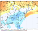
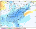
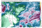
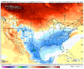
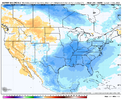
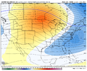
The armpit of hell LOL Well at least you know where you are Mitch. You're a good guy. Mitch, I watch your YT videos all the time.View attachment 138338View attachment 138339View attachment 138340View attachment 138341
Pretty significant shift for mid month on the EPS.
Car igot iced over from last night rain. Roads good shape

