NoSnowATL
Member
LOL, it goes from nothing to 4"+ in a span of 100 miles in AL.
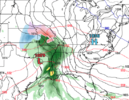
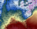
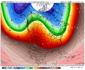
Canadian is interesting for Christmas Eve:That phase early next week, on the euro brings one of the colder airmasses this year so far to the Carolina’s. It’s quick but next Tuesday highs barely make it to 40. That’s a pretty chilly day, for the pattern that we’re in. Lol View attachment 138612View attachment 138613View attachment 138614
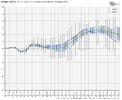
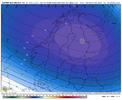
Still needs work but still seeing signs of something better View attachment 138622
Think what’s makes it better to, is that we are actually following a normal Nino progression, that typically happens the later it gets, the pac trough normally backs off. It’s harder to get a legit -EPO in a Nino Vs a nina, but far easier to get a western ridge/NW Canada ridge Vs a nina.Just need to clockwise rotate everything 1000 miles and we're golden. Man, that pacific vortex needs to get off the coast, soon as it does were in a good place if it can hold.
I’m in the fail boat with you. I thought +5-6 degrees was a lock going into the month. I honestly thought earlier last weekend that things would definitely trend warmer here late week. Well we’re here now and about to have a 3rd night this week down in the 20s and will possibly have a 4th tomorrow night if the clouds don’t move in early enough. As much as I’ve looked at the 500mb maps and thought we should torch, I guess JB is right with one of his sayings… we don’t live at 500mb

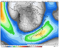
That's kind of the concern I have. There's a nice signal for lower anomalies in the south/southeast and ridging in Canada, but until we get a solid signal for some legit cold being injected into the pattern, most of us are going to be on the outside looking in. At least the shetleydrought won't crop up anytime soon.Something to look at. EPS has a nice +3 sigma +PNA. It’s not a bad H5 pattern. But dang there’s just no cold. The EPS control is a good example of the struggles we’d have to deal with, due to Canada being nuked from the pac jet. But at least ensembles are looking better View attachment 138644View attachment 138645View attachment 138646View attachment 138647
Here’s a comparison to the failed Miller B setup last year that had models bumping for a while until it got closer, and the H5 pattern being modeled. It’s definitely not a shutout pattern by any means, but it’s one that has a lot working against usSomething to look at. EPS has a nice +3 sigma +PNA. It’s not a bad H5 pattern. But dang there’s just no cold. The EPS control is a good example of the struggles we’d have to deal with, due to Canada being nuked from the pac jet. But at least ensembles are looking better View attachment 138644View attachment 138645View attachment 138646View attachment 138647
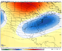
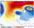
It's kind of remarkable to me that we're even having the conversation given the big trough off the west coast, but I think the sneaky factor here is the El Nino induced low height pattern from Baja to Florida. Less SE ridge type La Nina influence. So a well-timed cold shot over the Northeast gets us closerThat's kind of the concern I have. There's a nice signal for lower anomalies in the south/southeast and ridging in Canada, but until we get a solid signal for some legit cold being injected into the pattern, most of us are going to be on the outside looking in. At least the shetleydrought won't crop up anytime soon.
This is why I’ve said that it would probably take 10 days or so after a pattern change to get in a better position for winter storm possibilities… Canada getting flooded with mild air is always going to be an issue. Like you say though, it’s definitely not a guaranteed shut out pattern. We are going into the time of year where marginal cold can work and make for some decent storms… if we had just some marginal cold to work with this coming weekend, we would both be getting the shovels and sleds readyHere’s a comparison to the failed Miller B setup last year that had models bumping for a while until it got closer, and the H5 pattern being modeled. It’s definitely not a shutout pattern by any means, but it’s one that has a lot working against us View attachment 138649View attachment 138650
