-
Hello, please take a minute to check out our awesome content, contributed by the wonderful members of our community. We hope you'll add your own thoughts and opinions by making a free account!
You are using an out of date browser. It may not display this or other websites correctly.
You should upgrade or use an alternative browser.
You should upgrade or use an alternative browser.
Pattern December 2023
- Thread starter whatalife
- Start date
packfan98
Moderator
Looks like the target date for below average temperatures and a more favorable pattern for winter weather chances in the SE starts 12/28 on recent model runs. Let’s see if we can get that to hold. That’s getting into prime climo for early January. fingers crossed!
NCSNOW
Member
- Joined
- Dec 2, 2016
- Messages
- 9,582
- Reaction score
- 19,103
Or maybe start it a few days earlier, Not so much to get snow, but we don't torch Christmas Day like it was looking a couple days ago.Looks like the target date for below average temperatures and a more favorable pattern for winter weather chances in the SE starts 12/28 on recent model runs. Let’s see if we can get that to hold. That’s getting into prime climo for early January. fingers crossed!

Blue_Ridge_Escarpment
Member
Ran into a graupel shower heading into the office this morning.
NoSnowATL
Member
NoSnowATL
Member
weatherfide
Member
- Joined
- Jan 5, 2017
- Messages
- 3,242
- Reaction score
- 4,821
Itryatgolf
Member
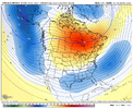
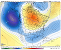
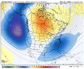
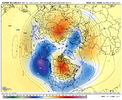
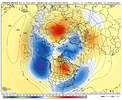
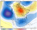
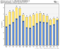
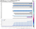
I'm hoping for more improvement moving forward as wellAll I see is improvement Christmas and beyond on the ENS. It’s not the final product we want, and not close, but the right direction. Clogging up the Atlantic and undercutting first is key View attachment 138582View attachment 138583View attachment 138584
Yeah definitely looking a lot better than a few days ago. I still think that it will take a couple weeks once the pattern change starts to get things right for a winter storm in the south, but if things start just after Christmas we could have things primed and ready for peak climo.All I see is improvement Christmas and beyond on the ENS. It’s not the final product we want, and not close, but the right direction. Clogging up the Atlantic and undercutting first is key View attachment 138582View attachment 138583View attachment 138584
tennessee storm
Member
Not trying be Debbie downer any means. Even that look looks transient cold to me, better then nothingYeah definitely looking a lot better than a few days ago. I still think that it will take a couple weeks once the pattern change starts to get things right for a winter storm in the south, but if things start just after Christmas we could have things primed and ready for peak climo.
You’re right. Like Fro said, it’s by no means what we want to get to, but it’s a step in the right direction. The biggest thing about that look is that you won’t see our source regions continue to get flooded with Pacific airNot trying be Debbie downer any means. Even that look looks transient cold to me, better then nothing
lexxnchloe
Member
NoSnowATL
Member
LukeBarrette
im north of 90% of people on here so yeah
Meteorology Student
Member
2024 Supporter
2017-2023 Supporter
JHS
Member
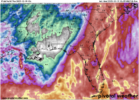
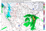
It has started to shift back to the east. We still get lots of rain, but I wonder just how far east it will shift. This could still be only a coastal storm with the center out over the gulf stream.Can you imagine the meltdown if this weekends storm would have had enough cold air. We started the coastal storm thread this was a ride the coast. Now its shifted to an Apps Runner. Fear the NW trend when tracking this year

