• Hello, please take a minute to check out our awesome content, contributed by the wonderful members of our community. We hope you'll add your own thoughts and opinions by making a free account!

Pattern December 2023

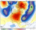
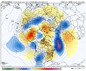
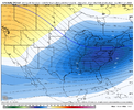
Euro Wk Jan 1 to Jan 8 850mb Temp Anomalies. Thing is, what makes this a bit more believable than normal is that we are in El Niño vs La Nina…the El Niño is strong but hasn’t established itself as a super & east-based Nino from a tropical forcing standpoint over the past several months leading in…and the MJO supports this type of pattern progression. At a minimum, potential for pattern improvement should increase late Dec / early Jan. We shall see

ADAADA34-FA0F-4625-ABD6-CAFE595CA433.png
 
Euro Wk Jan 1 to Jan 8 850mb Temp Anomalies. Thing is, what makes this a bit more believable than normal is that we are in El Niño vs La Nina…the El Niño is strong but hasn’t established itself as a super & east-based Nino from a tropical forcing standpoint over the past several months leading in…and the MJO supports this type of pattern progression. At a minimum, potential for pattern improvement should increase late Dec / early Jan. We shall see

View attachment 138220
Hopefully we can maintain it or get even colder moving forward. Be nice to be cold around the holidays here
 
Euro Wk Jan 1 to Jan 8 850mb Temp Anomalies. Thing is, what makes this a bit more believable than normal is that we are in El Niño vs La Nina…the El Niño is strong but hasn’t established itself as a super & east-based Nino from a tropical forcing standpoint over the past several months leading in…and the MJO supports this type of pattern progression. At a minimum, potential for pattern improvement should increase late Dec / early Jan. We shall see

View attachment 138220
Yeah grit. I am really liking the late December into early January period …
 
Euro Wk Jan 1 to Jan 8 850mb Temp Anomalies. Thing is, what makes this a bit more believable than normal is that we are in El Niño vs La Nina…the El Niño is strong but hasn’t established itself as a super & east-based Nino from a tropical forcing standpoint over the past several months leading in…and the MJO supports this type of pattern progression. At a minimum, potential for pattern improvement should increase late Dec / early Jan. We shall see

View attachment 138220
Just out of curiosity, what do think has caused caused the tropical forcing to not be matching what is typically seen with a strong, east based El Niño? Does it possibly have anything to do with go into the Nino after a 3 year La Niña?
 
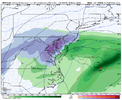
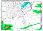
18z GFS trying hard for next wed. Has a nice little thump for the mtn folks. Been seeing some scattered chatter on a few ens frames for this time frame. Look close and Check out the blue New Bern as coastal deepens on way out. Maybebwe can get the trough to sharpen a bit ,get rid of the pos tilt. Assuming this actually unfolds.
1701220950830.png
1701221148617.png
 
Last edited:
18z gfs is northern OBX flurry watch lol. Couple ens members agree but really the first run that’s had anything to ? at.
 
Just out of curiosity, what do think has caused the tropical forcing to not be matching what is typically seen with a strong, east based El Niño? Does it possibly have anything to do with go into the Nino after a 3 year La Niña?
This El Nino started on the coast of Peru and the warm anomalies have expanded west thru this year (similar to 57-58 & 65-66) - can view a loop of it here: https://psl.noaa.gov/map/clim/sst.anom.anim.year.html

The big east-based Ninos (82-83 & 97-98) started out with the warmest anomalies to the west, then moved strongly east via big, low-level westerly wind bursts (WWBs) across the central Pacific. This year, we haven't seen nearly the WWB activity as 82 and 97, though we recently had the first big WWB in the C Pac. So, I think that is part of it just in terms of how the nino formed. Also, climate change may be a factor as nowadays it is more common for warm water to hang back in the W Pacific, whereas in 82 and 97, there was more of a slosh of evacuating the warm water out of the W Pac and move more of it east into the E Pac....and accordingly, the nino base state in those years had more convection / nino forcing in the E Pac compared to what we are seeing this year.

Those are my thoughts on it. I think we are going to see this nino strengthen just a little more over the next month, but my take is that the base tropical forcing pattern won't change much. I suspect we will see a mixuture of patterns in Jan-Mar. Some -EPO and +PNA episodes, and some with low pressure / trough off & along the west coast
 
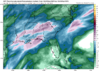
Last Night Euro below: Mtns still look good on previous frames We will at least get a quick in and out cold shot again next week, just like this week. But most likely our warmest weekend in December should be the weekend of the 9th it appears, BUT I must say The latest CFS doesn't agree with this. We would all cash out with the latest CFS run for December as it is a beaut throughout. Hopefully the weeklies Grit posted and the cfs all hang on to a much improved pattern over the Holidays, where we can keep the cold around for more than 48 hours.

prateptype_cat_ecmwf-imp.conus.png
 
Last edited:
Back
Top