NoSnowATL
Member
Suppression city but that's ok this far out.
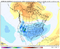
Pics or it didn’t happenToday's Euro Weeklies look delish post-Christmas to mid-Jan

Hopefully we can maintain it or get even colder moving forward. Be nice to be cold around the holidays hereEuro Wk Jan 1 to Jan 8 850mb Temp Anomalies. Thing is, what makes this a bit more believable than normal is that we are in El Niño vs La Nina…the El Niño is strong but hasn’t established itself as a super & east-based Nino from a tropical forcing standpoint over the past several months leading in…and the MJO supports this type of pattern progression. At a minimum, potential for pattern improvement should increase late Dec / early Jan. We shall see
View attachment 138220
Can you make sure I have a steady stream of moisture/snow into Lake Tahoe Jan 13-20 please and thank you! lol That map looks pretty good. lets get that jet undercutting.
Yeah grit. I am really liking the late December into early January period …Euro Wk Jan 1 to Jan 8 850mb Temp Anomalies. Thing is, what makes this a bit more believable than normal is that we are in El Niño vs La Nina…the El Niño is strong but hasn’t established itself as a super & east-based Nino from a tropical forcing standpoint over the past several months leading in…and the MJO supports this type of pattern progression. At a minimum, potential for pattern improvement should increase late Dec / early Jan. We shall see
View attachment 138220
Just out of curiosity, what do think has caused caused the tropical forcing to not be matching what is typically seen with a strong, east based El Niño? Does it possibly have anything to do with go into the Nino after a 3 year La Niña?Euro Wk Jan 1 to Jan 8 850mb Temp Anomalies. Thing is, what makes this a bit more believable than normal is that we are in El Niño vs La Nina…the El Niño is strong but hasn’t established itself as a super & east-based Nino from a tropical forcing standpoint over the past several months leading in…and the MJO supports this type of pattern progression. At a minimum, potential for pattern improvement should increase late Dec / early Jan. We shall see
View attachment 138220
it sounds good when you say it like that. Unfortunately it’s only like a 2 week timeframe In realityYeah grit. I am really liking the late December into early January period …


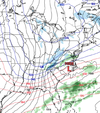
That's right in the middle of our torch too!18z gfs is northern OBX flurry watch lol. Couple ens members agree but really the first run that’s had anything to ? at.
This El Nino started on the coast of Peru and the warm anomalies have expanded west thru this year (similar to 57-58 & 65-66) - can view a loop of it here: https://psl.noaa.gov/map/clim/sst.anom.anim.year.htmlJust out of curiosity, what do think has caused the tropical forcing to not be matching what is typically seen with a strong, east based El Niño? Does it possibly have anything to do with go into the Nino after a 3 year La Niña?

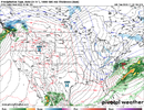
It's going to be incredibly warm this weekend. Some areas will have lows in the 60s which is very warm for December.NBM is printing up to 2" of rain for my area this weekend! Awesome to see! I get a break from heating my house, too. Thermostat is already set at 65 for the winter.View attachment 138237
That's not uncommon at all. Watching the highs, though. Any break in the precip and some sun breaking through and we may get up in to the mid 70's. That's pretty warm for December but quite welcome by me.It's going to be incredibly warm this weekend. Some areas will have lows in the 60s which is very warm for December.
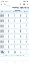
having low temps warmer than the average high is not uncommon ?That's not uncommon at all. Watching the highs, though. Any break in the precip and some sun breaking through and we may get up in to the mid 70's. That's pretty warm for December but quite welcome by me.
It's not really that uncommon. Although it seems to happen way more frequently and more than it should these days. But this is just a pulling a random year at GSP and that year had lows of 54 m, which is probably close to the average high.having low temps warmer than the average high is not uncommon ?

How many weeks of chances are we looking at? Any guesses? Hopefully more than the 1-2 week window as usual.Gonna go with post Christmas being a pattern change to a +PNA with chances across the SE. gefs extended especially hints at this
14.5 weeksHow many weeks of chances are we looking at? Any guesses? Hopefully more than the 1-2 week window as usual.
Aside from it being hour 364 of the GFS, the other good thing I see is that at least Canada isn’t getting flooded with mild air and looks to building up a considerable amount of cold air.Ooooooooof ?View attachment 138247
That time frame seems reasonable to me though I might go right around New Year’s and a few days after. I don’t think we want the PNA to be too positive though. Remember last December when it decided to go beast mode and we ended up with vodka cold at Christmas but no moisture to speak of because everything was getting squashed into the GOM. It’s been positive since early last week and honestly I think that with the teleconnections the way they have been, I think it would have been likely we would have scored something during a better climo period.Gonna go with post Christmas being a pattern change to a +PNA with chances across the SE. gefs extended especially hints at this
There was a pretty decent jump with regards to snow on last nights run.Gonna go with post Christmas being a pattern change to a +PNA with chances across the SE. gefs extended especially hints at this


reminder that a steady diet of i-95 cruisers that give the board 43 and rain will, in fact, depress average temperatures enough to warrant the light blue shading
