FridayAt what point will we begin to see the ULL on the NAM?
-
Hello, please take a minute to check out our awesome content, contributed by the wonderful members of our community. We hope you'll add your own thoughts and opinions by making a free account!
You are using an out of date browser. It may not display this or other websites correctly.
You should upgrade or use an alternative browser.
You should upgrade or use an alternative browser.
Wintry Dec 8-10th Winter Storm
- Thread starter SimeonNC
- Start date
olhausen
Member
yikes! I still think people need to temper their expectations this far out. This is the south and no matter how good the models look things can and do go wrong with winter weather. I’m not saying this won’t be a big winter storm but I see a lot of posters acting as if this is set in stone already.Going to go ahead and say it. Storm of the century totals will be rivalved and smashed for many locations in WNC. This one will be the new benchmark of all time esp west of i77.
Cad Wedge NC
Member
That may be possible, but if the models keep trending south and colder, her forecast will be in big trouble.KK going with 1-2” Greenville area, no road issues at all!
SimeonNC
Member
I mean in CLT it won't be hard at all to beat 1993, from the winter storm database there wasn't much snow here at all.I agree. This is going to rival the Storm of the Century (1993) in many areas.
ICON continues with the south trend and the high is 1 mb stronger.
The NC mtns are only south in latitude. They have a climate more similar to New England.yikes! I still think people need to temper their expectations this far out. This is the south and no matter how good the models look things can and do go wrong with winter weather. I’m not saying this won’t be a big winter storm but I see a lot of posters acting as if this is set in stone already.
Snowflowxxl
Member
ICON coming in colder
Also the models should start coming together a little better starting 24 hours from now once our wave gets sampled.
Round Oak Weather
Member
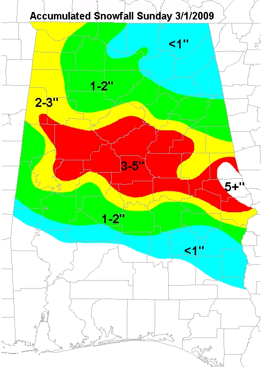
Gonna come out of my one day break to say this if the ULL continues to come better in the back half of the storm I think another March 2009 is not out of the books for parts of Georgia.
Stormlover
Member
Wow, that is a huge change0z NAM vs 18z GFS .spot the BIG difference?? View attachment 8337 View attachment 8338
That wasn’t excitement. That’s a warning. Prepare now for 1-2 week survival in the MTNS and Foothills. A large area of 2-3 feet of snow could mean air supply drops for Boone, Sparta and West Jefferson. The consistency in the EURO is dangerous at this stage and range.

RollTide18
Member
Gonna come out of my one day break to say this if the ULL continues to come better in the back half of the storm I think another March 2009 is not out of the books for parts of Georgia.
Was a good one for Alabama as well, that ULL moved SE & then NE through Georgia I believe
[
Even north miss, ala and ga. Have dew points in the 20’s. Vs the gfs. You would think that would be a good thing for all 3 states.0z NAM vs 18z GFS .spot the BIG difference?? View attachment 8337 View attachment 8338
No. Very general, said lots of rain Sundaydid she mention I-85?
Snowflowxxl
Member
NC gets snow on this run on the ICON. Backside looks healthy as well but a tad warm
Kylo
Member
Icon is impressive


Cary_Snow95
Member
18z

00z

00z
Its obviously not gonna be snow for ATL area. I could see a scenario if everything lines up correctly where we get alot of ice or sleet and then transition to snow in the last bit.
I've gone from unconcerned to cautiously optimistic the past couple of days. I could see this being a February 11-13, 2014 repeat here. So basically a sleetfest with a little bit of ice and possibly backend snow if the ULL works out for us. I'll call that success if somehow it happens. It's pretty funny how very close the 12z EURO was to showing an icy mess here when you look at 850/925mb temps, 2m temps, etc. If the 00z EURO comes in a degree or two colder in those thermal profiles we might be in trouble.
NWMSGuy
Member
Since I’m not sure, how could this help us?Even north miss, ala and ga. Have dew points in the 20’s. Vs the gfs. You would think that would be a good thing for all 3 states.
Even north miss, ala and ga. Have dew points in the 20’s. Vs the gfs. You would think that would be a good thing for all 3 states.
It's doable, but DPs in the teens would be better. Gives you a little elbow room to work with.
That wedge looks a little off!?
Lower the dew point the better. When precip comes in it will lower the temp down to the dew point reading. So if you have a dew point of 28 degrees. And let’s say it starts rain/snow at temp of 34 degrees. The precip would push down the temp to your dewpoint of 28 degrees which would change you all over to snow of snow/sleet depending of the condition on the upper atmosphere.Since I’m not sure, how could this help us?


Also we are getting a fresh push from the north of could air as you can see in these 4 frames. Which helps out north miss, ala and ga... hopes this helps... also this would be a awesome storm for Arkansas area also.Lower the dew point the better. When precip comes in it will lower the temp down to the dew point reading. So if you have a dew point of 28 degrees. And let’s say it starts rain/snow at temp of 34 degrees. The precip would push down the temp to your dewpoint of 28 degrees which would change you all over to snow of snow/sleet depending of the condition on the upper atmosphere.
Brent
Member
View attachment 8339 @Brent you should be excited. It nam getting closed to you. You could be Nam’d..
Lol this stupid rainstorm is gonna try and pull me back in

Flurry
Member
I agree...Way too much time for things to change drastically...Models are shifting every run now, and we"re still several days outyikes! I still think people need to temper their expectations this far out. This is the south and no matter how good the models look things can and do go wrong with winter weather. I’m not saying this won’t be a big winter storm but I see a lot of posters acting as if this is set in stone already.
tennessee storm
Member
anyone doing live play by play 0zgfs... I would, but I got two loud kids im dealing with. lol
Man! I’ve been out to dinner and just got a minute to check the threads. I must say, I see a lot of show boating. Somebody’s going to get burned. I guarantee it
Dont worry. I think a few people got you. I will be doing a few.anyone doing live play by play 0zgfs... I would, but I got two loud kids im dealing with. lol
NWMSGuy
Member
View attachment 8342 View attachment 8343 View attachment 8344 View attachment 8345
Also we are getting a fresh push from the north of could air as you can see in these 4 frames. Which helps out north miss, ala and ga... hopes this helps... also this would be a awesome storm for Arkansas area also.
This could get good!Lower the dew point the better. When precip comes in it will lower the temp down to the dew point reading. So if you have a dew point of 28 degrees. And let’s say it starts rain/snow at temp of 34 degrees. The precip would push down the temp to your dewpoint of 28 degrees which would change you all over to snow of snow/sleet depending of the condition on the upper atmosphere.
accu35
Member
Low looks little further south on gfs
drfranklin
Member
- Joined
- Dec 1, 2016
- Messages
- 511
- Reaction score
- 760
Update from Chris Justus via FB live just now: I-85 dividing between accumulating snow and mostly rain - cities of Greenville/Spartanburg/Gaffney will see significant transitions between snow/sleet/fz rain - Simpsonville/etc will see mostly rain - I'm expecting a sleet storm here being about 2 miles north of 85
Rather get burned than put peoples lives in danger. ------------- has upped his Charlotte forecast for bread and milk. Everyone is now urging to prepare and App State has already alerted everyone on campus of the danger.
He’s not the weenie he used to be, just sad! I hope I get 6” out of spite!Update from Chris Justus via FB live just now: I-85 dividing between accumulating snow and mostly rain - cities of Greenville/Spartanburg/Gaffney will see significant transitions between snow/sleet/fz rain - Simpsonville/etc will see mostly rain - I'm expecting a sleet storm here being about 2 miles north of 85
Low a little slower. High trying to move into cad alley
olhausen
Member
Lol, I know how the mountains work with elevation and all. The problem is that 99% of the people posting here don’t live in those mountains.The NC mtns are only south in latitude. They have a climate more similar to New England.
Wish that high pressure was on up to 1040 or 1041 on the gfs. That would help a lot. Right now it’s 1037 at hour 66..
True--but I am camping this weekend at Tate Branch in NE GA at 2600 feet! I hope we see some action!Lol, I know how the mountains work with elevation and all. The problem is that 99% of the people posting here don’t live in those mountains.
Thanks!
Ben
Round Oak Weather
Member
That storm gave me 4” the most I’ve ever seen but just a few miles up the road saw 6”Was a good one for Alabama as well, that ULL moved SE & then NE through Georgia I believe
[
KK going with GFS because it’s been must consistent! LolUpdate from Chris Justus via FB live just now: I-85 dividing between accumulating snow and mostly rain - cities of Greenville/Spartanburg/Gaffney will see significant transitions between snow/sleet/fz rain - Simpsonville/etc will see mostly rain - I'm expecting a sleet storm here being about 2 miles north of 85