You are close to Goldsboro. I seriously doubt you get much of anything frozen.AS long as it's FROZEN, I'm Good...
-
Hello, please take a minute to check out our awesome content, contributed by the wonderful members of our community. We hope you'll add your own thoughts and opinions by making a free account!
You are using an out of date browser. It may not display this or other websites correctly.
You should upgrade or use an alternative browser.
You should upgrade or use an alternative browser.
Wintry Dec 8-10th Winter Storm
- Thread starter SimeonNC
- Start date
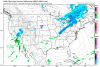
with sleet (smoother one), without sleet(blockier one)
For you met
Sent from my iPhone using Tapatalk
Thanks to both of you.... and yes I'm getting 4-5", brb going to purchase that sled
FFC:
.AVIATION...
18Z Update...
VFR conditions expected through at least early Friday afternoon,
with only mid and high level clouds over the area. Additional
moisture moves into the area Friday, and FEW-SCT MVFR or low VFR
possible after 18z. Light rain possible after 18z. Winds will be
light and variable this afternoon, trending towards the SW. Winds
will shift to the WNW overnight, then settle NW to NNW after 12z.
Speeds will be 3-6kt Friday. Heads up: Sleet or mixed precip is
possible at the metro Atlanta and Athens TAF sites after 06Z
Saturday.
I think he's just a real positive guy. Wish I could be like that.Why don't you "explain" to everybody what these models are seeing that will lead to all this snow for Wake County? You have sparked my curiosity. I have seen the pretty pictures too.....In all seriousness lets here your thoughts with a bit more of a meteorological perspective
6" in RDU without sleet? I don't believe that at all.
I could argue a blizzard warning for Watauga, Ashe and Alleghany. Gusts over 50 mph on Sunday. Along and west of the blue ridge parkway. Not for the foothills tho.
I probably sound like a broken record, but imo the sleet depiction on the ECMWF (and other global models) seems to be way underdone. Nice blend would be to take the QPF from the ECMWF and use the ptypes from the NAM honestly. Also those maps assume a 10:1 ratio, probably gonna be 4-7:16" in RDU without sleet? I don't believe that at all.

Fountainguy97
Member
I just checked our nam verification in relation to the strength of the high. It’s not good.
The 84hr nam for 18z today had a 1038mb high.

Here is reality today.

The nam was 6mb too strong. And probably means this trend is legit and will not reverse. In fact the HP could trend even weaker in the long range.
The 84hr nam for 18z today had a 1038mb high.
Here is reality today.
The nam was 6mb too strong. And probably means this trend is legit and will not reverse. In fact the HP could trend even weaker in the long range.
Attachments
B
Brick Tamland
Guest
I just think the technology and consistency of the models should have some weight. I just don't get why people even bother looking at the models if they don't ever believe them and then post negative things all the time about them being wrong because it was wrong before, or because it is rare for us to get a big storm like the models are showing. It would be one thing if the models are all over the place, but they are not. At least not yet. If you have one model showing a big storm, and the rest aren't, that is another thing, too.I think he's just a real positive guy. Wish I could be like that.
And that's all I am going to say about that.
Snowflowxxl
Member
This is not good at all!I just checked our nam verification in relation to the strength of the high. It’s not good.
The 84hr nam for 18z today had a 1038mb high.
View attachment 8666
Here is reality today.
View attachment 8667
The nam was 6mb too strong. And probably means this trend is legit and will not reverse. In fact the HP could trend even weaker in the long range.
ForsythSnow
Moderator
Well if the HRRR (a long shot) is right it'll strengthen 4 millibars in 14 hours. That should put us in place.I just checked our nam verification in relation to the strength of the high. It’s not good.
The 84hr nam for 18z today had a 1038mb high.
View attachment 8666
Here is reality today.
View attachment 8667
The nam was 6mb too strong. And probably means this trend is legit and will not reverse. In fact the HP could trend even weaker in the long range.
snowlover91
Member
Here's something of interest. At hour 60 the 3km NAM is a bit colder at the 850 level in places like Texas and Tennessee compared with the warmer 1-2C on the GFS.

GFS

The end result? The 3km NAM is much snowier in places like Oklahoma and Texas vs the GFS.


GFS
The end result? The 3km NAM is much snowier in places like Oklahoma and Texas vs the GFS.
 A ray of sunshine!? I’m assuming this map was made before the 12z runs!
Early Sunday looks crazy. Could see severe storms with heavy snow across western NC. More than just thundersnow. I’m talking 3” per rates with damaging winds. Wouldn’t rule out severe thunderstorm warnings overlapping blizzard warnings and possibly a tornado warning near the southern CAD boundary.
Sandbar
Member
Its still 3.5 days out and the ensembles are still very much worth watching versus individual models. With that being said those ensembles are withering a bit which is a sign to me to watch for things to start trending in the negative direction IMBY
That is also based off an analysis from 3 days ago, many of the upper level features were not even on the continent at that pointWell if the HRRR (a long shot) is right it'll strengthen 4 millibars in 14 hours. That should put us in place.
Wait, what ? We are back to 3.5 days out ? I thought we were at 2 days out ? So 3.5 days out would put us at Monday morning.Its still 3.5 days out and the ensembles are still very much worth watching versus individual models. With that being said those ensembles are withering a bit which is a sign to me to watch for things to start trending in the negative direction IMBY
Jessy89
Member
Yes I would be shocked happy and surprised if north of 85 in upstate saw 6-12. Honestly if we get 2-3 I’d be happyView attachment 8668 A ray of sunshine!? I’m assuming this map was made before the 12z runs!
Kylo
Member
FWIW....EPS largely the same. Fairly consistent across the members.


WXinCanton
Member
Do you still think this system will be bigger than the storm of the century?Early Sunday looks crazy. Could see severe storms with heavy snow across western NC. More than just thundersnow. I’m talking 3” per rates with damaging winds. Wouldn’t rule out severe thunderstorm warnings overlapping blizzard warnings and possibly a tornado warning near the southern CAD boundary.