FFC:
000
FXUS62 KFFC 071945
AFDFFC
Area Forecast Discussion
National Weather Service Peachtree City GA
245 PM EST Fri Dec 7 2018
.SHORT TERM /Tonight through Saturday Night/...
A strengthening storm system will gradually track from Texas to the
Lower Mississippi Valley and eventually the Southeast/Southern
Appalachians over the weekend with a series of
upper level
disturbances maintaining inclement weather across north & central
Georgia into early next week.
Here are a few of the forecast challenges with this package:
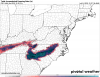
1. Duration, locations and amounts of wintry precipitation across
northeast Georgia Saturday night into Sunday. **See below for
further discussion on this**
2. Heavy rain Saturday into Sunday that could lead to river/stream
flooding. Confidence is high that this will occur.
3. Strong easterly winds late Saturday through Sunday morning.
4. Mix of rain/snow showers Sunday night into Monday with locally
heavy snow possible in the northern mountains.
Starting with #1... both the
NAM and
ECMWF continue to show an area
of sleet/snow/freezing rain developing late Saturday across the
higher elevations of northeast GA. Into Saturday night as the colder
low
lvl air aided by the "wedge" becomes reinforced, this area of
wintry precip is expected to expand south/west int the typical
"wedge zone" (Hall/Jackson/Madison/Banks/northern Gwinnett & Barrow
counties). Model soundings from Blairsville (Union Co.) to
Gainesville show temperature profiles supportive of any and all
wintry p-types (snow/sleet/freezing) from late Saturday through
Sunday, so trying to figure out what p-type and how much is
extremely challenging at this point. Also, there is still some
uncertainty as to how cold it will get near the surface. Went
conservative with initial Ice
accums but expanded the area farther
south/west from earlier forecasts.
Snow/sleet
accums should be confined to the highest of elevations in
Towns, Union, Lumpkin and White counties Saturday night into Sunday.
Will maintain Winter Storm
Watch across these areas until confidence
becomes a bit higher on whether to upgrade to a
Warning.
Outside of the winter weather concerns, what`s fairly certain is the
potential for heavy rain and strong/gusty winds developing Saturday
afternoon and continuing into early Sunday morning. Tightening
pressure
gradient between
sfc low moving just south and high
pressure over the Mid Atlantic will increase easterly winds across
the area. Strong 40-50kt winds around 925mb raise a level of concern
for winds especially in the higher elevations. On top of everything
else, may need to consider Wind Advisory for
Sat PM through Sunday
morning. Two to locally 4 inches of
rainfall is expected in the next
36-48 hours which will lead to localized river/stream flooding along
with flooding over poor drainage/urban areas.
Wrap-around precip lingering across the area Sunday night into
Monday could bring some snow showers across north GA, especially in
the favored NW-
flow mountainous areas. Something to
watch as we
progress through the weekend but let`s get through this initial
round of weather first.