Brandon10
Member
Now if we could get an east shift for the snow to reach to the coast
What were the earliest predictions for rainfall in areas of GA that are seeing it?
I feel like the "finger" is way ahead of schedule, although it shouldn't matter much at this very moment.
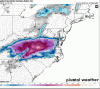
I saw on some of the forecasts that there was a 20% chance today.

I’m literally under the gray shade above lake Murray. Smh. Can’t make this stuff up
I’m literally under the gray shade above lake Murray. Smh. Can’t make this stuff up
What a nightmare this is going to be for forecasters. Especially for those just south of 85. Looks to be setting up for a shellacking for all. This one just has that feeling to it
Go back to sleep! It was all a dream, and your still getting cold rainWhat a nightmare this is going to be for forecasters. Especially for those just south of 85. Looks to be setting up for a shellacking for all. This one just has that feeling to it


The big question for me -- who has been asked to prepare a snow map for the state of NC this morning -- is how much more adjusting are we going to see based on the weaker, further south shortwave trend. Euro/FV3 have consistently been shaving off the northern edge and concurrently increasing totals further east as the mid-level low and associated WAA remain less amplified. Have to believe the 12z NAM will follow and should be an interesting run for it.
The big question for me -- who has been asked to prepare a snow map for the state of NC this morning -- is how much more adjusting are we going to see based on the weaker, further south shortwave trend. Euro/FV3 have consistently been shaving off the northern edge and concurrently increasing totals further east as the mid-level low and associated WAA remain less amplified. Have to believe the 12z NAM will follow and should be an interesting run for it.


Does a more South track guarantee colder air for those who get precip? It it suppression or just Southern trend?The big question for me -- who has been asked to prepare a snow map for the state of NC this morning -- is how much more adjusting are we going to see based on the weaker, further south shortwave trend. Euro/FV3 have consistently been shaving off the northern edge and concurrently increasing totals further east as the mid-level low and associated WAA remain less amplified. Have to believe the 12z NAM will follow and should be an interesting run for it.
Take your reasoning and sanity to banter please!please remember those clown maps are fun to look at but it assumes it is all snow but it is not. Sorry to bust your snow bubble.

You know this already, but trust your knowledge and gut .still not easy at all .My honest thoughts are this still has some room south. Mainly for the reasons you mentioned above .The big question for me -- who has been asked to prepare a snow map for the state of NC this morning -- is how much more adjusting are we going to see based on the weaker, further south shortwave trend. Euro/FV3 have consistently been shaving off the northern edge and concurrently increasing totals further east as the mid-level low and associated WAA remain less amplified. Have to believe the 12z NAM will follow and should be an interesting run for it.
You know this already, but trust your knowledge and gut .still not easy at all .My honest thoughts are this still has some room south. Mainly for the reasons you mentioned above .
It can't hurt! It will cut down totals on the northern edge, but will also reduce WAA at the same time, so a good thing for those further south. It seems like the southern trend is a subtle bit of two things - the shortwave itself appears to be ticking south and not interacting with the northern stream quite as quickly early on AND a piece of northern stream energy is also trending further south helping hold the southeastern Canada vortex further south a tad longer each run.Does a more South track guarantee colder air for those who get precip? It it suppression or just Southern trend?

Agreed! That's why I also think the euro (which is further west and SW with the backside ULL) has a better handle on it vs progressive GFS suite .It can't hurt! It will cut down totals on the northern edge, but will also reduce WAA at the same time, so a good thing for those further south. It seems like the southern trend is a subtle bit of two things - the shortwave itself appears to be ticking south and not interacting with the northern stream quite as quickly early on AND a piece of northern stream energy is also trending further south helping hold the southeastern Canada vortex further south a tad longer each run.
View attachment 8793
The bottom of the i in GreenvilleTarheel and Jimmy - where are you on this map:
do you have a generator? or all gas appliances?The bottom of the i in Greenville
.5-.6 contourTarheel and Jimmy - where are you on this map:
No way we get that much ice at the rates we are looking to get. .25 maybe but not .8Tarheel and Jimmy - where are you on this map:
probably agree; CJ put this graphic out about 12 hours ago; I suppose it's all about rates; hopeful for heavy rates?No way we get that much ice at the rates we are looking to get. .25 maybe but not .8
DT’s and Nicole Papays!@tarheel who’s bathtub do I need to slosh in to get that 06z Euro snow map to verify? damn
The 25 hour early arrival of precip , should keep me out of the 50s today! All systems go for .25 ZR to 10” of snow!!
I’m pretty sure TR gets 10” of snow/sleet mix. Down our way, Easley , Simpsonville , 2-4” of mostly sleet, would be great and about the highest we should hope forI’m stalking but I’m in Easley, do you really think it’ll pan out?