You are close to Goldsboro. I seriously doubt you get much of anything frozen.AS long as it's FROZEN, I'm Good...
-
Hello, please take a minute to check out our awesome content, contributed by the wonderful members of our community. We hope you'll add your own thoughts and opinions by making a free account!
You are using an out of date browser. It may not display this or other websites correctly.
You should upgrade or use an alternative browser.
You should upgrade or use an alternative browser.
Wintry Dec 8-10th Winter Storm
- Thread starter SimeonNC
- Start date
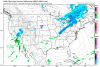
with sleet (smoother one), without sleet(blockier one)
For you met
Sent from my iPhone using Tapatalk
Thanks to both of you.... and yes I'm getting 4-5", brb going to purchase that sled
FFC:
.AVIATION...
18Z Update...
VFR conditions expected through at least early Friday afternoon,
with only mid and high level clouds over the area. Additional
moisture moves into the area Friday, and FEW-SCT MVFR or low VFR
possible after 18z. Light rain possible after 18z. Winds will be
light and variable this afternoon, trending towards the SW. Winds
will shift to the WNW overnight, then settle NW to NNW after 12z.
Speeds will be 3-6kt Friday. Heads up: Sleet or mixed precip is
possible at the metro Atlanta and Athens TAF sites after 06Z
Saturday.
I think he's just a real positive guy. Wish I could be like that.Why don't you "explain" to everybody what these models are seeing that will lead to all this snow for Wake County? You have sparked my curiosity. I have seen the pretty pictures too.....In all seriousness lets here your thoughts with a bit more of a meteorological perspective
6" in RDU without sleet? I don't believe that at all.
I could argue a blizzard warning for Watauga, Ashe and Alleghany. Gusts over 50 mph on Sunday. Along and west of the blue ridge parkway. Not for the foothills tho.
I probably sound like a broken record, but imo the sleet depiction on the ECMWF (and other global models) seems to be way underdone. Nice blend would be to take the QPF from the ECMWF and use the ptypes from the NAM honestly. Also those maps assume a 10:1 ratio, probably gonna be 4-7:16" in RDU without sleet? I don't believe that at all.

Fountainguy97
Member
I just checked our nam verification in relation to the strength of the high. It’s not good.
The 84hr nam for 18z today had a 1038mb high.

Here is reality today.

The nam was 6mb too strong. And probably means this trend is legit and will not reverse. In fact the HP could trend even weaker in the long range.
The 84hr nam for 18z today had a 1038mb high.
Here is reality today.
The nam was 6mb too strong. And probably means this trend is legit and will not reverse. In fact the HP could trend even weaker in the long range.
Attachments
B
Brick Tamland
Guest
I just think the technology and consistency of the models should have some weight. I just don't get why people even bother looking at the models if they don't ever believe them and then post negative things all the time about them being wrong because it was wrong before, or because it is rare for us to get a big storm like the models are showing. It would be one thing if the models are all over the place, but they are not. At least not yet. If you have one model showing a big storm, and the rest aren't, that is another thing, too.I think he's just a real positive guy. Wish I could be like that.
And that's all I am going to say about that.
Snowflowxxl
Member
This is not good at all!I just checked our nam verification in relation to the strength of the high. It’s not good.
The 84hr nam for 18z today had a 1038mb high.
View attachment 8666
Here is reality today.
View attachment 8667
The nam was 6mb too strong. And probably means this trend is legit and will not reverse. In fact the HP could trend even weaker in the long range.
ForsythSnow
Moderator
Well if the HRRR (a long shot) is right it'll strengthen 4 millibars in 14 hours. That should put us in place.I just checked our nam verification in relation to the strength of the high. It’s not good.
The 84hr nam for 18z today had a 1038mb high.
View attachment 8666
Here is reality today.
View attachment 8667
The nam was 6mb too strong. And probably means this trend is legit and will not reverse. In fact the HP could trend even weaker in the long range.
snowlover91
Member
Here's something of interest. At hour 60 the 3km NAM is a bit colder at the 850 level in places like Texas and Tennessee compared with the warmer 1-2C on the GFS.

GFS

The end result? The 3km NAM is much snowier in places like Oklahoma and Texas vs the GFS.


GFS
The end result? The 3km NAM is much snowier in places like Oklahoma and Texas vs the GFS.
 A ray of sunshine!? I’m assuming this map was made before the 12z runs!
Early Sunday looks crazy. Could see severe storms with heavy snow across western NC. More than just thundersnow. I’m talking 3” per rates with damaging winds. Wouldn’t rule out severe thunderstorm warnings overlapping blizzard warnings and possibly a tornado warning near the southern CAD boundary.
Sandbar
Member
Its still 3.5 days out and the ensembles are still very much worth watching versus individual models. With that being said those ensembles are withering a bit which is a sign to me to watch for things to start trending in the negative direction IMBY
That is also based off an analysis from 3 days ago, many of the upper level features were not even on the continent at that pointWell if the HRRR (a long shot) is right it'll strengthen 4 millibars in 14 hours. That should put us in place.
Wait, what ? We are back to 3.5 days out ? I thought we were at 2 days out ? So 3.5 days out would put us at Monday morning.Its still 3.5 days out and the ensembles are still very much worth watching versus individual models. With that being said those ensembles are withering a bit which is a sign to me to watch for things to start trending in the negative direction IMBY
Jessy89
Member
Yes I would be shocked happy and surprised if north of 85 in upstate saw 6-12. Honestly if we get 2-3 I’d be happyView attachment 8668 A ray of sunshine!? I’m assuming this map was made before the 12z runs!
Kylo
Member
FWIW....EPS largely the same. Fairly consistent across the members.


WXinCanton
Member
Do you still think this system will be bigger than the storm of the century?Early Sunday looks crazy. Could see severe storms with heavy snow across western NC. More than just thundersnow. I’m talking 3” per rates with damaging winds. Wouldn’t rule out severe thunderstorm warnings overlapping blizzard warnings and possibly a tornado warning near the southern CAD boundary.
Sandbar
Member
Thursday, Friday, Saturday into Sunday....That's 3.5 days give or takeWait, what ? We are back to 3.5 days out ? I thought we were at 2 days out ? So 3.5 days out would put us at Monday morning.
B
Brick Tamland
Guest
FWIW....EPS largely the same. Fairly consistent across the members.
View attachment 8669
View attachment 8670View attachment 8671
Very consistent, along with the other globals today. The last NAM run is really the only bad run today, and folks have said that run could have been wonky.
I'll be honest, I'm not getting all the sleet at RDU talk. Can someone show me where there is an abundance of sleet soundings around Wake County? I think that is just a strawman that is getting bandied about a lot without a proper assessment of the synoptic pattern. The H85 low is taking a near-optimal track for RDU - there shouldn't be a big warm nose unless that feature trends northward. Seems like it should be mainly a snow or rain scenario to me. I think there could be some sleet and a lot of 5:1 ratio snow with surface temps near freezing, but I'm not so sure I am ready to buy a sleet storm. It's close, don't get me wrong, but I don't think there is going to be a large area of sleet with this setup. I think there may be a narrow corridor of sleet before a quick transition to rain southeast of there, and yes, Wake County is going to be riding the line and yes, I realize how that normally ends up.Show me the scientific data that we have at this moment to say it is wrong. Not just because climatology and what has happened before. That's my point. If you think it's wrong just because of the past and pessimism, then why do you even bother to check out what the models show?
Kylo
Member
Very consistent, along with the other globals today. The last NAM run is really the only bad run today, and folks have said that run could have been wonky.
Nothing bad today. Odds are we won’t see big totals but still a good chance to see a major winter storm. My hope is it would be like Jan 2016 and not 2017. We get 1-2” sleet/snow in early December that would be a great start to winter.

Larger map posted above AshevilleWX
Showmeyourtds
Member
View attachment 8668 A ray of sunshine!? I’m assuming this map was made before the 12z runs!
Can't speak for the folks in the Carolinas, but anyone who expects a dusting to 2" along and north of I-20 thru Atlanta is out of their mind. Again, going to be predominantly a cold rain event down here...Along & north of Lake Lanier-different ball game, but for Atlanta, don't buy it.
Kylo
Member
I'll be honest, I'm not getting all the sleet at RDU talk. Can someone show me where there is an abundance of sleet soundings around Wake County? I think that is just a strawman that is getting bandied about a lot without a proper assessment of the synoptic pattern. The H85 low is taking a near-optimal track for RDU - there shouldn't be a big warm nose unless that feature trends northward. Seems like it should be mainly a snow or rain scenario to me. I think there could be some sleet and a lot of 5:1 ratio snow with surface temps near freezing, but I'm not so sure I am ready to buy a sleet storm. It's close, don't get me wrong, but I don't think there is going to be a large area of sleet with this setup.
Looks like Euro has it between ILM/MYR. Is that perfect or a little south of that better?
That's pretty darn good to get in the optimal banding, but given this marginal setup I'd trade a further south track and less lift for hopefully another degree or two.Looks like Euro has it between ILM/MYR. Is that perfect or a little south of that better?
FFC:
.SHORT TERM /Tonight through Friday Night/...
Rain returns to the area Friday, with a challenging forecast through
the next five days. Increasing mid and upper level moisture is
expected overnight tonight, and have opted to start rain chances 6-8
hours sooner than previously advertised given the tendency for high-
based precip to begin earlier than the model timing consensus.
At this point, precip Friday should be all rain given temperatures
will comfortably be above freezing across north and central Georgia.
Into the overnight period, temperatures in north Georgia will drop
into the mid 30s, with some isolated areas of 32. As a result, can
not rule out light rain/sleet mix over the higher elevations. No
accumulations are anticipated at this time.
Categorical pops remain in the grids into Saturday morning, with a
wet Saturday in store. See extended period discussion below.
31
.LONG TERM /Saturday through Thursday/...
The above storm system gets a little more complicated Saturday
into Monday night. Most of the precip Saturday will be rain with
rain becoming heavy at times Saturday afternoon and into Saturday
night. As the wedge strengthens Saturday night, colder air will
move into northeast GA turning the rain into snow on the mountain
ridges and freezing rain across parts of northeast GA.
Temperatures will bottom out right around the freezing mark across
northeast GA with mid 30s across the rest of north GA. While rain
is expected outside of northeast GA, there could be a little sleet
mixed in with the rain across north GA. The heaviest rain will
move off to our east Sunday but the cold air will stay in place
keeping a mix of r/zr over northeast GA, snow in the mountain and
rain elsewhere. As the surface low pulls to our east, colder air
will spread across the CWA Sunday night and into Monday and Monday
night. This will turn all precip into a rain/snow mix, although
amounts will be light. Skies clear Tuesday, but the relief will be
short lived as another system moves into the southeast US by mid
to late week.
An SPS will be issued for the winter precip potential and the
heavy rain potential.
packfan98
Moderator
The EPS, Euro, FV3, and UKMET held solid for the areas expected to get the heaviest axis of frozen precip. Living on the southern fringe of any potential system is always stressful. There is still some things to iron out with the extent of the cold air and timing. The NAM will be in useful range tomorrow and we will have better sampling too. It's pretty remarkable that the models have been locked onto this system for so many days!
Yeah this is one of those times when if you live in Atlanta, you drive up to Rabun County in NE GA and stay in a cabin for the weekend and hope to see some snow.Can't speak for the folks in the Carolinas, but anyone who expects a dusting to 2" along and north of I-20 thru Atlanta is out of their mind. Again, going to be predominantly a cold rain event down here...Along & north of Lake Lanier-different ball game, but for Atlanta, don't buy it.
Snow maps at this point (for a areas on the edges of the core) are only good for showing the transition zone. If a snow map goes from solid 10+ then rapidly starts contouring down from there and you find yourself in that contoured zone, you are in trouble. The snowfall numbers on the edges are complete bullsh** other than that
Almost 10 at the house. LolFor you met
Sent from my iPhone using Tapatalk

Sent from my SM-G955U using Tapatalk
No snow for you
Member
- Joined
- Dec 28, 2016
- Messages
- 583
- Reaction score
- 890
SCDOT treating the roads today. Seems early
I’ve been in the Euro 8+ camp for several days now but I’ve already accepted my backend half inch of slop and rain. I’m ok with that. My Miller A is waiting around January 4
snowlover91
Member
Interesting view from the RGEM ensembles for the LP track in the GOM.

Prepare for the worst and hope for the best ! Gotta keep expectations in check.I’ve been in the Euro 8+ camp for several days now but I’ve already accepted my backend half inch of slop and rain. I’m ok with that. My Miller A is waiting around January 4
Jon
Member
The last half of your post is pretty much what folks are talking about....I'll be honest, I'm not getting all the sleet at RDU talk. Can someone show me where there is an abundance of sleet soundings around Wake County? I think that is just a strawman that is getting bandied about a lot without a proper assessment of the synoptic pattern. The H85 low is taking a near-optimal track for RDU - there shouldn't be a big warm nose unless that feature trends northward. Seems like it should be mainly a snow or rain scenario to me. I think there could be some sleet and a lot of 5:1 ratio snow with surface temps near freezing, but I'm not so sure I am ready to buy a sleet storm.
It's close, don't get me wrong, but I don't think there is going to be a large area of sleet with this setup. I think there may be a narrow corridor of sleet before a quick transition to rain southeast of there, and yes, Wake County is going to be riding the line and yes, I realize how that normally ends up.
There doesn’t have to be a “big warm nose” for sleet, as I’m certain you know. In some gfs soundings yesterday they were definitely sleet. It just doesn’t take much...the soundings aren’t exactly spectacular and cold enough at all levels to rule out sleet....I’d have to have it a lot colder, like last year for our 6-10”+ storm we had.
Sent from my iPhone using Tapatalk
Avalanche
Member
Ouch that average dropped from like 10 inches to 2 inches in RDU. Maybe the NAM is not crazy after all.[
Not bad for kalibet springs.Almost 10 at the house. Lol
Sent from my SM-G955U using Tapatalk
The folks in NE ATL suburbs out towards Athens and up to the mountains should continue to monitor the weather. The models are under estimating the strength of CAD in GA. High snow/sleet accumulations are possible.