When I was a kid I remember John Cessarich at WYFF4 made a late call on a low coming out of the gulf 24-48 hours before it happened. We got several inches. Different times I know.the storm the gave nashville 8 inches of snow last year or something like that was high clouds in the models like 4 days out. i think about that basically every time there's a shortwave hanging around in the 3/5 day range
-
Hello, please take a minute to check out our awesome content, contributed by the wonderful members of our community. We hope you'll add your own thoughts and opinions by making a free account!
You are using an out of date browser. It may not display this or other websites correctly.
You should upgrade or use an alternative browser.
You should upgrade or use an alternative browser.
Pattern Dazzling December
- Thread starter Rain Cold
- Start date
I can remember plenty of southern sliders over the years that my area was forecasted to be dry 3-4 days out but ended up getting a decent snowfall. February 2010 was probably the best example as it was forecasted a slight chance of flurries 24 hours prior and ended up with 5” of snowthe storm the gave nashville 8 inches of snow last year or something like that was high clouds in the models like 4 days out. i think about that basically every time there's a shortwave hanging around in the 3/5 day range
. What was the Black line yesterday when you 1st introduced this to us? Did it increase or decrease for the dates 12/20-12/25. Thats a great metric to observe. Thank you for sharingThis is the second iteration of this graph
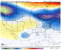
From the 00z runs last night, here is the percentage of members with a winter storm (snow or ice) in the blue area on the map (2nd image).
I changed it to express the numbers as a percentage since each ensemble has a different number of members (10 of 30 hits on GEFS is 33% hit rate / 10 of 50 hits on EPS is 20% hit rate). It doesn't effect the % for the total (black line) because it just so happens that we have 100 total ensemble members


Reminders:
1. I didn't count upslope snow in the mountains
2. I didn't count rain storms that ended as some snow
3. I didn't count weak storms with skiffs of snow
4. I didn't count the operational or control runs in the total
5. If a storm spanned multiple days or time periods, I only counted it once
NBAcentel
Member
Here you go.... What was the Black line yesterday when you 1st introduced this to us? Did it increase or decrease for the dates 12/20-12/25. Thats a great metric to observe. Thank you for sharing

NBAcentel
Member
NBAcentel
Member
WXinCanton
Member
Honestly would not take much at allMan if we could tweak this just a little…View attachment 126049
? Red in GreenlandLike the trend out in the pacific (stronger Aleutian low) should see a kick east shortly View attachment 126048
CMC about to give it a go
Cad Wedge NC
Member
If it ain't broke don't fix it..... this can work.Man if we could tweak this just a little…View attachment 126049

Here comes the arctic. Delayed but not denied
CMC about to give it a go

Big high pressure sliding down the Rockies. This is the tablesetter if you’re holding out hope for a Christmas storm. I don’t know how much more any of us can ask for. This gives everyone in America a fighting chance at a white Christmas.
Hypsometric
Member
I hope Texas is ready this time (they won’t be)1066 mb high.
NBAcentel
Member
- Joined
- Jan 23, 2021
- Messages
- 4,601
- Reaction score
- 15,196
- Location
- Lebanon Township, Durham County NC
Heading to Tejas on 12/24 and that was a conversation the wife and I had last night. oh boy. Looks like I miss experiencing a bucketlist wx phenomenon right now by two days(a blue norther).I hope Texas is ready this time (they won’t be)
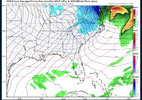
Another nuke of a wave diving in and going negative on the GFS. What a bomb. Someone somewhere is going to get absolutely crushed around Christmas. This has been a constant feature the last several runs
NBAcentel
Member
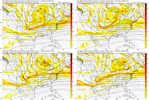
If we go to far west/interact we actually win because the cutoff block on top happens faster and we speed up flow under the cutoff ridge faster, which pushes the TPV out faster
Just can't seem to get this into the southeast though. The overall trend is obvious but still wrestling with how far into the southeast this can penetrate into meaningful cold for true winter weather. That seems to be the wobble from my untrained eye
NBAcentel
Member
WEATHERBOYROY
Member
Just curious, does anyone have access to the upper level archives to Christmas eve 1983? I wonder how this would compare....83" was supposed to be the coldest Christmas on record for the continental US.
- Joined
- Jan 23, 2021
- Messages
- 4,601
- Reaction score
- 15,196
- Location
- Lebanon Township, Durham County NC
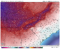
A fourth straight pixie dust event?High liquid equivalent ratio snow here View attachment 126055
ForsythSnow
Moderator
- Joined
- Jan 23, 2021
- Messages
- 4,601
- Reaction score
- 15,196
- Location
- Lebanon Township, Durham County NC
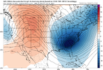
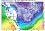
Mustve heard about southern hospitality.The GFS just drops the entire PV on the SE for ChristmasView attachment 126056View attachment 126057
Meanwhile, something possibly cooking on GEFS with the first event.
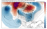
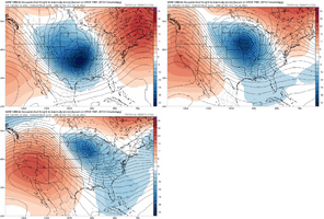
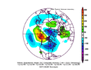
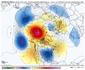
Here was the pattern surrounding Christmas '83 when compared to the LR EPS. Some noticeable similarities between the strong -NAO and +PNA. However, this pattern has a -NAO, but less of a SE Canada Vortex.Just curious, does anyone have access to the upper level archives to Christmas eve 1983? I wonder how this would compare....83" was supposed to be the coldest Christmas on record for the continental US.
iGRXY
Member
Need the trough to pull back west some and that would've been the Christmas of all Christmas gifts. Artic air flying in behind it over a snow airmass? it would be there for a week and we would likely get single digit and subzero temps for lows.
NBAcentel
Member
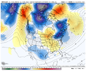
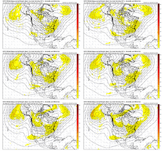
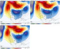
If we were going in a bad direction, you would think the ensemble mean would be either going in a worse direction or holding the line....but it's improving here on Dec 20th. I especially like the slight improvement with the -NAO placement. This is the GEFS Mean, last 5 runs


NBAcentel
Member
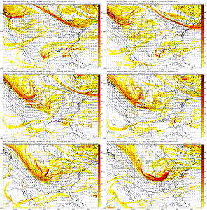
Notice the faster the cutoff ridge occurs on the trend/faster it disconnects from the higher heights in the GOA, the quicker the TPV moves out. That’s key since the cutoff ridge has flow sped up underneath, then the pac trough does it’s job pumping heights out westIf we were going in a bad direction, you would think the ensemble mean would be either going in a worse direction or holding the line....but it's improving here on Dec 20th. I especially like the slight improvement with the -NAO placement. This is the GEFS Mean, last 5 runs

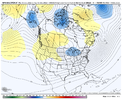
We really don't want to see a big Arctic plunge into Texas and eventually Florida. It would be better to see it come down boldly, but slide more west to east up under the Greenland block....that's moreso what that GEFS 500mb pattern is showing (and temp anomalies here)


- Joined
- Jan 23, 2021
- Messages
- 4,601
- Reaction score
- 15,196
- Location
- Lebanon Township, Durham County NC
Just my untrained, uneducated opinion:
Lean on the ensembles heavily in such a volatile period. They've been successively colder every run today.
Lean on the ensembles heavily in such a volatile period. They've been successively colder every run today.
LukeBarrette
im north of 90% of people on here so yeah
Meteorology Student
Member
2024 Supporter
2017-2023 Supporter
It’s just hard to believe that two systems in a row get sheared out on GFS and CMC

