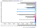
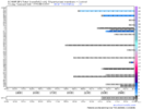
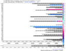
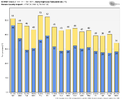
EPS snowfall for Columbia SC?
-
Hello, please take a minute to check out our awesome content, contributed by the wonderful members of our community. We hope you'll add your own thoughts and opinions by making a free account!
You are using an out of date browser. It may not display this or other websites correctly.
You should upgrade or use an alternative browser.
You should upgrade or use an alternative browser.
Pattern Dazzling December
- Thread starter Rain Cold
- Start date
Hypsometric
Member
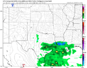
I’ll play along. Can you do Anderson SC?Yeah that’s the best snow run from the EPS so far, very active ! View attachment 125618
- Joined
- Jan 23, 2021
- Messages
- 4,601
- Reaction score
- 15,196
- Location
- Lebanon Township, Durham County NC
RAH vague at this point, which is understandable:
"Friday onward: Model solutions begin to diverge Fri and Sat. The
upper low will continue its slow east-northeastward migration over
the upper Great Lakes Fri and Sat, where it will either sit through
the weekend, or it will lift northward and get absorbed into a
southward sinking low over central Canada. Forecast uncertainty
increases through the weekend, thus confidence is low. Will keep the
weather largely dry through the weekend, however the 12Z GFS does
show some precipitation over the region Sun. Temperatures should
gradually decrease from near average to below average Fri to Sun."
NBAcentel
Member
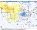
That's such a subtle difference in the grand scheme, it makes my stomach hurtIcon looks much much better View attachment 125627
Last edited:
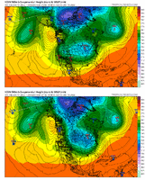
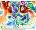
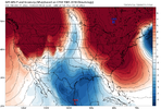
I feel we are starting to play with the theoretical limits on how good a pattern can be on some of these runs.Look at that cutoff block. Holy ---- that’s ------- incredible ----, the Arctic heigh field is on fire ! View attachment 125600View attachment 125599
This is that dreaded reference to the 'lakes low' we don't want to see folks.RAH vague at this point, which is understandable:
"Friday onward: Model solutions begin to diverge Fri and Sat. The
upper low will continue its slow east-northeastward migration over
the upper Great Lakes Fri and Sat, where it will either sit through
the weekend, or it will lift northward and get absorbed into a
southward sinking low over central Canada. Forecast uncertainty
increases through the weekend, thus confidence is low. Will keep the
weather largely dry through the weekend, however the 12Z GFS does
show some precipitation over the region Sun. Temperatures should
gradually decrease from near average to below average Fri to Sun."
Ron Burgundy
Member
FFC has gone from “not buying the pattern change” in this morning’s AFD to “kinda sorta maybe buying the pattern change a little” in the afternoon AFD. That’s about all you’ll ever get from them at this range (which I get):
Finally, we`ll be keeping an eye on next weekend where the latest
run of the GFS is now resolving a rain/snow system surging
through the Southeast. It is still very early in the forecast for
resolving wintry details and it still remains an outlier when
compared to other models which have the system pushing through a
couple days later, and further south, resolving all rain. However,
this system could be the first shot for some wintry precip for
the forecast area since last winter but chances for now are low.
Thiem
Yeah, but look at that door openThat's such a subtle difference in the hras scheme, it makes my stomach hurt
I thought there were exceptions to that rule, whereas that low could be cut off and help funnel cold air southeastward.This is that dreaded reference to the 'lakes low' we don't want to see folks.
I'll leave it to the experts but thinking only if it reacts like the ICON 18z depicts. Typically a parked LP over the GL is not good for us.I thought there were exceptions to that rule, whereas that low could be cut off and help funnel cold air southeastward.
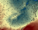
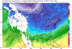
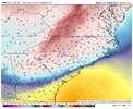
It also gives you an idea of how good the CAD could be when we end up with better snowpack in the northeast18z NAM temps for mid-afternoon on Wednesday. Again, no wintery precip but this is still winter weather folks.
View attachment 125628
NBAcentel
Member
Maybe not for y’all, but it’s great for us in the Deep South.I'll leave it to the experts but thinking only if it reacts like the ICON 18z depicts. Typically a parked LP over the GL is not good for us.
I remember a couple years back, this came up and Webb came in with some info that the Lakes low hasn’t really made a considerable difference in past set upsI'll leave it to the experts but thinking only if it reacts like the ICON 18z depicts. Typically a parked LP over the GL is not good for us.
Not even close! This is an actual system from the plains, the GLL is a different entity! Good try tho!This is that dreaded reference to the 'lakes low' we don't want to see folks.
NBAcentel
Member
it’s more of a deep vortex over the Great Lakes, it’s a good thing in this instance since it’s broad and suppressing the height field keeping storm tracks south, only problem is cold can be a issue with it sometimes but it’s a setup that can produce
Storm looks suppressed this time. On GFS
Snowlove33
Member
@ArccSo are you saying us folks south of I-20 in the Deep South has a shot?Maybe not for y’all, but it’s great for us in the Deep South.
NBAcentel
Member
D
Deleted member 609
Guest
mydoortotheworld
Member
Obligatory “suppression at this stage of the game is good”?
I would think so. Especially being 7-8 days out.Obligatory “suppression at this stage of the game is good”?
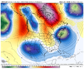
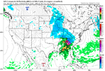
Yeah this is good to see. There is a mixture out there right now with how the models and model ensembles are handling that. UKMet here drops the low out west (no good)More western driving this GFS run so far View attachment 125629

NoSnowATL
Member
YesObligatory “suppression at this stage of the game is good”?
Absolutely. It will like always will depend on timing and wave location, but the chance is definitely there.@ArccSo are you saying us folks south of I-20 in the Deep South has a shot?
Sounds right. Origin makes sense as typically we've just seen them parked up there and not moving...guess coming from Canada originally and not from points west and southwestNot even close! This is an actual system from the plains, the GLL is a different entity! Good try tho!
dsaur
Member
I love this kind of set up in winter because it gives everyone a good chance at decent precip. Pretty much straight west to east with a heavy band sandwiched in between light precip areas, and sagging south. Everyone gets the train as it sags. Hate a winter storm were the front is severely leaning from the far sw to the ne, and if it's slow moving, it's agony. Huntsville gets creamed, then Atl and kids are already sledding, and I'm waiting on precip to start...still. And finally when it's about all over and Atl has it's 6 inches, and the kids are tired of sledding, and the energy has shifted to the atlantic, a straggler band of rear guard energy comes bustling thru on howling winds and drops a quick inch in it's hurry. Energy like this today... sagging, slowly... giving all a chance is what I always want in winter with cold air in place.
Regardless of how this run turns out, this is a really good look on the GFS with ridging in SW Canada, troughing in SE Canada, and ridging over Greenland.....with high pressure streaming into N Dakota > Iowa at the sfc


Last edited:
NBAcentel
Member
GFS incoming. 1040mb high above the lakes with CAD


NBAcentel
Member
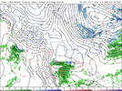
The power of blocking50/50 low hanging on. Nowhere for that high pressure to goView attachment 125639
NBAcentel
Member

