-
Hello, please take a minute to check out our awesome content, contributed by the wonderful members of our community. We hope you'll add your own thoughts and opinions by making a free account!
You are using an out of date browser. It may not display this or other websites correctly.
You should upgrade or use an alternative browser.
You should upgrade or use an alternative browser.
Pattern Dazzling December
- Thread starter Rain Cold
- Start date
NBAcentel
Member
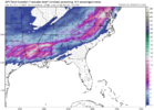
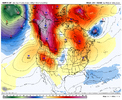
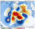
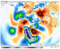
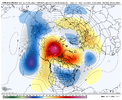
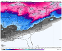
This is getting hard to ignore now. I imagine a lot of Mets will begin to discuss this potential over the next 1-3 days. Incredible pattern coming up right before Christmas
NBAcentel
Member
accu35
Member
NBAcentel
Member
That first little storm on the GFS run came from a wave pinwheeling down from the northern stream…but yeah, the thought occurred to me that we have no idea where these storms are going to come from out at range, but if we can get this pattern to set in, it’s going to become harder to miss outWe know it’s too far out but it’s good to show opportunities as we know this pattern should give them.
Very well put. The occasions of the southeast getting a decent storm without snowpack in place across the north are few and far between. The only times that come to mind are the Christmas Ice Storm in 1998 and 1/2-3/2002That’s not how this works and it never has lol. Better just suck it up and realize what it takes to get any type of winter weather in the south let alone snow. And plus it’s 12/11. Meteorological winter literally just started lol
Really hope the 12z Euro and EPS will show some support from what we just saw from the GFS in regards to next weekend. That’s a nice look for us to the west. All of this mild weather we’ve had will be 100% worth it if this pattern we are starting to see will unfold. Some very exciting times ahead and some late nights coming. No better time of year for it than the week before and of Christmas. Really hope we can get that board wide snow storm that we’ve all been waiting for what seems forever.
NBAcentel
Member
The gefs is pretty mid with the GFS storm barely any support
Theoretically this could end up being our legit table setter for the energy that comes after this storm. Very marginal cold air to work with here but this type of storm would surely bring the cold air south enough to where we want it for whatever happens 20-25th .. exciting model watching times ahead. Expect some fun runs over the next several days.
NBAcentel
Member
One note of caution for those of us east of the Appellations, this pattern as modeled favors areas to the west where the best cold looks to set up. Texas to Alabama looks like the place to be for the next couple of weeks.
NBAcentel
Member
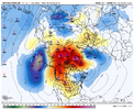
Of note, the mean trough axis has shifted east on the GEFS. Nice!


Not necessarily. I agree that the biggest temperature anamolies will be west of the Apps, but this is an overall pattern that does promote better opportunities of strong CAD east of the Apps. Also we’re going into an MJO phase that supports a more muted SER.One note of caution for those of us east of the Appellations, this pattern as modeled favors areas to the west where the best cold looks to set up. Texas to Alabama looks like the place to be for the next couple of weeks.
Edit: I should have said that yes those Texas to Alabama are in very good as they have more ways to score, the overall pattern is such that could support a long tracking board wide storm
Let me also come in and remind everyone … it’s still hard to get a good winter storm in the south! Keep expectations at a fair standard at this range. We have failed many great patterns before. But look at us! It’s mid December and we’re tracking an amazing pattern for Christmas week! That almost never happens and usually we’re all complaining about how warm it is for this time of year. Let’s appreciate what we can get and know that we still have January and February to score as well IF things don’t go the way we hope.
NBAcentel
Member
NBAcentel
Member
I’d still be a little nervous on the progression, I eventually think we’ll get a favorable ridge out west due to the pacific trough sliding east, but I’d watch for energy spoiling/pushing back our pacific pattern if it rounds the ridge to early behind our big cutoff next week and dumps in SW can/PNW. Something to keep a eye on, but I’m cautiously optimistic
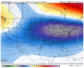
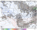
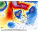
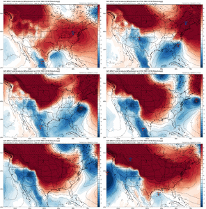
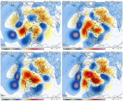
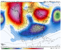
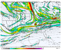
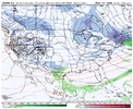
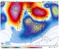
You don't make them much more classic than this for central NCSuch a weenie pattern on the 12z GEFS View attachment 125565View attachment 125566View attachment 125567
Met1985
Member
The GEFS is a thing of beauty! One of the best runs I've seen yet.
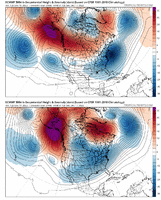
These 500mb anomalies are insane for a 240 hour ensemble mean. Can’t ask for a much better pattern for a winter storm. Just need a potent shortwave in the southern stream.
Sent from my iPhone using Tapatalk
Cad Wedge NC
Member
As long as we keep the strong -NAO, I am not too concerned about dumping the cold out west.I’d still be a little nervous on the progression, I eventually think we’ll get a favorable ridge out west due to the pacific trough sliding east, but I’d watch for energy spoiling/pushing back our pacific pattern if it rounds the ridge to early behind our big cutoff next week and dumps in SW can/PNW. Something to keep a eye on, but I’m cautiously optimistic
Cad Wedge NC
Member
I could not draw up a better pattern than that one. Now, let see if we can keep it there for a few weeks.The GEFS is a thing of beauty! One of the best runs I've seen yet.
NBAcentel
Member
NBAcentel
Member
Storm5
Member
???
Hypsometric
Member
NBAcentel
Member
NBAcentel
Member
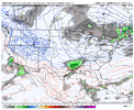
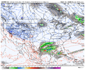
I really doubt that system has the potential of doing anything interesting beyond some flurries in AL/MS/LA/TX. The energy coming out from Canada is going to favor a sheared-out system.
NBAcentel
Member
While this may be true, it’s pretty early to be saying that in absolute, it’s a system that’s reliant on tilt and how low the height field is out ahead, and WAA. can’t disregard itI really doubt that system has the potential of doing anything interesting beyond some flurries in AL/MS/LA/TX. The energy coming out from Canada is going to favor a sheared-out system.
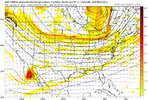
What's that 805 Mb LP doing out in hurricane land?


Cad Wedge NC
Member
I wouldn't turn my back on it.... it may surprise you.I really doubt that system has the potential of doing anything interesting beyond some flurries in AL/MS/LA/TX. The energy coming out from Canada is going to favor a sheared-out system.

