Webberweather53
Meteorologist
And the thing is, it going to trend colder as we get close to this time frame. Atlanta might be in play...definitely NE Atlanta and Northeastward I- 85 special.

With the Temps it likely is overdone so I'd knock those totals down to no more than 20% of what's shown and that could even be too generous.Yikes. Lights out.
Sent from my iPhone using Tapatalk
Yikes. Lights out.
Sent from my iPhone using Tapatalk
Pray to hold onto sleet as long as possible.Yikes. Lights out.
Sent from my iPhone using Tapatalk
I got my eye on this one. Could get interesting...


Pretty rare for such a strong CAD signal to show up this prominent 150 hours. Especially on an ensembleReally really bullish gefs run. Wow, lots of members below freezing across CAD regions in Nc/upstate of SC View attachment 125224View attachment 125225
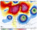
The GFS and the CMC both wreck the -NAO after the table setter which is ugly. What I would expect to see is closer to the ICON here with the blocked flow maintaining itself with these slow bowling balls trekking east underneath, but who knows. Model chaos, and it will continueThat’s hard to ignore, GEFS/GFS trending to phasing TPV/energy the right way to allow a bomb off the eastern US which means more CAA on the backside of it View attachment 125219

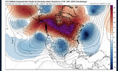
Sometimes a -EPO puts strain on a -NAO because Arctic energy is trying to plow through the blocking to dive down, but yeah not the best OP runs tonight honestlyThe GFS and the CMC both wreck the -NAO after the table setter which is ugly. What I would expect to see is closer to the ICON here with the blocked flow maintaining itself with these slow bowling balls trekking east underneath, but who knows. Model chaos, and it will continue
View attachment 125226
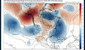
No kidding went from A to F real quick .. have to believe that’s a little fluky but we watch.The GFS and the CMC both wreck the -NAO after the table setter which is ugly. What I would expect to see is closer to the ICON here with the blocked flow maintaining itself with these slow bowling balls trekking east underneath, but who knows. Model chaos, and it will continue
View attachment 125226


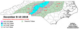
Early Jan 2018 is the one that stands out to me. There were some places like Greenville, NC that recorded it's coldest 12 day stretch or so of any winter period ever, dating back to the late 1800's. People were skating on ponds and creeks. Hard to imagine we will ever see those kinds of things again, but who knows. I made sure to take pictures / videos during that stretch of stuff frozen everywhere


Canadian showed this several days ago. Was hinting atJust was a matter of time before something showed on the surface.


The GFS went from a low of 19 in ATL on the 18th to now a low of 56, WTF?The 00z EC was about to drop the arctic hammer on the US days 9/10
Sent from my SM-A136U1 using Tapatalk
1) it’s the GFSThe GFS went from a low of 19 in ATL on the 18th to now a low of 56, WTF?

