• Hello, please take a minute to check out our awesome content, contributed by the wonderful members of our community. We hope you'll add your own thoughts and opinions by making a free account!

Pattern Dazzling December

If we only had a big lake to our NW for that cold wind to blow across lol. Waiting on a Mega Frost last night to melt off so we can build a handicap ramp for someone today. Hopefully my man FRO and Grit are posting today and find me some snow over the hollidays. Fro You still high on a storm # 2 chance right after Christmas. I know Webb is. Appreciate yalls high quality post on here.

Edit. Thought I was in banter, oops

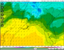
There could certainly be some snow showers over some of the local lakes around here & perhaps even the sounds over eastern NC, given enough of a fetch. You typically want 850mb temps of at least -8 to -10C over unfrozen lakes in order to create enough absolute instability in the low levels to have any shot at this. Definitely the kind of cold shot where I think a few places could see it. Downstream of Lake Kerr & Lake Gaston in the northern Piedmont & coastal plain of NC (including @metwannabe) maybe even the Pamlico + Albemarle sounds out east
 
There could certainly be some snow showers over some of the local lakes around here & perhaps even the sounds over eastern NC, given enough of a fetch. You typically want 850mb temps of at least -8 to -10C over unfrozen lakes in order to create enough absolute instability in the low levels to have any shot at this. Definitely the kind of cold shot where I think a few places could see it. Downstream of Lake Kerr & Lake Gaston in the northern Piedmont & coastal plain of NC (including @metwannabe) maybe even the Pamlico + Albemarle sounds out east
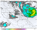
What's your opinion on the post I made about the possibility of snow showers breaking containment? That along with possible snow squalls in the MA/NE.

I have a good feeling about it but you're way more educated so I wanna know what you think.
 
There could certainly be some snow showers over some of the local lakes around here & perhaps even the sounds over eastern NC, given enough of a fetch. You typically want 850mb temps of at least -8 to -10C over unfrozen lakes in order to create enough absolute instability in the low levels to have any shot at this. Definitely the kind of cold shot where I think a few places could see it. Downstream of Lake Kerr & Lake Gaston in the northern Piedmont & coastal plain of NC (including @metwannabe) maybe even the Pamlico + Albemarle sounds out east
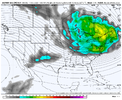
One thing I’ve wondered is if some of the obx might be able to squeeze out a trace or couple tenths of snow from sound effect if we get sufficiently cold + strong enough winds.
 
What's your opinion on the post I made about the possibility of snow showers breaking containment? That along with possible snow squalls in the MA/NE.

I have a good feeling about it but you're way more educated so I wanna know what you think.

This may be more of a case where remnant moisture via leftover remnants of snow showers from the Great Lakes combine with local moisture over warm lakes & is just enough to squeeze out some flurries in some locales.
 
There could certainly be some snow showers over some of the local lakes around here & perhaps even the sounds over eastern NC, given enough of a fetch. You typically want 850mb temps of at least -8 to -10C over unfrozen lakes in order to create enough absolute instability in the low levels to have any shot at this. Definitely the kind of cold shot where I think a few places could see it. Downstream of Lake Kerr & Lake Gaston in the northern Piedmont & coastal plain of NC (including @metwannabe) maybe even the Pamlico + Albemarle sounds out east
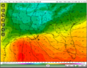
gfs_T850_eus_28.png
 
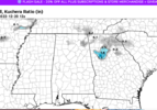
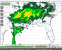
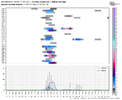
It’s a shame we aren’t getting a little more moisture with this Tuesday morning system. Everything is prime for a solid front end thump if the precip shield makes it here Monday night and drops a few tenths of liquid. (For NE Ga, upstate SC, SW NC). I haven’t given up yet. 06z NAM looked super juicy but fizzled fast. Still drops a coating of snow in north Georgia though.Screen Shot 2022-12-17 at 9.22.37 AM.png
 
Last edited:
Yep I read that. I just don't see it being strongly modeled at this time over the next two weeks.
My hope is it’s a relaxation and not a breakdown. It just feels like we’re in the opposite situation as last year where we might be struggling for part of our prime climo.
 
My hope is it’s a relaxation and not a breakdown. It just feels like we’re in the opposite situation as last year where we might be struggling for part of our prime climo.
Maybe. It's hard to know how things will shake out. But it's encouraging that we are off to a better than usual start and that the strat is not wound up super tight. That makes me think we may not stay locked into a warm pattern for long.
 
Back
Top