Brent
Member
Literally what you have been whining about for days….that just made a map of everything you’ve been saying.


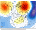
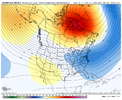
more likely be right...What a premature thing to do by accuweather.
Sent from my iPhone using Tapatalk
what pattern change ? LolThe SER firmly entrenched for the duration of the 06z gfs. This “models don’t know how to handle pattern changes” is harder to believe with each run.
Sent from my iPhone using Tapatalk
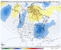
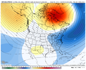
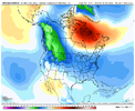
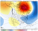
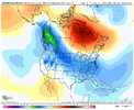

No, considering my lowest low in the next 15 days is 41, I don't think so.ah yes one bad run and the usual suspects are back.
Do you think this is just going to keep getting pushed out? Or is it a matter of not if but when?Although we've seen some changes for the worse on the models in the shorter-term (as I explained earlier yesterday), the overall evolution looks better as we get to the middle of December. Namely, the location of the blocking ridge to our north is a little more favorable for producing a coastal storm for the Carolinas, w/ the center of the +z500a being closer to the north shore of Labrador vs Baffin Island, as it was in earlier model forecasts.
View attachment 124658
View attachment 124659
View attachment 124660
That’s a typical Niña lookJust woke up and skipped last nights runs, they weren’t that bad honestly, in fact seemingly sped up a little on modeling, change trickling back to around day 7-8, we’ve certain delayed the pattern, but even with the +PNA event last winter, it was seemingly rushed on NWP on to be pushed back, just common NWP issues, sucks that we’re not gonna get a major chunk of the TPV under the block initially but models are dialing in on cold seeping in from the Alaskan ridge. Not great runs, but not bad runs from the 00z EPS and 06z GEFS.View attachment 124661View attachment 124662View attachment 124663View attachment 124664View attachment 124665
That is an ugly, ugly, animation! But that storm track tho??Siberia already had the good chunk of the cold air. I was ok with my small chunk. But no, they wanted it all, and they got it all.View attachment 124670
I made a comment about this a few days ago when it looked like all of the cold air was going back upstream instead of downstream under the block. I thought it was just bad model physics. Another nail in the coffin for Bastardi’s bathtub sloshing theory.Siberia already had the good chunk of the cold air. I was ok with my small chunk. But no, they wanted it all, and they got it all.View attachment 124670
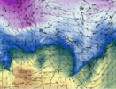
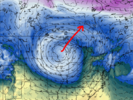
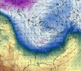
I remember that the Hudson Bay low use to be a term you would hear all the time on the Weather Channel back in the 90s, but I honestly haven’t heard in there in years. It does a couple things… first a stronger low can help steer disturbances and pieces of energy around well to the south of it…the deeper the low, the further south it pushes the track. Also it can act as a cold air source as well. It being in place prevents Canada from getting flooded with mild Pacific air and allows for more in the way of homegrown cold air masses… this can be certainly be helpful the deeper we go into the month and closer to peak climo as you don’t necessarily need an airmass of Siberian origin to get winter storms in the south.. especially when there is strong blockingLooking out to day 10, the latest GFS has lost the (great Lakes - transitioning to Hudson Bay) low. That helps establish the better pattern to pull cold air eastward. Side note: we don't tend to talk anymore about the Hudson Bay low effects on weather. I think it's because it gets set because of a -NAO. But nevertheless, seeing it is a good thing.
6z GFS at day 10:
View attachment 124671
0z GFS:
View attachment 124672
0z Euro:
View attachment 124673
Interested to see if it pops back up at 12z on the GFS and continues on the euro.
AO is negative. NAO is now negative.


And you’re leaving out the most important thing for winter storms. The PNA is not positive.
Sent from my iPhone using Tapatalk
Until we get more of a -epo and less of a -pna, we are chasing unicorns. Patience is required
I actually did a little bit deeper look into this on the ncsu.edu climate page, and for North Carolina at least, the -NAO is the most important teleconnection for winter storms. Months with an observed -NAO have a 25% increase in snow days. Now we’re obviously up against it if the PNA is much higher lower than -1 which is why we’re not going to get much help the next week. Something else interesting I found with regard to the PNA is that a +PNA has more of a positive impact on winter weather chances in El Niño years… this makes sense because often times periods of +PNA in a La Niña often lead to very suppressed storm tracks, fast flow, and very little moisture to work with.And you’re leaving out the most important thing for winter storms. The PNA is not positive.
Sent from my iPhone using Tapatalk
It takes time sure. But changes started the 1st week in Dec and we were rolling by the 2nd week of December in 2010. So our top analog year for this -NAO clearly isn't going to follow the same progression. Maybe it finally gets there who knows
FYI - I believe they defined a snow day as any day where any monitor outside of the mountains in NC recorded 1” or more of snow. FWIW.I actually did a little bit deeper look into this on the ncsu.edu climate page, and for North Carolina at least, the -NAO is the most important teleconnection for winter storms. Months with an observed -NAO have a 25% increase in snow days. Now we’re obviously up against it if the PNA is much higher lower than -1 which is why we’re not going to get much help the next week. Something else interesting I found with regard to the PNA is that a +PNA has more of a positive impact on winter weather chances in El Niño years… this makes sense because often times periods of +PNA in a La Niña often lead to very suppressed storm tracks, fast flow, and very little moisture to work with.
It takes time sure. But changes started the 1st week in Dec and we were rolling by the 2nd week of December in 2010. So our top analog year for this -NAO clearly isn't going to follow the same progression. Maybe it finally gets there who knows
It takes time sure. But changes started the 1st week in Dec and we were rolling by the 2nd week of December in 2010. So our top analog year for this -NAO clearly isn't going to follow the same progression. Maybe it finally gets there who knows
Looking back, the initial block in 2010 moved into Greenland around Nov 20th. This time, it's Dec 5.....so, 15 days later. Of course, no 2 years are alikeSomething to keep in mind though is that we are looking at timing differences compared to 2010… back then the processes had started about two weeks earlier and if you remember, there was some very mild weather leading into Thanksgiving that year with some severe weather across the Deep South
Good point. Maybe we'll get there and be cold by the 20th and be solidly in a winter storm pattern by months end into the 1st half of January when climo is peakingSomething to keep in mind though is that we are looking at timing differences compared to 2010… back then the processes had started about two weeks earlier and if you remember, there was some very mild weather leading into Thanksgiving that year with some severe weather across the Deep South
Well dang, did yall see the new GFS run
Well dang, did yall see the new GFS run
