-
Hello, please take a minute to check out our awesome content, contributed by the wonderful members of our community. We hope you'll add your own thoughts and opinions by making a free account!
You are using an out of date browser. It may not display this or other websites correctly.
You should upgrade or use an alternative browser.
You should upgrade or use an alternative browser.
Pattern Dazzling December
- Thread starter Rain Cold
- Start date
This is like getting front row tickets to a concert but not knowing who the band is yet. I never dismiss day 7 runs because even though there's wild swings one will be close to how it plays out.Yeah, it does seem the five-day disappearing act is real. It's almost like a day 7 model run is better than day 5.
SnowNiner
Member
I'd love to be wrong but I'd lean Euro/Ukie with 1st system, probably inland too warm for most except higher elevation. I'm concerned the impressive cold press after will suppress 2nd system but NW shifts, historically, are more doable then SE one's. We shall see
Agreed. I think the overnight GFS runs have showed their hand and went more toward the EURO with less separation from the PV less digging of the vort. That first storm is done in my mind, and really lowers the GFS/GEFS credibility for that timeframe. I'm taking anything with the GFS with a huge grain of salt.
10 days out for the rest, who knows. It would be SE style to miss the second one with suppression. We did that alot last year.
NCHighCountryWX
Member
- Joined
- Dec 28, 2016
- Messages
- 476
- Reaction score
- 1,323
All you need to know from GSP to operate your business
Accurate. Precise Efficient Reliable for decision makers
LONG TERM /WEDNESDAY THROUGH THURSDAY/
AS OF 300AM FRIDAY: THE LONG TERM STARTS OFF WEDNESDAY MORNING WITH
BROAD WESTERLY FLOW ALOFT ACROSS THE REGION AS A WEAK SHORTWAVE
TROUGH SHIFTS OFF THE CAROLINA COAST. FARTHER UPSTREAM, A PACIFIC
JET IS FORECAST TO INTENSIFY ACROSS BRITISH COLUMBIA INTO THE
NORTHERN ROCKIES, EVENTUALLY CARVING OUT A SHARP TROUGH AS IT DIGS
INTO THE GREAT PLAINS. IN ITS WAKE, GUIDANCE IS IN STRONG AGREEMENT
ON A STOUT 1050MB SURFACE HIGH AND ASSOCIATED CONTINENTAL ARCTIC
AIRMASS SPILLING INTO MUCH OF THE LOWER 48. THE 00Z SUITE OF GLOBAL
MODELS AND THEIR RESPECTIVE ENSEMBLES BEGIN TO DIVERGE THEREAFTER
WITH REGARDS TO THE EVOLUTION OF THE PREVIOUSLY MENTIONED TROUGH AND
RESULTING SENSIBLE WEATHER. THE DETERMINISTIC GFS REMAINS THE MOST
AGGRESSIVE DIGGING THE TROUGH ACROSS THE DEEP SOUTH AND INITIATING
STRONG SURFACE CYCLOGENESIS OFF THE CAROLINA COAST WITH BOUNTIFUL
MOISTURE AND PLENTY OF COLD AIR. THE ECMWF AND CMC, ON THE OTHER
HAND, KEEP THE TROUGH FARTHER NORTH WITH WARMER TEMPERATURES AND
LESS ABUNDANT MOISTURE AS COASTAL CYCLOGENESIS IS WEAKER RESULTING
IN WEAKER ONSHORE FLOW UNTIL THE LOW DEEPENS FARTHER NORTHEAST.
GIVEN THE WIDE RANGE OF SOLUTIONS DEPICTED IN THE GUIDANCE, HAVE
LEFT THE FORECAST IN LINE WITH THE NATIONAL MODEL BLEND AND LIMITED
PRECIPITATION TYPE TO JUST RAIN/SNOW. THE READER IS ENCOURAGED NOT
TO FOCUS ON ANY ONE INDIVIDUAL MODEL RUN AND TO STAY TUNED TO THE
FORECAST OVER THE NEXT WEEK. REGARDLESS OF WINTRY WEATHER POTENTIAL,
TEMPERATURES WILL BE QUITE COLD AND UPWARDS OF 20 DEGREES BELOW
NORMAL.
If the first one does not workout, don't worry, the Euro is really close to an east coast crawler after Christmas, won't take much with cold in place for that to go bonkers.
rburrel2
Member
Honestly, the best indicator for an 8-10 day wintry threat you can have is when longe range ensemble means are showing 2+ inches of snow. IMO, that usually correlates very well with eventually getting a winter storm, or at least tracking a legitimate threat in the short/medium range. It's a much better signal than any one model run showing a blizzard in that range.
That being said, the ensemble means are fairly paltry for the 12/22-23 system, but look very good for the 12/25-26 potential. That's where my money is going.
That being said, the ensemble means are fairly paltry for the 12/22-23 system, but look very good for the 12/25-26 potential. That's where my money is going.
Webberweather53
Meteorologist
This pattern has legit big dog potential around-just after Christmas.
The overall window in/around the Holidays-last week of Dec has certainly felt about right to me from a large-scale perspective & certainly fits in general with the prototypical La Nina winter evolution, as well as the analogs that have been discussed for a few weeks now (e.g. Dec 2010)
Big arctic cold front comes down in the days prior, firmly establishing a nice, deep-layer cold air mass & suppressing the baroclinic zone to the coastal SE & E Coast, where a trailing wave can take advantage + throw moisture back into the cold air. -NAO downstream slows the wave down & encourages it to cyclonically break/amplify underneath >> strengthening any would-be winter storm, while the +PNA helps suppress the storm track down into the southeastern US.
Today's 12z EPS & 12z GEFS means show a classic Miller A/coastal cyclone snowstorm look in the Carolinas, w/ the mean trough anchored in/around the TN Valley, west-based -NAO, & +PNA. Heck, we even have the ridge north of Alaska like the composite does.
Color me impressed.
Another intriguing climatological tendency I've noticed in reanalyzing storms like this, in the absence of a strong (often El Nino-induced subtropical jet) to increase available eddy potential energy (& strengthen + tuck in the low even closer to the coast >> allowing warm noses aloft to change snow to rain for those in Piedmont & Coastal Plain), these Nina Miller A storms tend to be historically kinder to folks around RDU & points east in the coastal plain & eastern piedmont of NC.
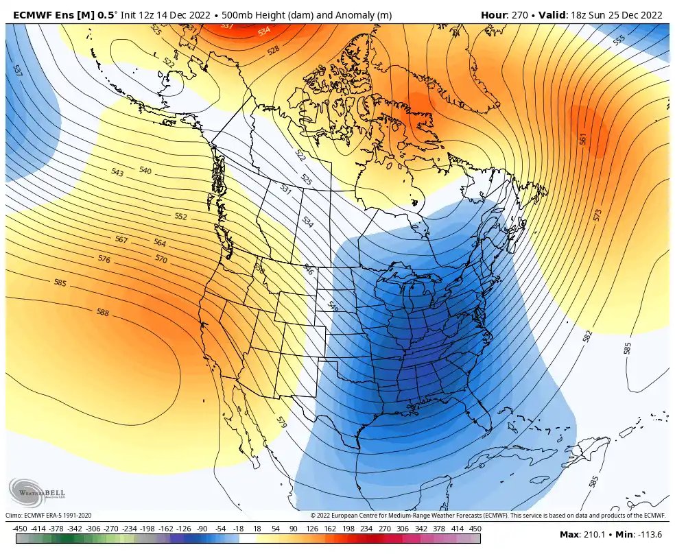
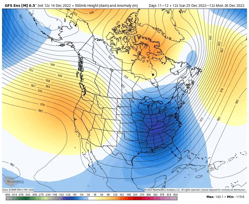
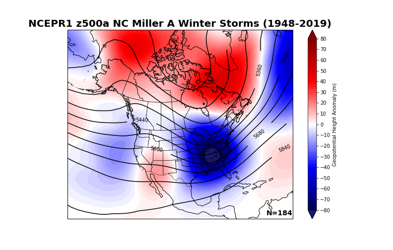
I know a lot of people are upset about losing the 12/22-23 storm, but imho it didn’t have a great chance to begin with, outside of maybe some backside snow flurries associated with the arctic front.
A lot (but not all) of those NWP runs over the last few-several days had the z500a mean centroid in the trough axis way too far north (over the OH valley and near the lower Great Lakes), without anything, besides the low level arctic front, to really suppress the storm track to the south. The 26th system has had the trough in roughly the right place (TN valley) for the se us, esp Carolinas to score, while also coming right on the heels of a big arctic cold front, not really having to worry as much about not being cold enough to generate wintry precip. It’s always better to generalize + analyze patterns from several runs of NWP ensembles than analyze snowfall maps or precip output from deterministic models more than 4-5 days out & this is another good reminder of that.
There’s of course an outside/small chance this 22nd-23rd storm actually happens, but I doubt it & wouldn’t have expected much to begin with because the pattern really wasn’t quite there yet.
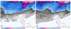
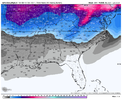
As Fro mentioned earlier, it's a good mean overall (up to 384) most of the change comes from after Christmas before New Year's. What looks like progress is my circled area. Seems like more solutions are favoring a miller a type of track with the mean increases in this area.
0z vs 6z
View attachment 126947
This is the 06z, i think you put the 18z on there. But yeh, definitely see your point.
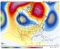
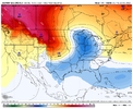
1st system really comes down to a function of amplitude of the ridge out west and depth/orientation of the trough. Even at Day 6 there are significant differences at H5 over the northern plains between the GFS, UK, EC and CMC, to the point I would question whether there is one group vs another, they all look pretty different. 1st system lacks what I would call a classic 50/50 which is a red flag, and I'm actually interested in this GoM low that pops around Day 4 to see if we can get a little bit of overrunning for some trivial mixed p-type in the northern portion of the SE, something not presently shown by guidance but maybe an indicator on trends for future systems in the period.
That low really just meanders off the SE coast, as opposed to kicking out and trying to get in some type of displaced 50/50 position. The GFS allows enough separation for a B type transfer through the Carolina's, whereas the Euro is a more classic OH Valley to Delmarva, and the CMC is similar but not as extreme as the EC with the Coastal transfer. Regardless of the evolution, still a potent signal for a cyclone around 40/70 at Day 7, which will then be in a solid spot as a 50/50 for round 2 a couple days later.
That low really just meanders off the SE coast, as opposed to kicking out and trying to get in some type of displaced 50/50 position. The GFS allows enough separation for a B type transfer through the Carolina's, whereas the Euro is a more classic OH Valley to Delmarva, and the CMC is similar but not as extreme as the EC with the Coastal transfer. Regardless of the evolution, still a potent signal for a cyclone around 40/70 at Day 7, which will then be in a solid spot as a 50/50 for round 2 a couple days later.
rburrel2
Member
We really need to be rooting for the 12/22-23 vortex to trend further north/weaker/quicker. Our biggest risk of losing the 12/25-26 threat is from suppression due to too much confluence.
I'm not worried about cold air with the 12/25-26 threat(famous last words). More worried about kicking out the first TPV in time.
I'm not worried about cold air with the 12/25-26 threat(famous last words). More worried about kicking out the first TPV in time.
iGRXY
Member
Go with climo and history. History says we have to sacrifice one storm for the 2nd 9/10x. That's likely going to be the solution here. That's not a bad thing however. We lay serious snow cover to our north, that 1st storm helps to act as our 50/50 confluence and helps set the stage for the trailing energy behind it. If you get snow from the first system, just consider it gravy at that point.
I’m waiting on a explanation other then “globals lose the storm only to bring it back”Some people just can’t hack it.
The lose it to come back - That applies most of the time with overrunning events when moisture is to our south, when storms are reliant on WAA, not a huge digging piece of energy that’s trending to being a cutter, we have a trend to a weaker vortex out ahead, it’s susceptible to becoming a front or runner. that’s just facts. Maybe this comes back, but I been saying for a while the first doesn’t look well the second does.
6z GEFS seemingly has minimal interest on the snow grids with the second event.
ForsythSnow
Moderator
A reminder, let's try to keep it calm and keep unrelated or one-liner posts in the whamby thread.
bouncycorn
Meteorologist
I think the whole “shows up, goes away, and comes back” phenomenon pertains to systems that show up, go suppressed, then Nw-trend their way back into play. Haven’t really seen it happen a lot with cutters.. though it can happen, especially in a La Niña year where models are more prone to a progressive bias.This is like getting front row tickets to a concert but not knowing who the band is yet. I never dismiss day 7 runs because even though there's wild swings one will be close to how it plays out.
whatalife
Moderator
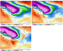
The GEFS is kinda following along as well. First system is done for us. imoJust took a peek at the EPS trend, it’s not pretty, let’s hope we reverse back at 12z, but dang it’s something if the UKMET takes a win, cold is gonna come but we’re losing cold out ahead due to vortex holding back/us not getting a vortex out ahead to get us cold prior to the system View attachment 126953
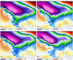
Last edited:
Looking at the models this morning, I’m really starting to see a January 2011 type look with what might be coming. If you remember, we saw a cutter type system that had the Arctic air spill in behind it… great NWFS event in the mountains with some flurries east into the Piedmont. Then we saw that great overrunning 2-3 days later.

