Need a house sitter while your gone? I mean only if it's still showing 2'i'll be staying true to my username and spending the 23rd-30thish in wilmington so it's 1989 or 2010 or bust for me, which makes me think yeah richmond is going to get slapped
-
Hello, please take a minute to check out our awesome content, contributed by the wonderful members of our community. We hope you'll add your own thoughts and opinions by making a free account!
You are using an out of date browser. It may not display this or other websites correctly.
You should upgrade or use an alternative browser.
You should upgrade or use an alternative browser.
Pattern Dazzling December
- Thread starter Rain Cold
- Start date
Likely right there. I still look for Christmas Eve to be the coldest day of all of them with snow or not on the ground. That looks like the maximum push of cold air.Only problem I have with this from the GFS is it's also based on a significant snow/ice pack which obviously affects those temps. Still gonna be cold but probably not that cold if there isn't said snow/ice on the ground
Tried to do my best yesterday conveying how climo more than likely doesn’t allow an immediate up the east coast widespread snowstorm. I hope things trend back as we get closer but that’s just not what climatology tells us happens this month. That then opens the door though to the potential behind this storm. I think once you see more GEFS members moving away from storm 1 you will see them pop on storm 2. How long will this take? Your guess is as good as mine but over the next couple days is a good bet.
Thor
Member
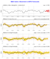
Quietly the below is playing a factor too. Although it shows a neutral average now, many of these solutions are highly positive or negative. Was hoping for better and I think the models are picking up on that a bit. Looking through the individual GEFS members you can really tell the difference on the backend.
Attachments
Yeah, that cold push is more or less a sea change right now and until the models fully get a handle on it (Which they are-Centering on the cutter idea it seems) the bouncy stuff will take some time to sort. Once that is more certain you will see a better look at the later weekend storm potential. It's there imho just not sure how much and where exactly.Tried to do my best yesterday conveying how climo more than likely doesn’t allow an immediate up the east coast widespread snowstorm. I hope things trend back as we get closer but that’s just not what climatology tells us happens this month. That then opens the door though to the potential behind this storm. I think once you see more GEFS members moving away from storm 1 you will see them pop on storm 2. How long will this take? Your guess is as good as mine but over the next couple days is a good bet.
NEGaweather
Member

Sent from my iPhone using Tapatalk
SnowwxAtl
Member
This probably suppose to be in the Whamby section, but I will add my two cents. That Jan. 2011 storm was actually a storm I enjoyed with Freezing rain. It started off as snow (I was at Walmart when the snow started) switch to sleet, by morning it was freezing rain. Later on that day, I think an ULL came through the area and we got additional snow. I saw this to say, while I enjoyed that freezing rain event, I do not like them. So, I will take 33 and rain and suck it up them having a freezing rain event. Sleet is my friend and wouldn't mind it if it doesn't snow.Lol, it would be 33, but if a big dogs spits out of this pattern it will be down to Perry probably. A storm like the gfs is showing will get a lot of us usually left out. In fact, the depictions look like a good hammering of sleet, like the old days, with snow too. It changes all over run to run, but the storm is still there, and the pattern is holding well...so it could happen. Be of good cheer at Xmas, lol. Just don't want a strong storm as the heat generator will for sure give us the cold rain. It's a dance at the edges when zr/ip/ and sn are looking to join up. I hate freezing rain, but love sleet, and I'm often on the dividing line between hell and heaven...but I've seen some really good ip/sn storms down here, but some bad zr storms too. When the woods are crashing down on you, 33 looks really good. Of course, 35 miles can make all the difference, so we need some constantly reinforced cold pushing deep.

Normally, I have one foot out the door when models are showing long range great arctic cold periods and 7 day snowstorms. It makes sense to be skeptical of those things, since like was pointed out earlier, the cold always seems to back off as we head closer and the storm track always seems to shift west and north. That's pretty typical to see, so it's understandable and reasonable to not get too excited about historic patterns showing up.
That said, we have a lot of anomalous blocking showing up, which, if real, makes depictions of anomalous patterns somewhat more believable. Now I'm not going to stand ten toes down in the sand on historic stretches of cold and blizzards. But given the support in the guidance and apparent configuration of teleconnections, an unusually cold and stormy pattern is more likely to be real than normal, IMO. When you couple that with the fact that we usually can't buy a fast start to winter, it's already been plenty cold, and Christmas is just around the corner, we have some exciting times ahead.
Even if it doesn't work out like we all hope, at least we're not waiting until late January to get the party started this year.
Webberweather53
Meteorologist
Here's the ZR accumulation map for yesterday's onset ice event in the northern mountains of NC. A very light glaze occurred mainly on elevated surfaces
December 15 2022 Ice Storm Map (NC)

December 15 2022 Ice Storm Map (NC)
Ayeee, not to bad !

Most of this will fall on the lighter side of the totals I put up, but here’s my thoughts View attachment 126194
Only good looking global for the first storm is the OP GFS blud ? there’s not much support outside of that, other then low means48 hours ago we had the Global Ensembles showing us the glory, with the Ops showing less than favorable outputs. Naysayers were buying the Ops. Now the script it flipped, and naysayers hugging the Ensembles….can’t make this stuff up. We are all still looking very good for the Christmas timeframe. Good Friday vibes!!
griteater
Member
Well well, such a lively debate in here for Sys 1 vs Sys 2. I see loads of potential with Sys 2, but it has to hit right with the northern stream dropping down. The comparison to Jan 2011 makes some sense with respect to the Arctic front clearing, then the storm moving in a couple days later. The difference is that was a cutoff low in the SW that slid west to east into the cold air over the Deep South, a setup that is less risky in terms of precip generation. At any rate, I think the cold plunge will be good behind the first storm. Sure, the next storm wave diving down could miss, but it could also wait a day too late and go bonkers and we warm ahead of it. I like the in-between idea though where we get a winter storm running into the cold high to the north and northwest. Could be more snow than ice OR more ice than snow
Here is the good high pressure setup with waviness in the NE Gulf to SE Coast on the GEFS and EPS


Here is the good high pressure setup with waviness in the NE Gulf to SE Coast on the GEFS and EPS
Last edited:
Icon following the euro/EPS/UK
Icon is a pretty massive fail
Much better +PNA ridge behind it though. This is great omens for storm 2Icon following the euro/EPS/UKView attachment 126978
Blue_Ridge_Escarpment
Member
Looks like the ICON may be close to some ice in the CAD areas on 12/22.
ICON still gets cold as ---- lol 
^^Yep, the CAD is better:
85andnorth
Member
LONG time lurker, hardly a poster here. Remember these models are going to be all over the place from run to run. We can't live and die with every run this far out. Let's get into next week before we throw the baby out with the bath water. We have a great pattern still and alot to be excited about. Let's get into Tues and see what trends are setting up before we jump off the ledge or scream from the mountain top.