griteater
Member
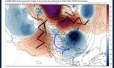
CMC Ens 5-day mean for Dec 22-27. Run 2 days ago vs. today's run


That looks really good. I might be wrong on this, but for SE snowstorms, I seem to remember an old post that Allan made one time that showed that it is ideal to have the negative anomaly center over TN. Regardless, the image above looks quite chilly!The looks coming up is almost a blockier version of jan-Feb 2014, but the cutoff subtropical strength ridge over the Arctic is what separates this one coming View attachment 126334View attachment 126335View attachment 126336View attachment 126337
Brutal. It's nice to see better placement and deeper cold as we work in. Still have to get down the home stretch, but we are usually trending in the opposite direction.CMC Ens 5-day mean for Dec 22-27. Run 2 days ago vs. today's run

The looks coming up is almost a blockier version of jan-Feb 2014, but the cutoff subtropical strength ridge over the Arctic is what separates this one coming View attachment 126334View attachment 126335View attachment 126336View attachment 126337


I wouldn’t be surprised if there would be a little sleet mixed in if precipitation were heavier12z euro has a little slug of precipitation with the Saturday system. 850’s at the time suggest it would be a close call on precip type if anything can fall View attachment 126341View attachment 126342


This looks like it will allow shortwave amplitude into the southeast via the gulf w/o just jutting up the coast?
Nothing like a good ole death star sitting right above you

