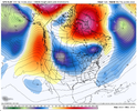
• Hello, please take a minute to check out our awesome content, contributed by the wonderful members of our community. We hope you'll add your own thoughts and opinions by making a free account!

Pattern Dazzling December

I meant to share this with everyone here yesterday, but couldn't find the time to put the finishing touches on it.

I gave the December 8-10 2018 snowfall map I made a few years ago a much needed facelift. Really cool to see the mesoscale banding features on here. The most obvious one goes from northern Durham Co & the northern shore of Falls Lake to Wake Forest, then Wilson & Greenville, basically along US HWY 264 east of Raleigh. You can also see another one from about Elkin (Surry Co.) to Yadkinville & Mocksville, just west of the Triad.

View attachment 125465

Remember this one, about 20” on the deck in a cabin near Blowing Rock.

71AD2E44-BD72-4FB3-A376-A18A9F8259A6.jpegE0827CC7-E18D-4BA5-BF6E-69AC3C40B34E.jpeg11DAD209-884A-45C6-9B56-AC3EA5CBDD2A.jpeg79523843-364F-407E-8CB9-964445779616.jpeg

Last image is 421, W King St, main strip through town.
 
Last edited:
re: 2018 storm. Wake county? Heck, how about Cary by itself. I was in the 4"accumation zone and could hop in my car for <10mins and see 8" of snow on the ground.
That’s very similar to the cut off not far from where I was living during the Crusher in 2000. 11” at my house in southern Cabarrus county… 10 minute up Hwy 601… less than 2
 
I meant to share this with everyone here yesterday, but couldn't find the time to put the finishing touches on it.

I gave the December 8-10 2018 snowfall map I made a few years ago a much needed facelift. Really cool to see the mesoscale banding features on here. The most obvious one goes from northern Durham Co & the northern shore of Falls Lake to Wake Forest, then Wilson & Greenville, basically along US HWY 264 east of Raleigh. You can also see another one from about Elkin (Surry Co.) to Yadkinville & Mocksville, just west of the Triad.

View attachment 125465
Ah yes I love re-living one of the most miserable events I've been through in this fancy new graphic ?

We lived a couple tenths of a mile into Johnston county right off the southern end of Wake. It was a painful evening while friends 30minutes north got plastered.

Very glad we left that cutoff zone far behind lol.
 
GFS past several runs .. check out the trend with our piece of energy off the west coast.. tantalizingly intriguing especially for being so close in time. (Something I’ve been noticing is there seems to be a lot of low pressure and such over the pacific that are effecting these runs and how things eject into the US.. we have very little to no sampling of data out there so this could be a reason we are seeing so many back and forths within the models (although others(EURO) are handling it better than others (GFS) ) 1670731310182.gif
 
The run to run differences on the op gfs have been pretty insane today


6470231b95a08488ad3afa054ac71adf.jpg


1b42c1a6a230cd383cb3699d4a255006.jpg
 
Back
Top