-
Hello, please take a minute to check out our awesome content, contributed by the wonderful members of our community. We hope you'll add your own thoughts and opinions by making a free account!
You are using an out of date browser. It may not display this or other websites correctly.
You should upgrade or use an alternative browser.
You should upgrade or use an alternative browser.
Misc Cold Season Complaining
- Thread starter SD
- Start date
Assclowns coming out of the woodwork now the storm is drying up! You know, the usual  ’s
’s
Snowlover34
Member
Hold on so now we not having a winter storm anymore???
Avalanche
Member
Mack how is CJ gonna walk this one back? Need a guest appearance from JC to tighten the lugs back on this thingAssclowns coming out of the woodwork now the storm is drying up! You know, the usual’s
I wish I didn’t see the UKMET. But we toss! 
This feels like January 2011 all over again. As someone in central NC, that is not a good thing at all.
NBAcentel
Member
Putting myself to sleep with sleep meds. So I can wake up to greatness with 06z runs
Avalanche
Member
Speaking of trends, let’s reverse the spell. Midnight bad now, morning greatness.Putting myself to sleep with sleep meds. So I can wake up to greatness with 06z runs
Speaking of trends, let’s reverse the spell. Midnight bad now, morning greatness.
I knew that was 300+ hours before I even checked, lol. We are getting so good at this.GFS tried to cook up a Don’Nado @ 00zView attachment 161148
I wish I could fall asleep lol.Putting myself to sleep with sleep meds. So I can wake up to greatness with 06z runs
Man. I just got out of my winter wx bubble and watched footage of the fires going on in California. Would gladly take sunny and 55 if it prevented that. Just horrible. 

Ask Kendra KentMack how is CJ gonna walk this one back? Need a guest appearance from JC to tighten the lugs back on this thing
You know what be nice? If there was a standard for where to put the model run info. Pick a damned side. Left side model run info. Right side valid at.
Clearly not aimed at bouncycorn. It’s screenshots from pivotal. Just a “we deserve nice things” complaint.
Always wasted brain cycles trying to figure out what looking at. Just sayin’ since maps were brought up as some cool idea to add new features for.
Silence says it all
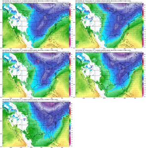
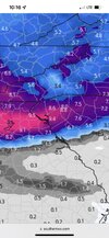
GFDL C-Shield continues to be very cold and snowy. It has consistently shown this solution for many runs, and it is hires like HRRR. Will be interesting to watch, though I am extremely doubtful about this solution.
View attachment 161168View attachment 161169
Oh we are definitely hugging that!
Because it's not according to GSP in the upstate. Will not reach Winter storm criteria only advisory levels.They did say WSW could be issued due to combination of snow and ice. But snowfall would have to reach 4 inches to do itYou would think there’s no winter storm coming by looking around here.
somebody is getting 4” in gville county. Jimmy guaranteeBecause it's not according to GSP in the upstate. Will not reach Winter storm criteria only advisory levels.They did say WSW could be issued due to combination of snow and ice. But snowfall would have to reach 4 inches to do it
Bigedd09
Member
Yes. Upstate is going to overachieve. This is upstate special IMHOsomebody is getting 4” in gville county. Jimmy guarantee
njbarrineau
Member
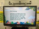
View attachment 161205
Morning Work in my second grade classroom today. I can’t wait for these!
Sent from my iPhone using Tapatalk
You win….
Yep I agree. Had to give Stevo a hard time. He's too excited lately lol. But GSP will probably have to play catch up once the front end thump occurs and it's apparent it's stronger than modeled. They will probably just issue a WWA until the snow is actually falling and then upgrade. Not a knock on them. They have to go by current data. And 1-3 is what they show as of nowsomebody is getting 4” in gville county. Jimmy guarantee
Agree. I don’t think amounts will be crazy. Looks like around .5 qpf is about all we’ll have to work with but it should all be frozen even into the southern fringes of the upstate. Ground is cold. Road surfaces are cold. I still think this is a high impact event relatively speaking. It’s been a while. The one thing they have going for them is the highest impact days will be over the weekend. People will stay home.Yep I agree. Had to give Stevo a hard time. He's too excited lately lol. But GSP will probably have to play catch up once the front end thump occurs and it's apparent it's stronger than modeled. They will probably just issue a WWA until the snow is actually falling and then upgrade. Not a knock on them. They have to go by current data. And 1-3 is what they show as of now
SnowNiner
Member
4 pages overnight on the storm thread. Guess we didn't juice our qpf back up. Nuisance Saturday morning event incoming!!
Hope Atlanta gets a good storm at least, it's been a while for them. Somebody in the SE needs to score as these cold conditions with a "storm" in the gulf are going to be hard to reproduce.
Hope Atlanta gets a good storm at least, it's been a while for them. Somebody in the SE needs to score as these cold conditions with a "storm" in the gulf are going to be hard to reproduce.
SnowNiner
Member
What do I have to do to get back to this run just yesterday morning? View attachment 161214
5 hour trip to Snowshoe WV.
NBAcentel
Member
yorkie ahh winter storm
I think the models have somewhat homed in on the path. I'm really hoping today we can have them reverse the QPF drop from the past days runs. At the very least have them stop dropping. I guess, this might also come down to short range models and now casting.
- Joined
- Jan 2, 2017
- Messages
- 1,566
- Reaction score
- 4,279
Agree as well as Oconee and Pickens. I look at it as if it were not a winter storm just rain and we may over performs due to lift and forcing. We almost always get way more precip than gsp forecasts. And that has been the case over the last month as well. It wouldn't surprise me to see some 6" reports from walhalla to salem and 4-5" down my way.somebody is getting 4” in gville county. Jimmy guarantee
Mtn Rest and Brasstown areas possible 8".
I'm going to have to move to Alaska at this point but if I did we would set a record for the longest duration epo ridge in history
I almost went and got a generator when I saw those huge totals show up yesterday morning for my area. Now yes eventually it’s a good thing to have and I probably should get one, but I’m glad I didn’t just for this “storm”Agree as well as Oconee and Pickens. I look at it as if it were not a winter storm just rain and we may over performs due to lift and forcing. We almost always get way more precip than gsp forecasts. And that has been the case over the last month as well. It wouldn't surprise me to see some 6" reports from walhalla to salem and 4-5" down my way.
Mtn Rest and Brasstown areas possible 8".
- Joined
- Jan 2, 2017
- Messages
- 1,566
- Reaction score
- 4,279
Taking an average of all 0z models and 6z models on qpf in my were right at .67 with no real high end to skew it.
Figure dry air takes .15 of that away to saturate then we're all over a 5" event which would be a monster and stick around esp if it sleeps on the backend.
Color me excited but tempered...happily take 2-3!
Figure dry air takes .15 of that away to saturate then we're all over a 5" event which would be a monster and stick around esp if it sleeps on the backend.
Color me excited but tempered...happily take 2-3!
Don't count on it seeing the overnight models. My iphone weather app shows partly sunny and 45 for SatFor Raleigh we need it to over perform precip and trend colder. Sounds like every winter event ever here.
- Joined
- Jan 2, 2017
- Messages
- 1,566
- Reaction score
- 4,279
Yea you never know Stevo...i have had a Generac for years and it's a wonderful security to have. That week during Helene reminded me it was a good purchase. Its only a matter of time and we get a winter crippler and out of power for a week. And that's real bad during cold!I almost went and got a generator when I saw those huge totals show up yesterday morning for my area. Now yes eventually it’s a good thing to have and I probably should get one, but I’m glad I didn’t just for this “storm”
Good thing is we won't have to watch anything melt Saturday afternoonDon't count on it seeing the overnight models. My iphone weather app shows partly sunny and 45 for Sat


