God what a storm bad lightning 5:30am. Not again. 2 weekends in a row
-
Hello, please take a minute to check out our awesome content, contributed by the wonderful members of our community. We hope you'll add your own thoughts and opinions by making a free account!
You are using an out of date browser. It may not display this or other websites correctly.
You should upgrade or use an alternative browser.
You should upgrade or use an alternative browser.
Arctic April
- Thread starter NBAcentel
- Start date
Nomanslandva
Member
It feels like I may burn more wood in April than I did in January... 35 in mby but many 30 - 31 reports on Wundermap in the valley.
33 this morning, more frost..... is this it finally?
31 over here. 3 frosts within a week.
Not complaining but what a bust today on rain for NC
Who said it was going to rain today?Not complaining but what a bust today on rain for NC
Nomanslandva
Member
pcbjr
Member
NoSnowATL
Member
If it was January, we want heat baby!
Sent from my iPhone using Tapatalk
pcbjr
Member
not necessarily ...If it was January, we want heat baby!
Sent from my iPhone using Tapatalk
?❄
It is so windy. The last couple of years around here seem windier that it used to be.
NBAcentel
Member
At this point I’ll take a heat ridge to get severe weather out of here
Just hit 20 inches of rain for the year overnight. 1.32 storm total
BufordWX
Member
That’s nothing compared to my 32.5 inches of rain so far this year.Just hit 20 inches of rain for the year overnight. 1.32 storm total
Dewpoint Dan
Member
Not good. This virus may never go away ?
smast16
Member
Gotta get those pool water temps up!If it was January, we want heat baby!
Sent from my iPhone using Tapatalk
pcbjr
Member
Jessy89
Member
I won’t lie would love to see the middle of summer bellow average temp wise. Instead of 95-100 love to see 80s
Sent from my iPhone using Tapatalk
GeorgiaGirl
Member
Dang that Florida map is actually shocking. That should get taken care of though in about 2-3 months however.
Well we just had a rainshower pop up over us
B
Brick Tamland
Guest
Couldn't buy a look like this in DJF...late April early May....no problem
View attachment 40266
Our seasons are so screwed up now. At least we are stuck in the house.
smast16
Member
In Feb. I would have put a $100 on the last frost being in march the way things were going.Couldn't buy a look like this in DJF...late April early May....no problem
View attachment 40266
Now, i'm not convinced I've seen my last frost.
NBAcentel
Member
cd2play
Member
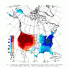
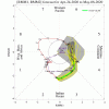
May the 4th be with us!Can’t delay the heat forever, it’ll make its presence known real soon View attachment 40319View attachment 40320
Tornadocane
Member
This is a weather forum so it is my duty to report significant weather events.
Hot April continues in South Florida, especially at my location between Ft. Lauderdale-Hollywood airport and interior Hollywood North Perry Airport (where the terrorists supposedly trained). Yesterday was the coldest day since April 3rd, and it was 1 degree above normal. Today we almost broke the April high minimum again, but the temperature dropped to 79.3. Tonight might be a repeat. The April High minimum temperature is 80 degrees. The high temperature for April is 97, and we got to 94 and 95 a few times.
Super warm waters off the Atlantic Coastline, and lakes are super warm. The lake outside my condo this afternoon was 86 degrees, and the drought has lowered the water level by 2 feet. I can see 2 foot fish breathing coming up to breath for air about five feet from the lake shore. The gulf and immediate Florida coast are very warm for this time a year, which is likely aiding to the tornado threat in the Southeast.
I have lived in Florida for 7 years now, and am pretty impressed by the conditions this year. It's hot. I walk my dog in the morning and night, and I'm sweating like I do in nighttime June temperatures. It's a very auspicous start to the hurricane season
NBAcentel
Member
Maybe so, but you have been noting for weeks now a return to warmth based on the models, but so far has not occurred. Unlike winter, the warmth keeps getting pushed back instead of forward! I for one will enjoy the cooler weather while we have it, no doubt the heat will get here eventually.looks like the switch to the warm pattern looks legit around day 7-10, tropical forcing/MJO headed towards phase 4-6 favors a SER, which is appearing
View attachment 40369
NBAcentel
Member
Maybe so, but you have been noting for weeks now a return to warmth based on the models, but so far has not occurred. Unlike winter, the warmth keeps getting pushed back instead of forward! I for one will enjoy the cooler weather while we have it, no doubt the heat will get here eventually.
Yeah I have definitely been burned lol the past few weeks, at this point I’m just ready to push this pattern out as it favors severe, only way we get rid of this “severe” pattern is a heat dome, but the difference with this vs the last times I’ve said it is that tropical forcing looks favorable for warmth vs the last times I was saying it, they were in phase 7-8, not to mention the CPC is favoring severe in the plains due to the pattern change

NBAcentel
Member
The constant troughs digging in the east allowing quick transient warm sector setups and severe gots to go
accu35
Member
I agree with you, we need the heat. Tired of this severe weather every week. Don't get me wrong I love extreme weather to a excitment level without any damage or injuries or worse but we do need a break.The constant troughs digging in the east allowing quick transient warm sector setups and severe gots to go
The warmth is coming but models and model biases likely pushed the window too early. I agree about the cooler weather though other than the frost it has been nice. I do think though the SE ridge makes some appearance in the next 10days gets pushed back then returns in full force by 5/10 or soMaybe so, but you have been noting for weeks now a return to warmth based on the models, but so far has not occurred. Unlike winter, the warmth keeps getting pushed back instead of forward! I for one will enjoy the cooler weather while we have it, no doubt the heat will get here eventually.
cd2play
Member
Rams Coach Sean McVay is wearing shorts during the draft
Another crisp refreshing day. What a April it has been. One of the most refreshing stretches I can remember in some time.
I agree. We’ve had our windows open almost constantly since the shutdown began. Now that my maters are in the ground I want some warmth but this has been a Godsend.Another crisp refreshing day. What a April it has been. One of the most refreshing stretches I can remember in some time.
tennessee storm
Member
think a thread needs to be started for the severe threat next week Tuesday wed time frameThe constant troughs digging in the east allowing quick transient warm sector setups and severe gots to go
Yupthink a thread needs to be started for the severe threat next week Tuesday wed time frame


