• Hello, please take a minute to check out our awesome content, contributed by the wonderful members of our community. We hope you'll add your own thoughts and opinions by making a free account!

April 2024 Discussion

Unfortunately, the next real chance of rain (aside from very isolated convection) for NC isn't until early/mid next week, depending on you model of choice.
 
Severe weather was a total bust here

As late as Saturday night I heard someone on the radio talking about a historic outbreak. I havent even seen one tornado warning
 
Level 1 risk out for Friday as of now. The SPC hasn't had the best track record lately when it comes to severe threats here.
Their track record has been pretty good. A possibility of storms doesn't mean that storms are a guarantee or even likely.
 
Their track record has been pretty good. A possibility of storms doesn't mean that storms are a guarantee or even likely.
I am talking specifically for the Triangle area. I know it doesn't guarantee storms, but when you keep saying there is a rosk for severe storms and nothing happens, people are going to start thinking you're crying wolf.
 
I am talking specifically for the Triangle area. I know it doesn't guarantee storms, but when you keep saying there is a rosk for severe storms and nothing happens, people are going to start thinking you're crying wolf.
Yeah. I know they see that conditions seem favorable, but for whatever reason nothing materializes. I will still listen, but with much less concern now until I see that line to my west on radar.

Good post and I think the fact that not much has happened in spite of the warnings, people will in fact have much less regard for watches and severe outlooks which isn’t good for when stuff gets real.
 
I am talking specifically for the Triangle area. I know it doesn't guarantee storms, but when you keep saying there is a rosk for severe storms and nothing happens, people are going to start thinking you're crying wolf.
So what is your expectation here? They don't say anything? All general tstorm and MRGL risks are intended to do is raise awareness that a storm or 2 could be severe. It's not like spc is busting on high end outlooks locally.

Looking at Friday it's the same as the rest of the setups we've had. Decent setup but a list of question marks and possible detractors from severe weather. If we can clear up and destabilize behind the initial ofb and debris clouds we could get a few storms rolling off the mountains that drop golf ball hail and wind damage across multiple counties. If we stay too cloudy or subsident in the wake of the morning disturbance nothing happens. There's no good way to convey that publicly but it's the whole reason for mrgl. If they say nothing and we get a long track storm/supercell or 2 that affects multiple counties it'll be "NO ONE TOLD US!".
 
Last edited:
I am talking specifically for the Triangle area. I know it doesn't guarantee storms, but when you keep saying there is a rosk for severe storms and nothing happens, people are going to start thinking you're crying wolf.
What would you do if you were the SPC and 48 to 24 hours out, some models were showing some level of storm coverage across the area, and there were at least a few parameters that suggested that any storms that form could become severe? What would you do?
 
What would you do if you were the SPC and 48 to 24 hours out, some models were showing some level of storm coverage across the area, and there were at least a few parameters that suggested that any storms that form could become severe? What would you do?
You would have to do what the SPC has for our area Friday and put the marginal risk out. This setup looks a bit like one we had here in 1992 when there were questions about coverage. The SPC went with a watch and for some of us it verified bigtime. Only 3 storms, but all of them were long tracked, damaging storms. One of them came through this area with golf ball size hail and hundreds of trees down. It is still the worst storm the Jonesville area has had in my lifetime.
 
You would have to do what the SPC has for our area Friday and put the marginal risk out. This setup looks a bit like one we had here in 1992 when there were questions about coverage. The SPC went with a watch and for some of us it verified bigtime. Only 3 storms, but all of them were long tracked, damaging storms. One of them came through this area with golf ball size hail and hundreds of trees down. It is still the worst storm the Jonesville area has had in my lifetime.
But it sounds like if you ("you" being an organization that primarily outlines the risk of severe thunderstorms in the United States) outline a risk of any level for a region and somebody's house or their county or their general community doesn't receive a severe storm, then you are just crying wolf and nobody will trust you.
 
But it sounds like if you ("you" being an organization that primarily outlines the risk of severe thunderstorms in the United States) outline a risk of any level for a region and somebody's house or their county or their general community doesn't receive a severe storm, then you are just crying wolf and nobody will trust you.
Oh yeah, they have a tough job for sure, one I don't think I could handle for many reasons. They catch it from both sides when things do not go right, or even if they do in marginal situations. Going back to 1992 that watch was needed, but for 90% of its coverage area nothing happened. For those of us that did get hit though, it was rough. The storm here had winds at least up to 60mph and closer to 80-90 in a small area just north of me. Another one dropped a tornado south of Greenwood SC that same day.
 
So what is your expectation here? They don't say anything? All general tstorm and MRGL risks are intended to do is raise awareness that a storm or 2 could be severe. It's not like spc is busting on high end outlooks locally.

Looking at Friday it's the same as the rest of the setups we've had. Decent setup but a list of question marks and possible detractors from severe weather. If we can clear up and destabilize behind the initial ofb and debris clouds we could get a few storms rolling off the mountains that drop golf ball hail and wind damage across multiple counties. If we stay too cloudy or subsident in the wake of the morning disturbance nothing happens. There's no good way to convey that publicly but it's the whole reason for mrgl. If they say nothing and we get a long track storm/supercell or 2 that affects multiple counties it'll be "NO ONE TOLD US!".

I wasn't saying they shouldn't have issued a risk level based on the conditions. Just saying it hasn't worked out so well so far based on what people actually got, and stating that the public isn't going to listen like they should. And then the other day there was a line of severe storms that nobody expected. I know they are trying to be more safer than sorry. Just saying for me personally I have gotten worse storms at my house the last few years when we're not under any kind of watch or any level of risk from the SPC than when we are. So I make sure to be aware when there is a risk or a watch, but most of the time I don't think I'm going to get a storm at all. That's just how it's worked out for me and a lot of others the last few years.

And lately the morning rain and clouds hang on and we don't get the clearing needed to spark the storms.
 
Predicting the future is hard, NWS has to forecast for an area not just a particular backyard.... you issue a risk area or a watch, nothing happens, people claim they cry wolf. You don't issue a risk area or a watch, something happens, people claim they had no warning. Damned if you do, damned if you don't. Use some common knowledge and stop expecting perfection, be prepared and respect those that have tough jobs. It's life
 
Man my yard needs rain. Best bet for central and northern NC looks to be this Sunday. Problem, is most models show the highest amounts south and east. I'll take anything at this point, but it would be nice to shift this northwest 75 miles or so.

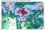
6z GFS 24-hour totals at 12z Monday:

1713452799601.png
 
Garbage model. If the HRRR is having a tough time you know the NAM will suck.


Sent from my iPhone using Tapatalk

It's outside the HRRR window still....the 3k FV3 and Rgem all have a meso low type system crossing NC Friday night at around 38-40 hrs out.
 
Back
Top